1950s Maps of Vickery Meadows PID, Dallas
Explore 9 historic maps of Vickery Meadows PID from the 1950s. These maps offer a rare glimpse into what life looked like during the 1950s — showing old roads, neighborhoods, homes, and landmarks that have changed or disappeared over time.
Whether you're researching your family's past, planning a metal detecting trip, or studying how Vickery Meadows PID's landscape evolved across the 1950s, these high-resolution maps are a powerful tool for exploring the history of this region.
- Focus on a specific era: All maps on this page are from the 1950s, giving you a focused view of this time period.
- See what’s changed: Compare century-old streets, trails, and buildings to today's modern landscape using overlays and satellite layers.
- Research with precision: Use these maps for genealogy, historical research, land use analysis, or educational projects.
- View, download, or print: Maps are fully viewable online in high resolution, and can be downloaded or printed for your own records.
Start exploring Vickery Meadows PID's history through authentic maps from the 1950s. This is your window into the past.
Vickery Meadows PID, Dallas maps
(9)- 1954 Map of Dallas, 1963 Print
 1954 Dallas1963 Print · USGSNorth Texas in the mid-fifties and early sixties reveals a landscape of rapid urban growth and water management. Genealogists and historians can trace the evolution of the metroplex through landmarks like Hensley Field, Boles Orphan Home, and the Texas & Pacific RR.4 unique versions available
 - 1957 Map of White Rock Lake, 1959 Print
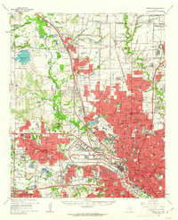
 1957 White Rock Lake1959 Print · USGSEast Dallas and the surrounding suburban reaches are shown in this late fifties survey as the urban grid expands toward White Rock Lake. Genealogists and local historians can trace the early footprints of Reinhardt, the grounds of the Buckner Orphans Home, and regional hubs like White Rock Airport.3 unique versions available
 - 1958 Map of Dallas
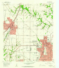
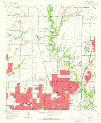
 1958 Dallas1958 Print · USGSNorth Texas in the late fifties shows the dramatic expansion of the Metroplex as it absorbs surrounding farm towns. Genealogists and historians can trace old rail lines like the Missouri-Kansas-Texas and locate early lakefront developments at Eagle Mountain Lake and Lake Worth Village.
 - 1958 Map of Dallas, 1959 Print
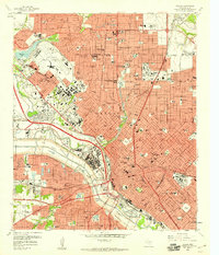 1958 Dallas1959 Print · USGSMid-century Dallas is seen here at a peak of expansion, as new turnpikes and expressways began to encircle the historic core. Local historians can trace the foundations of the city through landmarks like Fair Park, Love Field, and the Cotton Bowl.7 unique versions available
 - 1958 Map of White Rock Lake, 1974 Print
 1958 White Rock Lake1974 Print · USGSEast Dallas and the surrounding suburban reaches are shown here during a mid-century period of intense residential growth. Researchers can trace the development of local schools like Adams High Sch, find the Buckner Orphans Home, or locate the former sites of White Rock Airport and Garland Airport.2 unique versions available
 - 1959 Map of Garland, 1960 Print
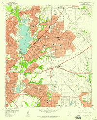
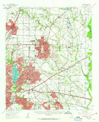
 1959 Garland1960 Print · USGSNortheast Dallas County is shown here in the late fifties, just as the postwar suburban boom began to reshape the countryside. Genealogists and historians can trace family-named sites like Blewett Cem and early communities such as Audelia and Shiloh.5 unique versions available
 - 1959 Map of Addison, 1960 Print
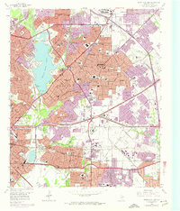
 1959 Addison1960 Print · USGSThe northern fringes of Dallas were transforming from rural farmsteads to suburban hubs during the late fifties. Genealogists and historians can trace the growth of local institutions like Ursuline Academy, the Addison Sch, and the historic White Rock Cem.6 unique versions available
 - 1959 Map of Garland, 1963 Print
 1959 Garland1963 Print · USGSEastern Dallas County is captured in the late fifties as small towns begin to merge into a growing suburban landscape. Genealogists and historians can trace local family roots at Blewett Cem and see the early footprints of Richardson, Sunnyvale, and the White Rock Airport.
 - 1959 Map of Carrollton, 1963 Print
 1959 Carrollton1963 Print · USGSNorth Dallas and its surrounding suburbs are captured during a period of massive suburban growth in the late fifties. Genealogists can trace family sites near Trinity Mills, while researchers can locate mid-century landmarks like Love Field Municipal Airport and Calvary Hill Cemetery.
End of results
Showing maps 1-9 of 9
Frequently asked questions
- What are the different types of historical maps available for Vickery Meadows PID?
- What is the oldest map of Vickery Meadows PID?
- Where can I purchase historical maps of Vickery Meadows PID for my home or office?
- Where can I download high-res historical maps of Vickery Meadows PID?
- Are there historical topographic maps available for Vickery Meadows PID?
- Is there historical aerial imagery available for Vickery Meadows PID?
- Where are historical maps of Vickery Meadows PID sourced from?