1940s Maps of Montwood Plaza, El Paso
Explore 3 historic maps of Montwood Plaza from the 1940s. These maps offer a rare glimpse into what life looked like during the 1940s — showing old roads, neighborhoods, homes, and landmarks that have changed or disappeared over time.
Whether you're researching your family's past, planning a metal detecting trip, or studying how Montwood Plaza's landscape evolved across the 1940s, these high-resolution maps are a powerful tool for exploring the history of this region.
- Focus on a specific era: All maps on this page are from the 1940s, giving you a focused view of this time period.
- See what’s changed: Compare century-old streets, trails, and buildings to today's modern landscape using overlays and satellite layers.
- Research with precision: Use these maps for genealogy, historical research, land use analysis, or educational projects.
- View, download, or print: Maps are fully viewable online in high resolution, and can be downloaded or printed for your own records.
Start exploring Montwood Plaza's history through authentic maps from the 1940s. This is your window into the past.
Montwood Plaza, El Paso maps
(3)- 1942 Map of Fort Bliss
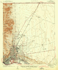 1942 Fort Bliss1942 Print · USGSEl Paso and its military neighbors are captured here in the early 1940s as the desert landscape rapidly modernized. Researchers can trace family ranching sites like Tobin Ranch alongside the expansion of Fort Bliss and the Biggs Field.
 - 1945 Map of Fort Bliss
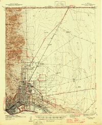 1945 Fort Bliss1945 Print · USGSEl Paso and its military environs are captured here during the mid-1940s, showing the intersection of rapid defense growth and desert ranching. Genealogists and historians can trace family sites like Tobin Ranch, locate the CCC Camp, and study the early layout of Biggs Field.
 - 1948 Map of Fort Bliss SE
 1948 Fort Bliss SE1948 Print · USGSEl Paso County at the end of the 1940s reveals a desert landscape defined by military boundaries and small-scale ranching operations. Researchers can locate the early footprints of the Sherman Hog Ranch, Price Dairy, and Bakers Well Windmill.
End of results
Showing maps 1-3 of 3
Frequently asked questions
- What are the different types of historical maps available for Montwood Plaza?
- What is the oldest map of Montwood Plaza?
- Where can I purchase historical maps of Montwood Plaza for my home or office?
- Where can I download high-res historical maps of Montwood Plaza?
- Are there historical topographic maps available for Montwood Plaza?
- Is there historical aerial imagery available for Montwood Plaza?
- Where are historical maps of Montwood Plaza sourced from?