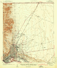
1942 Map of Fort Bliss
USGS Topo · Published 1942About this map
The Franklin Mountains dominate the western landscape of this 1942 military survey, rising sharply above the desert floor where the Rio Grande and the Southern Pacific railroad converge. The map documents a pivotal moment of expansion for Fort Bliss, showing the installation alongside Biggs Field US Military Res and the Wm Beaumont Hospital. Beyond the structured cantonments, the desert floor is dotted with family-run outposts and commercial enterprises including Tobin Ranch, the Price Dairy, and the Sherman Hog Ranch, illustrating the transition from rural ranching to military dominance.
Find a feature on this map
60 named features on this map. Tap any name to fly to it.
Don’t see what you’re looking for? This feature index may not catch every label — zoom into the map to look around manually.
Map Details
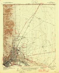
Editions of this 1942 Fort Bliss Map
This is the sole edition of this map. No revisions or reprints were ever made.
Historical Maps of El Paso Through Time
Featured Locations
- El Paso, TX
- Turf Estates Number 1 Colonia, TX
- Mission Hills, El Paso
- Planeport, El Paso
- Sunrise Acres, El Paso