1950s Maps of Vista Larga Number 2 Colonia, Texas
Explore 3 historic maps of Vista Larga Number 2 Colonia from the 1950s. These maps offer a rare glimpse into what life looked like during the 1950s — showing old roads, neighborhoods, homes, and landmarks that have changed or disappeared over time.
Whether you're researching your family's past, planning a metal detecting trip, or studying how Vista Larga Number 2 Colonia's landscape evolved across the 1950s, these high-resolution maps are a powerful tool for exploring the history of this region.
- Focus on a specific era: All maps on this page are from the 1950s, giving you a focused view of this time period.
- See what’s changed: Compare century-old streets, trails, and buildings to today's modern landscape using overlays and satellite layers.
- Research with precision: Use these maps for genealogy, historical research, land use analysis, or educational projects.
- View, download, or print: Maps are fully viewable online in high resolution, and can be downloaded or printed for your own records.
Start exploring Vista Larga Number 2 Colonia's history through authentic maps from the 1950s. This is your window into the past.
Vista Larga Number 2 Colonia, TX maps
(3)- 1953 Map of El Paso
 1953 El Paso1953 Print · USGSEl Paso and the border region are shown here in the early fifties, documenting a landscape of shared river life and rising military presence. Genealogists and historians can trace rail-tied communities like Smeltertown, San Elizario, and the grounds of Fort Bliss.
 - 1955 Map of Clint, 1959 Print
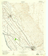 1955 Clint1959 Print · USGSThe El Paso County borderlands are captured here in the mid-1950s, showing the agricultural transformation of San Elizario Island. Genealogists and historians can trace rail-side life in Clint and Fabens, alongside landmarks like San Lorenzo Cemetery and the early Fabens Airfield.2 unique versions available
 - 1959 Map of El Paso, 1968 Print
 1959 El Paso1968 Print · USGSEl Paso and the international borderlands come alive in this mid-century survey of the Chihuahuan Desert. Genealogists and historians can trace rail-side settlements like Columbus and Fabens, locate the sprawling Fort Bliss, and explore the geologically unique Kilbourne Hole.2 unique versions available
End of results
Showing maps 1-3 of 3
Top cities near Vista Larga Number 2 Colonia
- El Paso historical maps
- Socorro historical maps
- Horizon City historical maps
- San Elizario historical maps
- Fabens historical maps
- Tornillo historical maps
See more
Frequently asked questions
- What are the different types of historical maps available for Vista Larga Number 2 Colonia?
- What is the oldest map of Vista Larga Number 2 Colonia?
- Where can I purchase historical maps of Vista Larga Number 2 Colonia for my home or office?
- Where can I download high-res historical maps of Vista Larga Number 2 Colonia?
- Are there historical topographic maps available for Vista Larga Number 2 Colonia?
- Is there historical aerial imagery available for Vista Larga Number 2 Colonia?
- Where are historical maps of Vista Larga Number 2 Colonia sourced from?