2020s Maps of Stephenville, Texas
Explore 2 historic maps of Stephenville from the 2020s. These maps offer a rare glimpse into what life looked like during the 2020s — showing old roads, neighborhoods, homes, and landmarks that have changed or disappeared over time.
Whether you're researching your family's past, planning a metal detecting trip, or studying how Stephenville's landscape evolved across the 2020s, these high-resolution maps are a powerful tool for exploring the history of this region.
- Focus on a specific era: All maps on this page are from the 2020s, giving you a focused view of this time period.
- See what’s changed: Compare century-old streets, trails, and buildings to today's modern landscape using overlays and satellite layers.
- Research with precision: Use these maps for genealogy, historical research, land use analysis, or educational projects.
- View, download, or print: Maps are fully viewable online in high resolution, and can be downloaded or printed for your own records.
Start exploring Stephenville's history through authentic maps from the 2020s. This is your window into the past.
Stephenville, TX maps
(2)- 2022 Map of Stephenville, 2022 Print
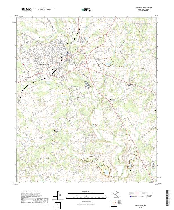 2022 Stephenville2022 Print · USGSThe Erath County seat and the expanding campus of Tarleton State University are documented here in the early twenty-first century. Genealogists can trace family names and locations at the Allard Cem, Mount Olive Cem, and across the quiet settlement of Welcome Valley.
 - 2022 Map of Bunyan, 2022 Print
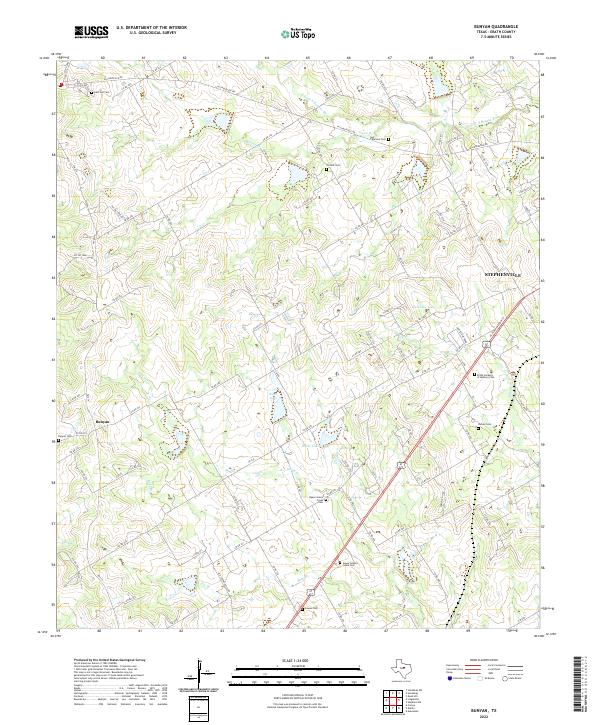 2022 Bunyan2022 Print · USGSIn the early 2020s, the rural reaches of Erath County remain anchored by historic family sites and the waters of the North Bosque. Genealogists can trace local heritage at Bunyan Cem, Corinth Cem, or the quiet banks of Green Cr.
End of results
Showing maps 1-2 of 2
Top cities near Stephenville
Frequently asked questions
- What are the different types of historical maps available for Stephenville?
- What is the oldest map of Stephenville?
- Where can I purchase historical maps of Stephenville for my home or office?
- Where can I download high-res historical maps of Stephenville?
- Are there historical topographic maps available for Stephenville?
- Is there historical aerial imagery available for Stephenville?
- Where are historical maps of Stephenville sourced from?