1900s (20th Century) Maps of Leonard, Texas
Explore 7 historic maps of Leonard from the 1900s (20th Century). These maps offer a rare glimpse into what life looked like during the 1900s — showing old roads, neighborhoods, homes, and landmarks that have changed or disappeared over time.
Whether you're researching your family's past, planning a metal detecting trip, or studying how Leonard's landscape evolved across the 1900s, these high-resolution maps are a powerful tool for exploring the history of this region.
- Focus on a specific era: All maps on this page are from the 1900s, giving you a focused view of this time period.
- See what’s changed: Compare century-old streets, trails, and buildings to today's modern landscape using overlays and satellite layers.
- Research with precision: Use these maps for genealogy, historical research, land use analysis, or educational projects.
- View, download, or print: Maps are fully viewable online in high resolution, and can be downloaded or printed for your own records.
Start exploring Leonard's history through authentic maps from the 1900s. This is your window into the past.
Leonard, TX maps
(7)- 1954 Map of Sherman, 1964 Print
 1954 Sherman1964 Print · USGSThe Red River valley and North Texas plains are captured here in the mid-fifties, showing the region as new reservoirs like Lake Texoma and Lavon Reservoir reshaped the land. Genealogists can trace family roots through specific local landmarks like Courtney P O, Pilot Grove Sch, and New Hope Ch.2 unique versions available
 - 1958 Map of Sherman, 1959 Print
 1958 Sherman1959 Print · USGSNorth Texas and Southern Oklahoma were undergoing significant development in the late fifties as the Red River Valley transit networks matured. Researchers can trace historic family-named locations such as Saddler Bend, the grounds of Perrin AFB, and early shoreline developments at Lake Texoma.
 - 1960 Map of Pike, 1962 Print
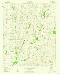 1960 Pike1962 Print · USGSNortheast Texas at the start of the sixties is a landscape of quiet rural junctions and family homesteads where Collin, Fannin, and Hunt counties meet. Genealogists can trace early settler footprints at Indian Creek Cem, Fuller Cem, and the small settlement of Frognot.2 unique versions available
 - 1964 Map of Trenton, 1967 Print
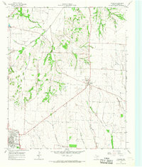
 1964 Trenton1967 Print · USGSThe rural landscape of Fannin County in the mid-1960s is defined by its small rail-side settlements and winding creek beds. Genealogists and historians can trace family roots through landmarks like Burns Cem, Blanton Chapel, and the communities of Orangeville and Nobility.
 - 1964 Map of Celeste, 1968 Print
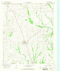 1964 Celeste1968 Print · USGSHunt County at the height of the mid-century rail era reveals a landscape shaped by competing locomotives and winding river forks. Genealogists and local historians can trace family ties through Nicholson Cemetery and Kingston Cemetery or locate old settlements like Hogeye and Lester.
 - 1964 Map of Leonard, 1968 Print
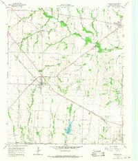
 1964 Leonard1968 Print · USGSFannin County agriculture and rail transit intersect in the mid-1960s, centered on the growing hub of Leonard and the M-K-T RR. Researchers can locate family landmarks like Grove Hill Ch, Whiterock Cem, and the old Valley Creek Community Center.
 - 1985 Map of McKinney
 1985 McKinney1985 Print · USGSNorth Texas in the mid-1980s was a landscape of rural communities connected by a complex web of railroads and creek systems. Researchers can trace family roots through settlements like Westminster, find local landmarks like Henslee Chapel, or map the industrial activity at various Gravel Pits.2 unique versions available
End of results
Showing maps 1-7 of 7
Top cities near Leonard
- Anna historical maps
- Bonham historical maps
- Farmersville historical maps
- Bells historical maps
- Wolfe City historical maps
- Blue Ridge historical maps
See more
Frequently asked questions
- What are the different types of historical maps available for Leonard?
- What is the oldest map of Leonard?
- Where can I purchase historical maps of Leonard for my home or office?
- Where can I download high-res historical maps of Leonard?
- Are there historical topographic maps available for Leonard?
- Is there historical aerial imagery available for Leonard?
- Where are historical maps of Leonard sourced from?