Old Maps of Union, Texas for Hiking & Exploration
Hike through history with 10 historic maps of Union. Explore old trails, ghost towns, and forgotten backroads — perfect for outdoor adventurers and local explorers.
- Rediscover forgotten places: Map out old mining camps, roads, and footpaths that no longer exist on modern maps.
- Layer with modern tools: Combine with LiDAR or satellite views to plan hikes through historical terrain.
- Made for exploration: Popular among hikers, overlanders, and local history lovers.
Use these maps to find adventure and explore the hidden past of Union.
Union, TX maps
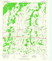
(10)- 1953 Map of Texarkana, 1964 Print
 1953 Texarkana1964 Print · USGSThe Texas-Arkansas borderlands are captured here in the mid-fifties, during a decade of massive military and hydraulic engineering projects. Genealogists and researchers can locate family landmarks like Old Boston Cem, Siloam Ch, and the vast Red River Arsenal.4 unique versions available
 - 1956 Map of Texarkana
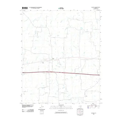
 1956 Texarkana1956 Print · USGSThe Ark-La-Tex borderlands come alive in the mid-fifties, showing the transition from a rail-dependent rural economy to a post-war industrial landscape. Researchers can trace the massive Red River Ordnance Depot and find towns like Talco, Bogata, and Naples.
 - 1964 Map of Saltillo, 1967 Print
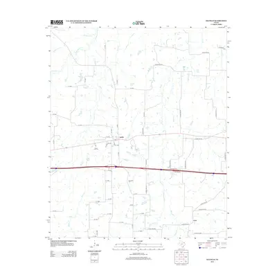
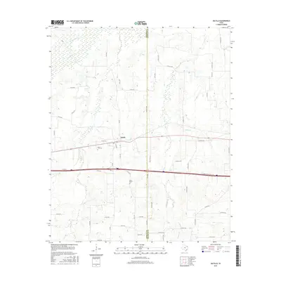
 1964 Saltillo1967 Print · USGSNorthwest Texas during the mid-sixties reveals a landscape of rural schoolhouses and creekside settlements. Genealogists and local historians can locate legacy landmarks like Old Saltillo Ch, Stouts Creek Cem, and the path of the St Louis Southwestern rail line.
 - 1985 Map of Sulphur Springs
 1985 Sulphur Springs1985 Print · USGSNortheast Texas in the mid-eighties shows a landscape transitioning between its deep-rooted rail towns and a new era of reservoir development. Genealogists and historians can trace family locations near Shooks Chapel, the rural Farmers Academy, and the banks of the South Sulphur River.
 - 1991 Map of Sulphur Springs
 1991 Sulphur Springs1991 Print · USGSNortheast Texas in the early nineties shows a transition from rail-dependent agriculture to a landscape defined by massive reservoirs. Researchers can trace rural lineages through sites like Gafford Chapel and the Forest Academy Cem, or follow the path of the St Louis Southwestern RR.
 - 2010 Map of Saltillo, 2010 Print
 2010 Saltillo2010 Print · USGSCovers Union, including Saltillo, Hopkins County, and other nearby areas
 - 2012 Map of Saltillo, 2012 Print
 2012 Saltillo2012 Print · USGSCovers Union, including Saltillo, Hopkins County, and other nearby areas
 - 2016 Map of Saltillo, 2016 Print
 2016 Saltillo2016 Print · USGSCovers Union, including Saltillo, Hopkins County, and other nearby areas
 - 2019 Map of Saltillo, 2019 Print
 2019 Saltillo2019 Print · USGSCovers Union, including Saltillo, Hopkins County, and other nearby areas
 - 2022 Map of Saltillo, 2022 Print
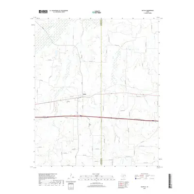
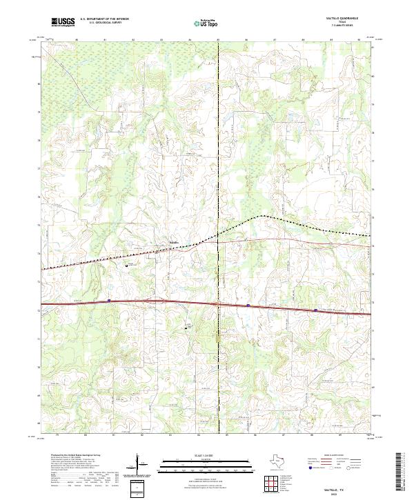 2022 Saltillo2022 Print · USGSNortheast Texas in 2022 remains a landscape shaped by its numerous waterways and quiet rural crossroads. Researchers can locate family landmarks like Stouts Creek Cem and the Old Saltillo Cem near the town of Saltillo.
End of results
Showing maps 1-10 of 10
Top cities near Union
- Winnsboro historical maps
- Mount Vernon historical maps
- Como historical maps
- Talco historical maps
- Winfield historical maps
- Miller's Cove historical maps
See more
Frequently asked questions
- What are the different types of historical maps available for Union?
- What is the oldest map of Union?
- Where can I purchase historical maps of Union for my home or office?
- Where can I download high-res historical maps of Union?
- Are there historical topographic maps available for Union?
- Is there historical aerial imagery available for Union?
- Where are historical maps of Union sourced from?