Old Maps of Arbor Gate, Friendswood for Genealogy
Trace your family roots with 12 historic maps of Arbor Gate. These high-res maps reveal old neighborhoods, homesites, landmarks, and streets — helping you uncover where your ancestors lived and how the area evolved over time.
- Explore historic neighborhoods: Identify where your relatives may have lived in the 1800s or 1900s.
- Compare maps over time: Trace the changes in streets, buildings, and landmarks for multi-generational research.
- Perfect for genealogy & ancestry research: Used by family historians and researchers to map out lineage and migration.
These maps are an incredible resource for exploring your personal connection to Arbor Gate's past.
Arbor Gate, Friendswood maps
(12)- 1929 Map of Algoa
 1929 Algoa1929 Print · USGSThe coastal plains of Galveston County come into focus during the late twenties as the rail economy of Algoa took shape. Genealogists and historians can trace the early path of the Gulf Colorado and Santa Fe and locate unique geological Gas Bumps.
 - 1932 Map of Algoa
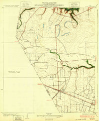 1932 Algoa1932 Print · USGSCoastal Texas in the early thirties centers on the railroad junction at Algoa, where steam-era transportation met the early automotive age. Genealogists and historians can trace the crossing of the Missouri Pacific and Gulf Colorado and Santa Fe near Dickinson Bayou.3 unique versions available
 - 1950 Map of Houston, 1953 Print
 1950 Houston1953 Print · USGSCoastal Texas in the early fifties reveals a landscape of massive civil engineering and industrial transit. Genealogists and researchers can trace the growth of the Houston suburbs and the maritime infrastructure of Galveston Bay, including the Gulf Freeway and the Texas City Dike.
 - 1956 Map of Algoa, 1957 Print
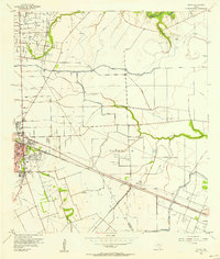 1956 Algoa1957 Print · USGSThe Galveston and Brazoria county lines meet in the 1950s amidst a landscape of expanding oil fields and irrigation canals. Genealogists can trace family names near Magnolia Cem or follow the rail junction at Alvin and the smaller depot at Algoa.4 unique versions available
 - 1956 Map of Houston, 1963 Print
 1956 Houston1963 Print · USGSSoutheast Texas in the mid-fifties is captured here as a powerhouse of oil and maritime trade. Genealogists and historians can trace the foundations of Houston and its ports, alongside landmarks like the Rice Institute and the Spindletop Oil Field.2 unique versions available
 - 1975 Map of Houston, 1977 Print
 1975 Houston1977 Print · USGSThe Texas Gulf Coast in the mid-seventies shows a sprawling Houston metropolis linked to the sea by the massive Houston Ship Channel. Researchers can trace the mid-century industrial landscape from the Astrodome to the Lyndon B. Johnson Space Center.2 unique versions available
 - 1984 Map of Angleton
 1984 Angleton1984 Print · USGSThe Texas Gulf Coast in the mid-eighties shows a landscape of salt domes and bayous at the height of its oil-and-river economy. Researchers can trace land use through the Damon Mound Oil Field and the sprawling State Department of Corrections (Retrieve Unit).2 unique versions available
 - 2010 Map of Algoa, 2010 Print
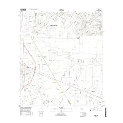
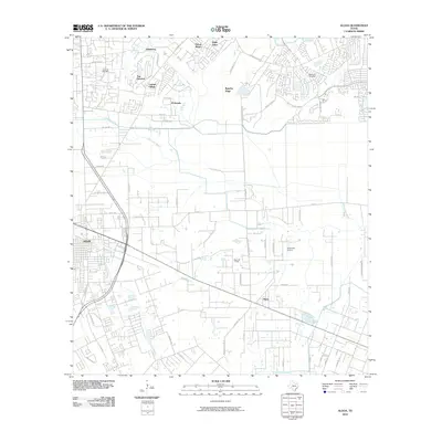 2010 Algoa2010 Print · USGSCovers Arbor Gate, including League City, Friendswood, and other nearby areas
 - 2013 Map of Algoa, 2013 Print
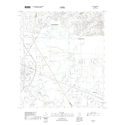
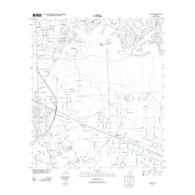 2013 Algoa2013 Print · USGSCovers Arbor Gate, including League City, Friendswood, and other nearby areas
 - 2016 Map of Algoa, 2016 Print
 2016 Algoa2016 Print · USGSCovers Arbor Gate, including League City, Friendswood, and other nearby areas
 - 2019 Map of Algoa, 2019 Print
 2019 Algoa2019 Print · USGSCovers Arbor Gate, including League City, Friendswood, and other nearby areas
 - 2022 Map of Algoa, 2022 Print
 2022 Algoa2022 Print · USGSCoastal Texas expansion meets established local history in this study of the Alvin and Santa Fe corridor. Genealogists and researchers can map out the residential growth around Dickinson Bayou and locate landmarks like the Confederate Cem or Alvin Community College.
End of results
Showing maps 1-12 of 12
Frequently asked questions
- What are the different types of historical maps available for Arbor Gate?
- What is the oldest map of Arbor Gate?
- Where can I purchase historical maps of Arbor Gate for my home or office?
- Where can I download high-res historical maps of Arbor Gate?
- Are there historical topographic maps available for Arbor Gate?
- Is there historical aerial imagery available for Arbor Gate?
- Where are historical maps of Arbor Gate sourced from?