1960s Maps of Gregg County, Texas
Explore 5 historic maps of Gregg County from the 1960s. These maps offer a rare glimpse into what life looked like during the 1960s — showing old roads, neighborhoods, homes, and landmarks that have changed or disappeared over time.
Whether you're researching your family's past, planning a metal detecting trip, or studying how Gregg County's landscape evolved across the 1960s, these high-resolution maps are a powerful tool for exploring the history of this region.
- Focus on a specific era: All maps on this page are from the 1960s, giving you a focused view of this time period.
- See what’s changed: Compare century-old streets, trails, and buildings to today's modern landscape using overlays and satellite layers.
- Research with precision: Use these maps for genealogy, historical research, land use analysis, or educational projects.
- View, download, or print: Maps are fully viewable online in high resolution, and can be downloaded or printed for your own records.
Start exploring Gregg County's history through authentic maps from the 1960s. This is your window into the past.
Gregg County, TX maps
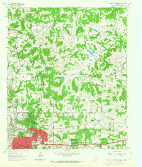
(5)- 1960 Map of White Oak, 1962 Print
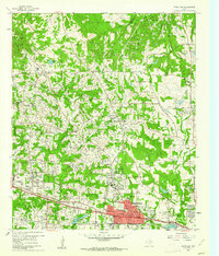 1960 White Oak1962 Print · USGSMid-century East Texas reveals an economy driven by petroleum and the Texas and Pacific rail line. Researchers can trace company outposts like Amerada Camp or locate community centers like Sherman Chapel and Pine Tree Sch.3 unique versions available
 - 1960 Map of Glenwood, 1962 Print
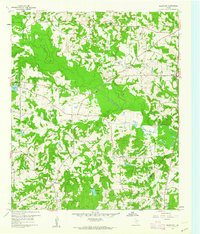 1960 Glenwood1962 Print · USGSEastern Upshur County is captured here at the height of its mid-century oil production. Researchers can trace rural lineages through family landmarks like Mattox Cem or locate community centers such as Valley View Sch and the Lake Providence Ch.2 unique versions available
 - 1960 Map of Gladewater, 1962 Print
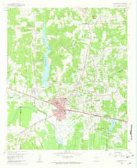 1960 Gladewater1962 Print · USGSEast Texas at the start of the 1960s reveals a landscape of oil production and rural communities centered on the Sabine River. Researchers can trace the Texas and Pacific rail line through Gladewater and locate local landmarks like the Edwards Cem and Warren City.2 unique versions available
 - 1962 Map of Ashland, 1964 Print
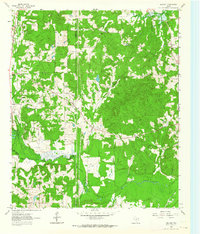 1962 Ashland1964 Print · USGSNortheast Texas in the early sixties shows a landscape of timber and rising industry as new reservoirs took shape. Genealogists and historians can locate rural hubs like Ashland and Old Diana, along with several family landmarks including Jones Cem and Shady Grove Ch.2 unique versions available
 - 1962 Map of Longview Heights, 1964 Print
 1962 Longview Heights1964 Print · USGSEastern Harrison County is captured here during the early sixties as the city of Longview pushed into new residential additions. Researchers can trace the mid-century layout of Longview Heights, find old rural landmarks like Harleton Junction Station, or locate family sites at Grace Hill Cemetery.3 unique versions available
End of results
Showing maps 1-5 of 5
Top cities of Gregg County
- Longview historical maps
- Kilgore historical maps
- White Oak historical maps
- Liberty City historical maps
- Lakeport historical maps
Frequently asked questions
- What are the different types of historical maps available for Gregg County?
- What is the oldest map of Gregg County?
- Where can I purchase historical maps of Gregg County for my home or office?
- Where can I download high-res historical maps of Gregg County?
- Are there historical topographic maps available for Gregg County?
- Is there historical aerial imagery available for Gregg County?
- Where are historical maps of Gregg County sourced from?