1980s Maps of Hale County, Texas
Explore 10 historic maps of Hale County from the 1980s. These maps offer a rare glimpse into what life looked like during the 1980s — showing old roads, neighborhoods, homes, and landmarks that have changed or disappeared over time.
Whether you're researching your family's past, planning a metal detecting trip, or studying how Hale County's landscape evolved across the 1980s, these high-resolution maps are a powerful tool for exploring the history of this region.
- Focus on a specific era: All maps on this page are from the 1980s, giving you a focused view of this time period.
- See what’s changed: Compare century-old streets, trails, and buildings to today's modern landscape using overlays and satellite layers.
- Research with precision: Use these maps for genealogy, historical research, land use analysis, or educational projects.
- View, download, or print: Maps are fully viewable online in high resolution, and can be downloaded or printed for your own records.
Start exploring Hale County's history through authentic maps from the 1980s. This is your window into the past.
Hale County, TX maps
(10)- 1985 Map of Muleshoe
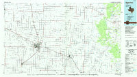
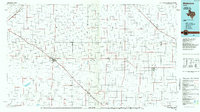 1985 Muleshoe1985 Print · USGSThe High Plains of the Texas Panhandle in the mid-eighties show a landscape defined by industrial agriculture and rail. Genealogists and local historians can trace family roots through rural communities like Lazbuddie, Sudan, and the uniquely named town of Earth.2 unique versions available
 - 1985 Map of Underwood
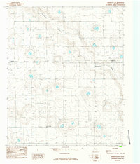
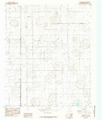 1985 Underwood1985 Print · USGSHale County in the mid-1980s reveals a High Plains landscape defined by intense resource extraction and small rural hubs. Trace the distribution of numerous Well sites near Underwood, Alley, and Crawfish Draw.
 - 1985 Map of Anton NE
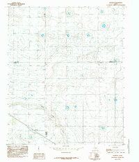
 1985 Anton NE1985 Print · USGSTexas Panhandle agriculture and infrastructure are on full display in the mid-1980s. Trace the path of Blackwater Draw across the Lamb Co and Hale Co line, alongside utility features like the Trans-line Wooden H-frame.
 - 1985 Map of Abernathy
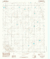
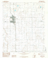 1985 Abernathy1985 Print · USGSAbernathy and the surrounding South Plains are captured in the mid-1980s as the region's agricultural and energy infrastructure expanded across the Hale and Lubbock county line. Researchers can trace the layout of Abernathy, the community of New Deal, and landmarks like the Abernathy Municipal Airport.
 - 1985 Map of Plainview
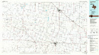
 1985 Plainview1985 Print · USGSThe Texas Panhandle's agricultural heartland and the dramatic escarpment are captured here in the mid-eighties. Genealogists and local historians can trace the rail-side growth of Lockney, the layout of Plainview, and the rugged breaks of Caprock Canyon State Park.2 unique versions available
 - 1985 Map of Abernathy SW
 1985 Abernathy SW1985 Print · USGSThe High Plains of the Texas Panhandle are captured here in the mid-1980s, showing a landscape defined by industrial agriculture and rural boundaries. Genealogists and local historians can locate the settlement of Caldwell or trace the path of Blackwater Draw past a local Gravel Pit.
 - 1985 Map of Roundup
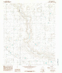
 1985 Roundup1985 Print · USGSThe Texas High Plains at the junction of four counties are captured here in the mid-1980s. Genealogists and land researchers can trace property boundaries near Roundup and follow the natural drainage of Yellow House Draw across the Llano Estacado.
 - 1985 Map of Cotton Center
 1985 Cotton Center1985 Print · USGSThe Texas High Plains around the mid-1980s reveal a landscape defined by industrial-scale agriculture and groundwater management. Genealogists and local historians can trace the townsite of Cotton Center and the natural paths of Crawfish Draw and Blackwater Draw.
 - 1985 Map of Levelland, 1986 Print
 1985 Levelland1986 Print · USGSThe West Texas High Plains are captured here in the mid-eighties as oil production and agriculture defined the region's economy. Researchers can trace the sprawling Levelland and Slaughter Oil and Gas Field or locate rural landmarks like Lums Chapel and South Plains College.2 unique versions available
 - 1986 Map of Lubbock
 1986 Lubbock1986 Print · USGSLubbock and the surrounding High Plains are documented in the mid-eighties as a structured grid of agricultural tracts and growing urban centers. Genealogists and local historians can trace family-named areas like Heckville, old rail stops on the Atchison Topeka and Santa Fe, and the winding path of Yellow House Canyon.2 unique versions available
End of results
Showing maps 1-10 of 10
Top cities of Hale County
- Plainview historical maps
- Abernathy historical maps
- Hale Center historical maps
- Petersburg historical maps
- Edmonson historical maps
Frequently asked questions
- What are the different types of historical maps available for Hale County?
- What is the oldest map of Hale County?
- Where can I purchase historical maps of Hale County for my home or office?
- Where can I download high-res historical maps of Hale County?
- Are there historical topographic maps available for Hale County?
- Is there historical aerial imagery available for Hale County?
- Where are historical maps of Hale County sourced from?