Old Maps of Hale County, Texas for Hiking & Exploration
Hike through history with 70 historic maps of Hale County. Explore old trails, ghost towns, and forgotten backroads — perfect for outdoor adventurers and local explorers.
- Rediscover forgotten places: Map out old mining camps, roads, and footpaths that no longer exist on modern maps.
- Layer with modern tools: Combine with LiDAR or satellite views to plan hikes through historical terrain.
- Made for exploration: Popular among hikers, overlanders, and local history lovers.
Use these maps to find adventure and explore the hidden past of Hale County.
Hale County, TX maps
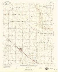
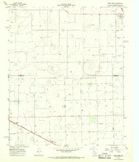
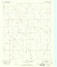
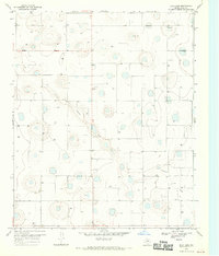
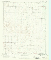
(70)- 1954 Map of Lubbock, 1958 Print
 1954 Lubbock1958 Print · USGSThe High Plains and Caprock region of West Texas come alive in the mid-1950s, showing a landscape defined by oil discovery and the Brazos River headwaters. Genealogists and historians can trace rail-connected towns like Roaring Springs, find the Pleasant Valley church, or locate family-named landmarks such as Soldier Mound.4 unique versions available
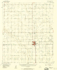
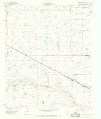
 - 1954 Map of Plainview, 1966 Print
 1954 Plainview1966 Print · USGSThe Texas Panhandle and the rugged Caprock Escarpment appear in detail as the region's agricultural and rail networks reached their mid-century peak. Trace family roots and old land patterns through the canyons and plains near Plainview, Palo Duro State Park, and Childress.3 unique versions available
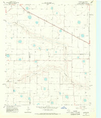
 - 1954 Map of Clovis, 1966 Print
 1954 Clovis1966 Print · USGSThe High Plains of the Texas-New Mexico borderland come alive in this mid-century survey as the region's agricultural and rail networks reached their peak. Trace family roots and local history through features like Cannon AFB, the massive Sand Hills, and busy rail towns such as Friona and Littlefield.4 unique versions available
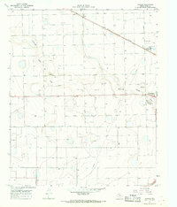
 - 1954 Map of Brownfield, 1975 Print
 1954 Brownfield1975 Print · USGSThe High Plains of the Texas-New Mexico border are captured here in the mid-twentieth century, as ranching and oil extraction shaped the Llano Estacado. Genealogists and historians can trace small rural centers like Lums Chapel, Hillburn City, and the Friendship Sch amid a landscape of windmills.2 unique versions available
 - 1957 Map of Anton, 1958 Print
 1957 Anton1958 Print · USGSThe South Plains of Texas come alive in the late fifties, showcasing the intersection of ranching and oil production. Trace family roots and vanished infrastructure through the Anton-Irish Oil Field, the Hardy Sch, and the depot at Anton.
 - 1957 Map of Abernathy, 1958 Print
 1957 Abernathy1958 Print · USGSThe High Plains of the Texas Panhandle appear here in the mid-fifties as a landscape of emerging oil fields and steady rail commerce. Researchers can trace rural genealogy through the IOOF Cem, Center Ch, and the outlying community of Cotton Center.2 unique versions available
 - 1958 Map of Brownfield
 1958 Brownfield1958 Print · USGSThe High Plains of the Texas-New Mexico border are captured here during a mid-century oil boom. Genealogists and historians can trace old community sites like Lums Chapel and Tokio alongside the vast Levelland and Slaughter Oil and Gas Field.
 - 1958 Map of Clovis
 1958 Clovis1958 Print · USGSThe High Plains of the New Mexico-Texas borderlands are captured here in the late fifties, during a period of significant military and agricultural expansion. Genealogists and historians can trace the rail-side growth of Clovis, the operations at Clovis Air Force Base, and the rural layout of communities like Muleshoe and Hereford.
 - 1958 Map of Plainview
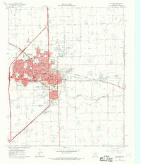
 1958 Plainview1958 Print · USGSThe High Plains and Caprock Escarpment meet in the late fifties, showcasing the ranching and rail networks of the Texas Panhandle. Trace family roots and vanished stops along the Panhandle and Santa Fe railroad through Plainview, Silverton, and Matador.
 - 1962 Map of Brownfield
 1962 Brownfield1962 Print · USGSThe High Plains of Texas and New Mexico are captured in the early sixties as a thriving hub of oil production and ranching. Researchers can trace the industrial footprint of the Levelland and Slaughter Oil and Gas Field or locate smaller towns like Sundown and Littlefield.
 - 1965 Map of Petersburg, 1966 Print
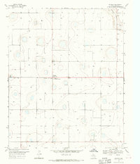
 1965 Petersburg1966 Print · USGSThe South Plains of West Texas appear in the mid-1960s as a landscape of rural town centers and rail-side industry. Genealogists and historians can trace the Petersburg townsite and Estacado settlement, or locate the local Cemetery and the Fort Worth and Denver railroad.
 - 1965 Map of Heckville, 1966 Print
 1965 Heckville1966 Print · USGSLubbock and Hale County farm life in the mid-sixties is centered on the railway and irrigation wells of the High Plains. Trace the path of the Fort Worth and Denver railroad through Becton and locate the historic Becton Cem and Heckville settlement.
 - 1965 Map of Kress West, 1968 Print
 1965 Kress West1968 Print · USGSThe High Plains landscape of Swisher and Hale counties is captured in the mid-1960s, showing a vital agricultural rail corridor. Researchers can trace family roots at Running Water Cem and follow the Fort Worth and Denver line through Farmers Spur.
 - 1965 Map of Edmonson, 1968 Print
 1965 Edmonson1968 Print · USGSThe Texas Panhandle comes into focus during the mid-sixties as agricultural and rail networks expanded across the plains. Genealogists and local historians can trace the footprint of Edmonson and Center Plains alongside the Fort Worth and Denver line.
 - 1965 Map of Hilburn, 1968 Print
 1965 Hilburn1968 Print · USGSThe High Plains of West Texas are captured here in the mid-1960s, showing a landscape shaped by the Fort Worth and Denver rail line. Genealogists and local historians can locate the Valley View Ch and early settlements at Hilburn and Grisham.2 unique versions available
 - 1965 Map of Wasson, 1968 Print
 1965 Wasson1968 Print · USGSHale County's agricultural landscape comes alive in the 1960s, showing the industrial infrastructure and small settlements north of the regional center. You can trace the path of the Aqueduct and locate sites like the Heck Cotton Gin and Boone.2 unique versions available
 - 1965 Map of Plainview, 1968 Print
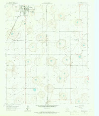
 1965 Plainview1968 Print · USGSPlainview and its surrounding High Plains landscape are captured here in the mid-sixties as the city grew into a major regional hub. Trace the development of Wayland College, locate early neighborhood schools like Ash Sch, and see the rail-driven economy of Grain Elevators along the Fort Worth and Denver line.
 - 1968 Map of Halfway, 1970 Print
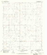
 1968 Halfway1970 Print · USGSAgricultural life in Hale County during the late sixties is defined by a landscape of irrigation and scientific research. Researchers can locate the High Plains Research Foundation, the Halfway Cem, and the private Laney Farm Landing Field among the local farmsteads.
 - 1968 Map of Happy Union, 1970 Print
 1968 Happy Union1970 Print · USGSHale County's agricultural High Plains are captured here in the late sixties as irrigation transformed the Texas Panhandle. Researchers can trace rural landmarks from the Four Hundred Cotton Gin to the small settlements of Happy Union and Ellen.
 - 1968 Map of Barwise, 1970 Print
 1968 Barwise1970 Print · USGSThe High Plains of West Texas are captured in the late sixties as the agricultural and oil industries reshaped the Hale and Floyd county line. Genealogists can locate family landmarks like Carrs Chapel, Harmony, and the Fort Worth and Denver rail line.
 - 1968 Map of Plainview SE, 1970 Print
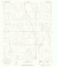
 1968 Plainview SE1970 Print · USGSThe West Texas High Plains at the close of the 1960s reveal a landscape of intensive irrigation and rail transport. Genealogy and local history researchers can trace family landmarks like Arick Cem, the Snead Landing Strip, and the path of the Fort Worth and Denver railroad.
 - 1968 Map of Julia Lake, 1970 Print
 1968 Julia Lake1970 Print · USGSHale County's high plains landscape is captured in the late sixties, showing a rural Texas territory defined by water management and mineral extraction. Researchers can locate the Lakeview Ch, trace the path of Crawfish Draw, and identify family-named points like Stewart 2.
 - 1968 Map of Hale Center SW, 1970 Print
 1968 Hale Center SW1970 Print · USGSHale County was a landscape of cotton gins and private airfields in the late sixties. Genealogists and local historians can locate the Mayfield community, the Center Plains cemetery, and farm-based aviation sites like the Sherrod Landing Strip.
 - 1968 Map of Hale Center, 1970 Print
 1968 Hale Center1970 Print · USGSHale Center and the surrounding plains are captured in the late sixties as the local agricultural economy thrived alongside the railroad. Researchers can trace the legacy of local families at the Hale Center Cem or locate rural landmarks like Akin Sch and the Boyd Airstrip.
 - 1968 Map of Corry, 1970 Print
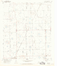
 1968 Corry1970 Print · USGSThe Texas Panhandle comes into focus during the late sixties as agricultural and energy development shaped the border of Lamb and Hale Counties. Researchers can trace the layout of Corry or locate the Sherrod Landing Strip and the course of Blackwater Draw.2 unique versions available
Showing maps 1-25 of 70
Top cities of Hale County
- Plainview historical maps
- Abernathy historical maps
- Hale Center historical maps
- Petersburg historical maps
- Edmonson historical maps
Frequently asked questions
- What are the different types of historical maps available for Hale County?
- What is the oldest map of Hale County?
- Where can I purchase historical maps of Hale County for my home or office?
- Where can I download high-res historical maps of Hale County?
- Are there historical topographic maps available for Hale County?
- Is there historical aerial imagery available for Hale County?
- Where are historical maps of Hale County sourced from?