
1965 Map of Hilburn
USGS Topo · Published 1968About this map
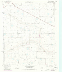
The Fort Worth and Denver railroad cuts a straight diagonal across this West Texas landscape, connecting the small settlements of Hilburn and Grisham. This 1965 field-checked survey reveals an agricultural terrain defined by the meandering course of the North Fork Running Water Draw, which snakes through the southern half of the quadrangle. The map is characterized by numerous small, isolated depressions and intermittent water features, typical of the High Plains geology in this region where Castro and Hale counties meet. Settlement is sparse, anchored by the Valley View Ch and scattered industrial sites like the Gravel Pit and Borrow Pit, illustrating a rural economy tied to the land and the rail line.
Find a feature on this map
9 named features on this map. Tap any name to fly to it.
Don’t see what you’re looking for? This feature index may not catch every label — zoom into the map to look around manually.
Map Details
Editions of this 1965 Hilburn Map
2 editions found
Other maps of this area

1954 · Plainview
USGS Topo · 1:250,000

1954 · Clovis
USGS Topo · 1:250,000

1958 · Clovis
USGS Topo · 1:250,000

1958 · Plainview
USGS Topo · 1:250,000

1963 · Hart NW
USGS Topo · 1:24,000

1963 · Olton
USGS Topo · 1:24,000

1963 · Hart SW
USGS Topo · 1:24,000

1965 · Hart
USGS Topo · 1:24,000

1965 · Edmonson
USGS Topo · 1:24,000

1965 · Center Plains School
USGS Topo · 1:24,000