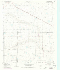
1965 Map of Hilburn
USGS Topo · Published 1981About this map
Hilburn and the small settlement of Grisham anchor this agricultural landscape on the High Plains, mapped during a period of significant water resource monitoring by the State of Texas Texas Water Development Board. The terrain is defined by the winding course of the North Fork Running Water Draw, which carves a distinct path through the surrounding fields. Industrial and community life are marked by the presence of a Valley View Ch, alongside several extractive sites like a Gravel Pit and Borrow Pit. The Fort Worth and Denver railroad cuts a sharp diagonal across the northern section of the map, serving as the primary transportation artery for the region's agricultural output. This survey captures the rural layout of the Panhandle where county lines for Castro, Hale, and Lamb all converge, highlighting the intersection of transit and topography.
Find a feature on this map
9 named features on this map. Tap any name to fly to it.
Don’t see what you’re looking for? This feature index may not catch every label — zoom into the map to look around manually.
Map Details
Editions of this 1965 Hilburn Map
2 editions found
Other maps of this area

1954 · Plainview
USGS Topo · 1:250,000

1954 · Clovis
USGS Topo · 1:250,000

1958 · Clovis
USGS Topo · 1:250,000

1958 · Plainview
USGS Topo · 1:250,000

1963 · Hart NW
USGS Topo · 1:24,000

1963 · Olton
USGS Topo · 1:24,000

1963 · Hart SW
USGS Topo · 1:24,000

1965 · Hart
USGS Topo · 1:24,000

1965 · Edmonson
USGS Topo · 1:24,000

1965 · Hilburn
USGS Topo · 1:24,000