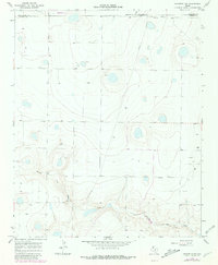
1966 Map of Nazareth NW
USGS Topo · Published 1981About this map
Middle Tule Draw defines the southern landscape of this High Plains quadrangle, carving a distinct topographic path through the panhandle terrain. This area, where the borders of Deaf Smith, Castro, and Randall counties meet, reflects a mid-century agricultural and infrastructure pattern typical of the region. A notable Landing Field sits in the northwest, while a localized Gravel Pit and a prominent Pipeline indicate the light industrial footprint alongside traditional ranching and farming operations. The small settlement of Hendrix appears in the eastern section, connected by a network of section-line roads such as County Line Road. This survey documents the transition into more intensive land use, with revisions from the late 1970s capturing developments in local infrastructure that occurred after the initial mid-1960s mapping.
Find a feature on this map
9 named features on this map. Tap any name to fly to it.
Don’t see what you’re looking for? This feature index may not catch every label — zoom into the map to look around manually.
Map Details
Editions of this 1966 Nazareth NW Map
2 editions found
Other maps of this area

1954 · Clovis
USGS Topo · 1:250,000

1958 · Clovis
USGS Topo · 1:250,000

1961 · Buffalo Lake
USGS Topo · 1:62,500

1965 · Dimmitt
USGS Topo · 1:24,000

1965 · Nazareth SW
USGS Topo · 1:24,000

1965 · Nazareth
USGS Topo · 1:24,000

1966 · Jumbo
USGS Topo · 1:24,000

1966 · Nazareth NW
USGS Topo · 1:24,000

1966 · Arney
USGS Topo · 1:24,000

1971 · Hereford SE
USGS Topo · 1:24,000