
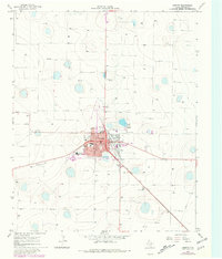
1965 Map of Dimmitt
USGS Topo · Published 1968About this map
Dimmitt serves as the focal point of this mid-1960s survey, showing a well-developed High Plains county seat defined by its civic infrastructure and transport links. The town core includes the Courthouse, Hospital, and Post Office, surrounded by residential blocks and educational facilities like the Jr High Sch and High Sch. The economy and social life of the era are reflected in the presence of the Refinery and the Fort Worth and Denver railroad line cutting through the landscape.
Find a feature on this map
19 named features on this map. Tap any name to fly to it.
Don’t see what you’re looking for? This feature index may not catch every label — zoom into the map to look around manually.
Map Details
Editions of this 1965 Dimmitt Map
2 editions found
Other maps of this area

1954 · Clovis
USGS Topo · 1:250,000

1958 · Clovis
USGS Topo · 1:250,000

1962 · Dodd NE
USGS Topo · 1:24,000

1963 · Flagg
USGS Topo · 1:24,000

1963 · Hart NW
USGS Topo · 1:24,000

1965 · Dimmitt SW
USGS Topo · 1:24,000

1965 · Nazareth SW
USGS Topo · 1:24,000

1966 · Jumbo
USGS Topo · 1:24,000

1966 · Nazareth NW
USGS Topo · 1:24,000

1966 · Easter
USGS Topo · 1:24,000