
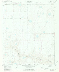
1966 Map of Nazareth NW
USGS Topo · Published 1968About this map
Middle Tule Draw carves a distinctive path across this High Plains landscape, where the borders of three counties meet. Surveyed in the mid-1960s, the map reveals a sparsely settled agricultural region defined by large land tracts and an extensive network of fencelines. The small settlement of Hendrix appears on the eastern edge of the quadrangle, serving as a focal point for the surrounding rural community. Evidence of local industry is visible along the draws, specifically near the Gravel Pit sites that utilized the area's natural deposits. A Pipeline cuts through the northern sections, signaling the infrastructure supporting the broader Texas Panhandle energy economy. This topographic record documents a specific era of land management before more intensive modern development, capturing the layout of rural roads and isolated water wells that sustained the local ranching and farming operations.
Find a feature on this map
7 named features on this map. Tap any name to fly to it.
Don’t see what you’re looking for? This feature index may not catch every label — zoom into the map to look around manually.
Map Details
Editions of this 1966 Nazareth NW Map
2 editions found
Other maps of this area

1954 · Clovis
USGS Topo · 1:250,000

1958 · Clovis
USGS Topo · 1:250,000

1961 · Buffalo Lake
USGS Topo · 1:62,500

1965 · Dimmitt
USGS Topo · 1:24,000

1965 · Nazareth SW
USGS Topo · 1:24,000

1965 · Nazareth
USGS Topo · 1:24,000

1966 · Jumbo
USGS Topo · 1:24,000

1966 · Arney
USGS Topo · 1:24,000

1971 · Hereford SE
USGS Topo · 1:24,000
1984 · Buffalo Lake SW
USGS Topo · 1:24,000