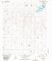
1984 Map of Buffalo Lake SW
USGS Topo · Published 1984About this map
Tierra Blanca Creek winds through the high plains of the Texas Panhandle, defining the drainage patterns of this agricultural landscape. The northeast corner of the sheet is dominated by the National Wildlife Refuge, where Buffalo Lake provides a critical stopover for migratory birds in an otherwise semi-arid region. This 1980s data illustrates the managed water resources of the era, marked by numerous Tanks and Wells distributed across the terrain to support livestock and farming.
Find a feature on this map
13 named features on this map. Tap any name to fly to it.
Don’t see what you’re looking for? This feature index may not catch every label — zoom into the map to look around manually.
Map Details
Editions of this 1984 Buffalo Lake SW Map
This is the sole edition of this map. No revisions or reprints were ever made.
Other maps of this area

1954 · Clovis
USGS Topo · 1:250,000

1958 · Clovis
USGS Topo · 1:250,000

1961 · Buffalo Lake
USGS Topo · 1:62,500

1966 · Jumbo
USGS Topo · 1:24,000

1966 · Nazareth NW
USGS Topo · 1:24,000

1966 · Arney
USGS Topo · 1:24,000

1971 · Hereford NE
USGS Topo · 1:24,000

1971 · Hereford SE
USGS Topo · 1:24,000
1984 · Dawn
USGS Topo · 1:24,000
1984 · Umbarger
USGS Topo · 1:24,000