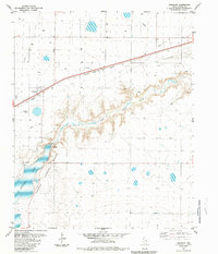
1984 Map of Umbarger
USGS Topo · Published 1984About this map
Tierra Blanca Creek carves a deep path across the High Plains of the Texas Panhandle, defining the geography of this mid-1980s landscape. The small community of Umbarger sits at the intersection of local roads and the Atchison Topeka and Santa Fe railroad, serving as a focal point for the surrounding agricultural plains. Nearby, the St Marys Cem serves as a silent record of the area's local genealogy and pioneer roots.
Find a feature on this map
15 named features on this map. Tap any name to fly to it.
Don’t see what you’re looking for? This feature index may not catch every label — zoom into the map to look around manually.
Map Details
Editions of this 1984 Umbarger Map
This is the sole edition of this map. No revisions or reprints were ever made.
Other maps of this area

1954 · Tucumcari
USGS Topo · 1:250,000

1954 · Amarillo
USGS Topo · 1:250,000

1954 · Plainview
USGS Topo · 1:250,000

1954 · Clovis
USGS Topo · 1:250,000

1958 · Clovis
USGS Topo · 1:250,000

1958 · Amarillo
USGS Topo · 1:250,000

1958 · Tucumcari
USGS Topo · 1:250,000

1958 · Plainview
USGS Topo · 1:250,000

1960 · Canyon
USGS Topo · 1:62,500
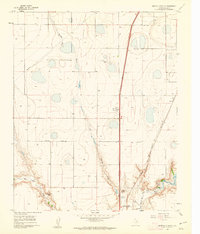
1960 · Buffalo Stadium
USGS Topo · 1:24,000