
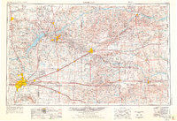
1954 Map of Amarillo
USGS Topo · Published 1966About this map
The High Plains of the Texas Panhandle are defined here by a dense industrial and agricultural network during the mid-1960s. Amarillo serves as the primary hub, surrounded by a landscape of sprawling cattle ranches and growing energy infrastructure. To the northeast, the Sanford Reservoir has reshaped the drainage of the Canadian River, while the Pantex Ordnance Plant sits as a massive installation east of the city. The era's transportation backbone is clearly visible through the major rail lines like the Panhandle and Santa Fe and the legendary U.S. 66, which connects small settlements such as Groom and McLean. Significant industrial presence is noted in towns like Borger and Phillips, centers for the region's oil and gas production. Genealogists can trace family footprints across smaller locales like Mobeetie, White Deer, and Skellytown, as well as the numerous windmills and ranches that dot the draws leading to the North Fork Red River.
Find a feature on this map
101 named features on this map. Tap any name to fly to it.
Don’t see what you’re looking for? This feature index may not catch every label — zoom into the map to look around manually.
Map Details
Editions of this 1954 Amarillo Map
2 editions found
Other maps of this area

1934 · Ady
USGS Topo · 1:62,500

1934 · Cliffside
USGS Topo · 1:62,500

1936 · Fourways
USGS Topo · 1:62,500

1936 · Cliffside
USGS Topo · 1:62,500

1936 · Ady
USGS Topo · 1:62,500

1939 · Sanford
USGS Topo · 1:62,500

1953 · Sanford
USGS Topo · 1:24,000

1953 · Plemons
USGS Topo · 1:24,000

1953 · Chunky
USGS Topo · 1:24,000

1953 · Marsh
USGS Topo · 1:24,000