
1954 Map of Plainview
USGS Topo · Published 1966About this map
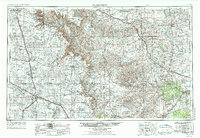
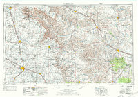
Palo Duro State Park and the dramatic incisions of the Palo Duro Canyon dominate the northern landscape of this Texas Panhandle survey. The terrain transitions from the high, flat plains around Plainview and Tulia into the complex breaks and draws of the Prairie Dog Town Fork Red River and the Pease River systems. This 1950s data, revised in the mid-1960s, reveals a region defined by its agricultural grid and a robust transportation network.
Find a feature on this map
112 named features on this map. Tap any name to fly to it.
Don’t see what you’re looking for? This feature index may not catch every label — zoom into the map to look around manually.
Map Details
Editions of this 1954 Plainview Map
3 editions found
Other maps of this area

1927 · Quanah 3-b
USGS Topo · 1:48,000

1932 · Vivian
USGS Topo · 1:62,500

1954 · Lubbock
USGS Topo · 1:250,000

1954 · Tucumcari
USGS Topo · 1:250,000

1954 · Amarillo
USGS Topo · 1:250,000

1954 · Wichita Falls
USGS Topo · 1:250,000

1954 · Clovis
USGS Topo · 1:250,000

1954 · Brownfield
USGS Topo · 1:250,000

1955 · Lawton
USGS Topo · 1:250,000

1955 · Clinton
USGS Topo · 1:250,000