
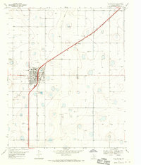
1965 Map of Plainview
USGS Topo · Published 1968About this map
Plainview serves as the focal point of this mid-1960s West Texas landscape, where the urban grid intersects with the vital infrastructure of the High Plains. The map reveals a community deeply rooted in education and regional services, anchored by Wayland College and numerous local schools such as Booker T Washington High Sch and Thunderbird Sch. The industrial character of the era is evident in the cluster of Grain Elevators and Storage Bins situated along the Atchison Topeka and Santa Fe and Fort Worth and Denver railroad lines, which dominate the local logistics network.
Find a feature on this map
45 named features on this map. Tap any name to fly to it.
Don’t see what you’re looking for? This feature index may not catch every label — zoom into the map to look around manually.
Map Details
Editions of this 1965 Plainview Map
This is the sole edition of this map. No revisions or reprints were ever made.
Other maps of this area

1954 · Plainview
USGS Topo · 1:250,000

1958 · Plainview
USGS Topo · 1:250,000

1965 · Kress West
USGS Topo · 1:24,000

1965 · Wasson
USGS Topo · 1:24,000

1968 · Happy Union
USGS Topo · 1:24,000

1968 · Plainview SE
USGS Topo · 1:24,000
1968 · Hale Center
USGS Topo · 1:24,000

1968 · Aiken
USGS Topo · 1:24,000

1969 · Kress East
USGS Topo · 1:24,000
1969 · Providence
USGS Topo · 1:24,000