
1969 Map of Kress East
USGS Topo · Published 1971About this map
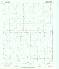
The High Plains landscape of Swisher and Hale Counties is defined here by the industrial-scale agricultural development of the late 1960s. The Atchison Topeka and Santa Fe railroad serves as the primary corridor for commerce, cutting diagonally through the terrain to connect the settlements of Kress and Finney. The map reveals a high density of water infrastructure, with dozens of irrigation wells scattered across the township grids, supporting the region's intensive farming legacy. Local landmarks include the High Sch in Kress and the winding course of Rock Draw to the north. A notable administrative detail is the Swisher Co Hale Co line, which bisects the quadrangle, alongside an Indefinite Boundary that suggests the complex nature of local land surveying in this portion of the Texas Panhandle.
Find a feature on this map
11 named features on this map. Tap any name to fly to it.
Don’t see what you’re looking for? This feature index may not catch every label — zoom into the map to look around manually.
Map Details
Editions of this 1969 Kress East Map
This is the sole edition of this map. No revisions or reprints were ever made.
Other maps of this area

1954 · Plainview
USGS Topo · 1:250,000

1958 · Plainview
USGS Topo · 1:250,000

1965 · Edmonson NE
USGS Topo · 1:24,000

1965 · Kress West
USGS Topo · 1:24,000

1965 · Wasson
USGS Topo · 1:24,000

1965 · Plainview
USGS Topo · 1:24,000

1968 · Aiken
USGS Topo · 1:24,000

1969 · Claytonville
USGS Topo · 1:24,000

1969 · Claytonville NW
USGS Topo · 1:24,000
1969 · Providence
USGS Topo · 1:24,000