
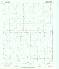
1969 Map of Claytonville
USGS Topo · Published 1971About this map
Claytonville anchors the southern portion of this landscape, situated at the intersection of local roads and surrounded by a vast network of property boundaries marked by fine fence lines. The terrain is defined by the significant incision of Tule Draw in the northwest, where the drainage of South Tule Creek has carved deep contours into the High Plains surface. An industry-grounded detail is the Gravel Pit located near the draw, suggesting local extraction of materials for road building or construction in the late 1960s.
Find a feature on this map
9 named features on this map. Tap any name to fly to it.
Don’t see what you’re looking for? This feature index may not catch every label — zoom into the map to look around manually.
Map Details
Editions of this 1969 Claytonville Map
This is the sole edition of this map. No revisions or reprints were ever made.
Other maps of this area

1954 · Plainview
USGS Topo · 1:250,000

1958 · Plainview
USGS Topo · 1:250,000

1965 · Rock Creek
USGS Topo · 1:24,000

1965 · Silverton SW
USGS Topo · 1:24,000

1965 · Cope Creek
USGS Topo · 1:24,000

1968 · Tule Lake
USGS Topo · 1:24,000

1969 · Love
USGS Topo · 1:24,000

1969 · Kress East
USGS Topo · 1:24,000

1969 · Claytonville NW
USGS Topo · 1:24,000
1969 · Providence
USGS Topo · 1:24,000