Old Maps of Randall County, Texas
Explore 178 old maps of Randall County, spanning from 1954 to today. These high-resolution historic maps reveal how streets, neighborhoods, landmarks, and natural features evolved over time — perfect for genealogy, metal detecting, research, and local history exploration.
What you can do with these maps:
- See how Randall County changed over time: Compare historical maps to modern-day views to trace roads, homesites, rail lines & more.
- View detailed metadata: Each map includes creators, publishers, year, scale, and archive source.
- Overlay maps with satellite & LiDAR: Visualize the past alongside modern tools to explore terrain & human change.
- Trusted historical sources: Maps sourced from the USGS, Library of Congress, and other archives.
- Access maps your way: View online, download high-res files, or order prints for personal or research use.
Start exploring old maps of Randall County to uncover forgotten places, hidden landmarks, and the deep history beneath your feet.
Randall County, TX maps
(178)- 1954 Map of Tucumcari, 1965 Print
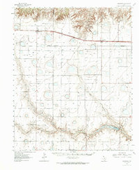
 1954 Tucumcari1965 Print · USGSThe high plains along the New Mexico and Texas border come alive in this mid-century survey, just as the regional highway network was maturing. Trace the historic route of U.S. 66 through Glenrio and San Jon or locate remote rail sidings like Rehm Station and Obar.2 unique versions available
 - 1954 Map of Amarillo, 1966 Print
 1954 Amarillo1966 Print · USGSThe Texas Panhandle in the mid-1960s shows a landscape of rising industrial power and deep-rooted ranching tradition. Local historians can trace the paths of the Panhandle and Santa Fe railroad or locate sites like the Pantex Ordnance Plant and Mobeetie.2 unique versions available
 - 1954 Map of Plainview, 1966 Print
 1954 Plainview1966 Print · USGSThe Texas Panhandle and the rugged Caprock Escarpment appear in detail as the region's agricultural and rail networks reached their mid-century peak. Trace family roots and old land patterns through the canyons and plains near Plainview, Palo Duro State Park, and Childress.3 unique versions available
 - 1954 Map of Clovis, 1966 Print
 1954 Clovis1966 Print · USGSThe High Plains of the Texas-New Mexico borderland come alive in this mid-century survey as the region's agricultural and rail networks reached their peak. Trace family roots and local history through features like Cannon AFB, the massive Sand Hills, and busy rail towns such as Friona and Littlefield.4 unique versions available
 - 1956 Map of Fortress Cliff, 1957 Print
 1956 Fortress Cliff1957 Print · USGSPalo Duro Canyon’s geological landmarks and early park infrastructure are captured here in the mid-fifties. Researchers can trace historic landmarks like Lighthouse Peak, the Historical Battle Site Marker, and the route of the Miniature Railroad.4 unique versions available
 - 1956 Map of Amarillo East, 1957 Print
 1956 Amarillo East1957 Print · USGSAmarillo and the surrounding Panhandle plains are shown here during a period of significant mid-century growth and industrial expansion. Local historians can trace dozens of neighborhood landmarks, from the Tradewind Airport to numerous schools like Carver Sch and Palo Duro High Sch.3 unique versions available
 - 1956 Map of Washburn, 1957 Print
 1956 Washburn1957 Print · USGSThe Texas Panhandle comes alive in the mid-1950s at the vital rail crossing of Washburn, where two major lines met the legendary Route 66. Genealogists and rail historians can trace the local Washburn Cem and the busy junction of the Fort Worth and Denver and the Rock Island railroads.3 unique versions available
 - 1956 Map of Thomas Ranch, 1957 Print
 1956 Thomas Ranch1957 Print · USGSThe Texas Panhandle ranching landscape is captured here in the mid-1950s, highlighting the dramatic drop into Palo Duro Canyon. Genealogists and researchers can trace family-named sites like Thomas Ranch, Sorelle Ranch, and Owens Ranch.3 unique versions available
 - 1956 Map of Pullman, 1958 Print
 1956 Pullman1958 Print · USGSThe Texas Panhandle comes into focus during the mid-fifties, showing a landscape defined by massive military airbases and a dense crossroads of three major railroads. Trace the development of Amarillo Air Force Base and the small siding at Pullman alongside the Panhandle and Santa Fe tracks.3 unique versions available
 - 1958 Map of Clovis
 1958 Clovis1958 Print · USGSThe High Plains of the New Mexico-Texas borderlands are captured here in the late fifties, during a period of significant military and agricultural expansion. Genealogists and historians can trace the rail-side growth of Clovis, the operations at Clovis Air Force Base, and the rural layout of communities like Muleshoe and Hereford.
 - 1958 Map of Amarillo
 1958 Amarillo1958 Print · USGSThe Texas Panhandle in the mid-1950s reveals a landscape of expanding military installations and oil-rich rail towns. Local historians can trace the development of Amarillo Air Force Base or locate smaller settlements like Magic City and New Mobeetie.
 - 1958 Map of Tucumcari
 1958 Tucumcari1958 Print · USGSEastern New Mexico and the Texas Panhandle meet in this mid-century survey of the high plains ranching and rail corridor. Researchers can trace the path of Mother Road travelers through Tucumcari and Glenrio or locate remote rail stops like Nara Visa Station and Hartley Station.
 - 1958 Map of Plainview
 1958 Plainview1958 Print · USGSThe High Plains and Caprock Escarpment meet in the late fifties, showcasing the ranching and rail networks of the Texas Panhandle. Trace family roots and vanished stops along the Panhandle and Santa Fe railroad through Plainview, Silverton, and Matador.
 - 1960 Map of Canyon, 1961 Print
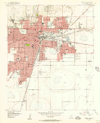
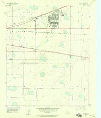
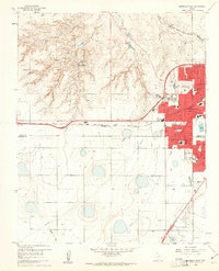
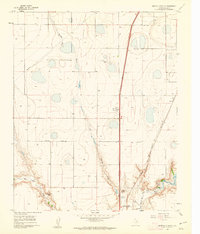
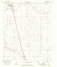
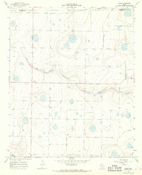
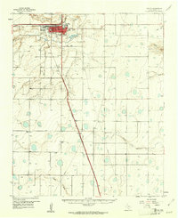 1960 Canyon1961 Print · USGSRandall County in the early sixties centers on the growing campus of West Texas State College and the surrounding plains. Genealogists and rail historians can trace the Panhandle and Santa Fe line through the small siding at Ogg and locate rural landmarks like Dreamland Cem.2 unique versions available
 - 1960 Map of Fairview, 1961 Print
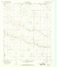
 1960 Fairview1961 Print · USGSArmstrong and Randall counties are shown here in the early 1960s, a period of established High Plains ranching. Researchers can trace historic property boundaries and family-named homesteads such as Willow Valley Farm, Butterfield, and the small community of Fairview.3 unique versions available
 - 1960 Map of The Palisades, 1961 Print
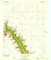
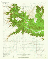
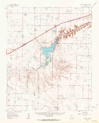
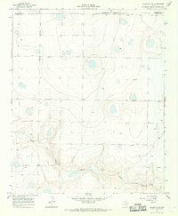
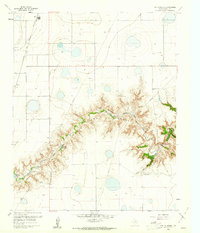 1960 The Palisades1961 Print · USGSRandall County's dramatic canyonlands are shown in detail during the early sixties as the landscape supported both ranching and recreation. Researchers can locate the winding Prairie Dog Town Fork Red River, Camp Harrington, and the railroad stops at Zita and Haney.3 unique versions available
 - 1960 Map of Amarillo West, 1961 Print
 1960 Amarillo West1961 Print · USGSThe Texas Panhandle meets mid-century suburban growth in this survey of West Amarillo during the early 1960s. Researchers can trace the expansion of neighborhood schools like Olsen Park Sch and locate the historic Kiwanis Camp near the rugged breaks of West Amarillo Creek.3 unique versions available
 - 1960 Map of Buffalo Stadium, 1962 Print
 1960 Buffalo Stadium1962 Print · USGSRandall County's dramatic canyon breaks and high plains industry are captured here in the early sixties. Genealogists and local historians can trace the Panhandle and Santa Fe railroad line, locate Haney, or find Memory Gardens (Cem).3 unique versions available
 - 1960 Map of Wayside, 1962 Print
 1960 Wayside1962 Print · USGSThe Texas Panhandle in the early sixties reveals the dramatic vertical landscape of Palo Duro Canyon. Researchers can trace the 1874 Mackenzie Battleground, family ranch sites like Harrell Ranch, and the isolated community of Wayside.2 unique versions available
 - 1961 Map of Buffalo Lake, 1964 Print
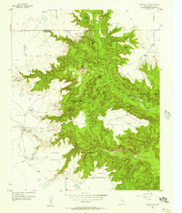
 1961 Buffalo Lake1964 Print · USGSThe Texas Panhandle comes alive in the early sixties, showing the vital relationship between the Panhandle and Santa Fe railroad and local ranching life. Trace family roots and land use near Umbarger, St Mary Cem, and the Flying Mare Ranch.2 unique versions available
 - 1962 Map of Wildorado, 1964 Print
 1962 Wildorado1964 Print · USGSThe Texas Panhandle comes into focus during the early sixties, showing the rail-and-ranch life along the Chicago Rock Island and Pacific line. Genealogists and historians can trace local landmarks like Palo Duro Ch, Highland Sch, and the Bynum Ranch.
 - 1965 Map of Happy, 1968 Print
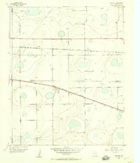
 1965 Happy1968 Print · USGSThe High Plains of Swisher and Randall Counties are captured here in the mid-1960s, a period of established rail transport and rural agricultural growth. Researchers can trace the path of the Atchison Topeka and Santa Fe railroad from Happy down to Kaffir or locate the Happy Cem.
 - 1966 Map of Tulia NW, 1968 Print
 1966 Tulia NW1968 Print · USGSSwisher County in the mid-sixties shows a quiet Panhandle landscape shaped by the natural carving of North Tule Draw. Local historians can trace the paths of early energy infrastructure like the Pipeline or locate the site of the Radio Tower.
 - 1966 Map of Nazareth NW, 1968 Print
 1966 Nazareth NW1968 Print · USGSThe High Plains of the Texas Panhandle appear in the mid-1960s as a landscape of rural ranching and infrastructure. Researchers can trace the intersection of three counties and locate local landmarks like the Hendrix settlement and several Gravel Pit sites.2 unique versions available
 - 1966 Map of Arney, 1968 Print
 1966 Arney1968 Print · USGSThe Castro County high plains are captured here in the mid-1960s, showing a landscape defined by playa lakes and rural section roads. Researchers can trace the settlement of Arney and the seasonal paths of North Tule Draw and Middle Tule Draw.2 unique versions available
Showing maps 1-25 of 178
Top cities of Randall County
- Canyon historical maps
- Lake Tanglewood historical maps
- Timbercreek Canyon historical maps
- Palisades historical maps
Frequently asked questions
- What are the different types of historical maps available for Randall County?
- What is the oldest map of Randall County?
- Where can I purchase historical maps of Randall County for my home or office?
- Where can I download high-res historical maps of Randall County?
- Are there historical topographic maps available for Randall County?
- Is there historical aerial imagery available for Randall County?
- Where are historical maps of Randall County sourced from?