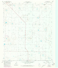
1966 Map of Jumbo
USGS Topo · Published 1981About this map
Jumbo and Lambert anchor this section of the Texas Panhandle, recorded by the Geological Survey during the mid-1960s with revisions reflecting the late 1970s. The landscape is defined by the ephemeral drainage of Middle Tule Draw and a dense network of water wells, essential for the high-plains agricultural economy of the era. The survey captures the early industrialization of cattle ranching, marked by a significant Feedlot and the infrastructure of a power Substation. Spanning the boundary of Deaf Smith and Castro Counties, the map documents a transition from traditional land use to more intensive irrigation and livestock management, with fine red dashed lines indicating the specific layout of fence lines across the high plains.
Find a feature on this map
6 named features on this map. Tap any name to fly to it.
Don’t see what you’re looking for? This feature index may not catch every label — zoom into the map to look around manually.
Map Details
Editions of this 1966 Jumbo Map
2 editions found
Other maps of this area

1954 · Clovis
USGS Topo · 1:250,000

1958 · Clovis
USGS Topo · 1:250,000

1961 · Buffalo Lake
USGS Topo · 1:62,500

1965 · Dimmitt
USGS Topo · 1:24,000

1965 · Dimmitt SW
USGS Topo · 1:24,000

1965 · Nazareth SW
USGS Topo · 1:24,000

1966 · Jumbo
USGS Topo · 1:24,000

1966 · Nazareth NW
USGS Topo · 1:24,000

1966 · Easter
USGS Topo · 1:24,000

1970 · Hereford
USGS Topo · 1:24,000