Old Maps of Hall County, Texas
Explore 135 old maps of Hall County, spanning from 1954 to today. These high-resolution historic maps reveal how streets, neighborhoods, landmarks, and natural features evolved over time — perfect for genealogy, metal detecting, research, and local history exploration.
What you can do with these maps:
- See how Hall County changed over time: Compare historical maps to modern-day views to trace roads, homesites, rail lines & more.
- View detailed metadata: Each map includes creators, publishers, year, scale, and archive source.
- Overlay maps with satellite & LiDAR: Visualize the past alongside modern tools to explore terrain & human change.
- Trusted historical sources: Maps sourced from the USGS, Library of Congress, and other archives.
- Access maps your way: View online, download high-res files, or order prints for personal or research use.
Start exploring old maps of Hall County to uncover forgotten places, hidden landmarks, and the deep history beneath your feet.
Hall County, TX maps
(135)- 1954 Map of Plainview, 1966 Print
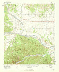
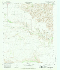
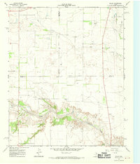
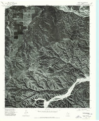
 1954 Plainview1966 Print · USGSThe Texas Panhandle and the rugged Caprock Escarpment appear in detail as the region's agricultural and rail networks reached their mid-century peak. Trace family roots and old land patterns through the canyons and plains near Plainview, Palo Duro State Park, and Childress.3 unique versions available
 - 1958 Map of Plainview
 1958 Plainview1958 Print · USGSThe High Plains and Caprock Escarpment meet in the late fifties, showcasing the ranching and rail networks of the Texas Panhandle. Trace family roots and vanished stops along the Panhandle and Santa Fe railroad through Plainview, Silverton, and Matador.
 - 1960 Map of Brice, 1963 Print
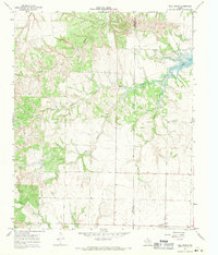
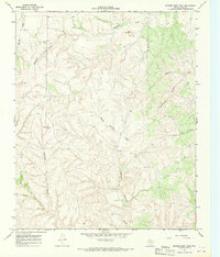
 1960 Brice1963 Print · USGSHall County ranching and the rugged breaks of the Red River are documented here in the early sixties. Genealogists and historians can trace family landholdings like Shoe Bar Ranch and locate the Hickman Sch or the remote Oxbow Ranch.
 - 1961 Map of Memphis, 1963 Print
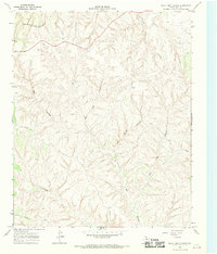
 1961 Memphis1963 Print · USGSThe Texas Panhandle is captured here in the early sixties as a network of rail-side settlements and wide river basins. Genealogists and local historians can trace the foundations of Memphis or locate rural sites like Plaska, Hulver Cemetery, and the Travis School.
 - 1961 Map of Estelline, 1963 Print
 1961 Estelline1963 Print · USGSThe Texas Panhandle's rail-and-river landscape comes alive in this early 1960s survey of the Hall and Childress county lines. Genealogists and historians can trace the foundations of Estelline and Newlin, locating Estelline Cem and Harrell Chapel.2 unique versions available
 - 1967 Map of Tell South, 1969 Print
 1967 Tell South1969 Print · USGSThe Texas Panhandle at the intersection of three counties shows a landscape defined by the winding North Pease River during the late sixties. Researchers can trace land boundaries and drainage patterns along Running Water Creek and Richland Creek or locate old Gravel Pits.2 unique versions available
 - 1967 Map of North Windmill, 1969 Print
 1967 North Windmill1969 Print · USGSThe rolling canyonlands of Motley and Hall County are captured in the late 1960s, a time when ranching life centered on the vital water of Turkey Creek. Genealogists can locate Dreamland Cem and remote landmarks like Dogtown Windmill or the settlement at Kent.2 unique versions available
 - 1967 Map of Tell North, 1969 Print
 1967 Tell North1969 Print · USGSAcross the Hall and Childress county line in the late 1960s, this survey captures the rural ranching landscape surrounding Tell. Researchers can locate the community cemetery and trace the winding courses of North Baylor Creek and Baylor Lake.2 unique versions available
 - 1967 Map of Cottonwood Camp, 1969 Print
 1967 Cottonwood Camp1969 Print · USGSMotley and Hall counties are shown during the late sixties as a network of cattle camps and vital water points. Genealogists and historians can trace local landmarks like Turkey Creek Ranch and the namesake Cottonwood Camp along the North Pease River.2 unique versions available
 - 1967 Map of Tampico Siding, 1969 Print
 1967 Tampico Siding1969 Print · USGSHall County's canyonlands and ranching country are frozen in time during the late sixties. Trace the FORT WORTH AND DENVER line to Tampico Siding or explore local landmarks like Wolf Flat and Mockingbird Draw.2 unique versions available
 - 1967 Map of Badger Nest Tank, 1969 Print
 1967 Badger Nest Tank1969 Print · USGSHall County ranching country is captured here in the late sixties, showing a landscape defined by deep canyons and critical water sources. Local researchers can trace the drainages of North Baylor Creek or locate landmarks like Red Camp and Wolf Mountain.
 - 1967 Map of Northfield, 1969 Print
 1967 Northfield1969 Print · USGSThe West Texas Panhandle near the North Pease River is shown in the late 1960s as a landscape of ranching and river canyons. Genealogists and historians can trace the rural settlement of Northfield or locate family landmarks like Lake Joe and Cheney Mountain.2 unique versions available
 - 1967 Map of Turkey, 1970 Print
 1967 Turkey1970 Print · USGSThe ranching and rail landscape of Hall County is captured here in the late sixties, centered on the community of Turkey. Researchers can trace the path of the Fort Worth and Denver railroad and find local landmarks like the Drive-in Theater and Fuston Camp Windmill.2 unique versions available
 - 1967 Map of Blue Tank Canyon, 1970 Print
 1967 Blue Tank Canyon1970 Print · USGSHall County ranch lands in the late sixties remain defined by deep canyon breaks and the lone reach of the Fort Worth and Denver railroad. Trace old property lines and remote tracks near Parnell, Mill Iron, and the winding Blue Tank Canyon.2 unique versions available
 - 1967 Map of Folley, 1970 Print
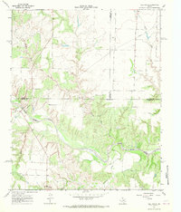
 1967 Folley1970 Print · USGSThe ranching country of Motley County comes alive in the late sixties as the Quitaque Creek canyons cut through the high plains. Genealogists and historians can locate Folley, the Turkey Airfield, and the vintage Drive-in Theater near the Briscoe county line.2 unique versions available
 - 1976 Map of Brice SE, 1978 Print
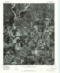
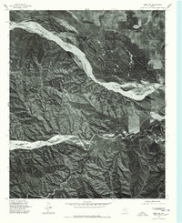 1976 Brice SE1978 Print · USGSThe Texas Panhandle landscape in the mid-seventies is revealed through detailed aerial imagery of the Hall County breaks. Researchers can trace the wide, braided path of the Prairie Dog Town Fork Red River and the winding course of the Little Red River.
 - 1976 Map of Brice NW, 1978 Print
 1976 Brice NW1978 Print · USGSHall County land patterns are captured in the mid-seventies, showing the intersection of high-plains farming and river breaks. Trace the winding paths of Mulberry Creek and Battle Creek as they flow toward the Prairie Dog Town Fork Red River.
 - 1976 Map of Memphis NW, 1978 Print
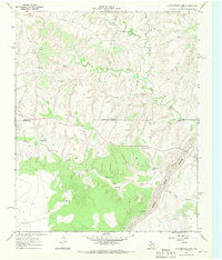
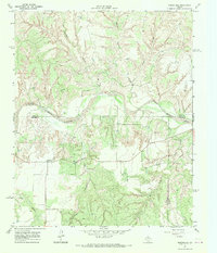
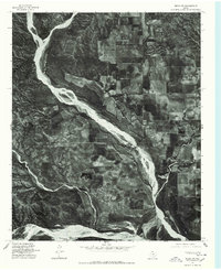
 1976 Memphis NW1978 Print · USGSThe Texas Panhandle comes into focus in the mid-1970s, showcasing a landscape of precision-terraced fields and dry arroyos. Trace the residential layout of Lakeview and the winding course of Oaks Creek across this detailed aerial survey.
 - 1976 Map of Brice NE, 1978 Print
 1976 Brice NE1978 Print · USGSHall County farmland and rural drainage are revealed in this mid-seventies aerial survey of the Texas Panhandle. Genealogists and historians can pinpoint rural homesites near Lesley and trace the shoreline of Hancock Lake.
 - 1976 Map of Memphis SE, 1978 Print
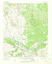
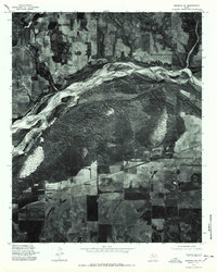 1976 Memphis SE1978 Print · USGSHall County in the mid-seventies is captured in this detailed orthophotograph showing the confluence of desert hydrology and agriculture. Researchers can trace the rural layouts of Parnell and Hulver along the Prairie Dog Town Fork Red River.
 - 1976 Map of Memphis NE, 1978 Print
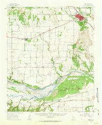
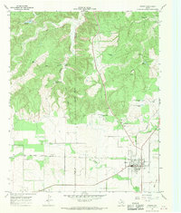
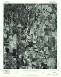
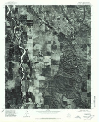 1976 Memphis NE1978 Print · USGSThe Texas Panhandle reveals its mid-seventies agricultural and urban landscape in this high-contrast aerial study. Genealogists and local historians can trace the exact street grid and perimeter of Memphis as it looked decades ago.
 - 1976 Map of Memphis SW, 1978 Print
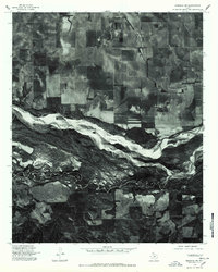 1976 Memphis SW1978 Print · USGSHall County land and river patterns are captured in the mid-seventies just as the agricultural landscape matured. Researchers can trace the braided channels of the Prairie Dog Town Fork Red River and locate the rural settlement of Plaska.
 - 1976 Map of Brice SW, 1978 Print
 1976 Brice SW1978 Print · USGSHall County land patterns are frozen in time during the mid-seventies, showing the intersection of agricultural plateaus and deep canyon breaks. Researchers can trace the braided channels of the Little Red River and the Prairie Dog Town Fork Red River.
 - 1984 Map of Estelline NW, 1985 Print
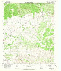
 1984 Estelline NW1985 Print · USGSThe Texas Panhandle ranchlands appear in transition during the mid-1980s, where Hall, Childress, and Collingsworth counties meet. Researchers can trace the path of the Burlington Northern railroad or locate water sources like Bryants Lake and several working corrals.
 - 1985 Map of Lesley
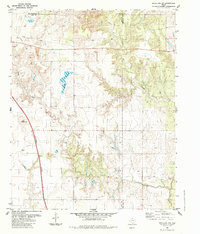
 1985 Lesley1985 Print · USGSThe Texas Panhandle in the mid-eighties shows a landscape of deep creek breaks and isolated windmills near the Hall-Donley line. Researchers can trace the community of Lesley, the local Cem, and small water features like Finger Lake and Handcock Lake.
Showing maps 1-25 of 135
Top cities of Hall County
Frequently asked questions
- What are the different types of historical maps available for Hall County?
- What is the oldest map of Hall County?
- Where can I purchase historical maps of Hall County for my home or office?
- Where can I download high-res historical maps of Hall County?
- Are there historical topographic maps available for Hall County?
- Is there historical aerial imagery available for Hall County?
- Where are historical maps of Hall County sourced from?