1910s Maps of Goose Creek Reserve, Baytown
Explore 3 historic maps of Goose Creek Reserve from the 1910s. These maps offer a rare glimpse into what life looked like during the 1910s — showing old roads, neighborhoods, homes, and landmarks that have changed or disappeared over time.
Whether you're researching your family's past, planning a metal detecting trip, or studying how Goose Creek Reserve's landscape evolved across the 1910s, these high-resolution maps are a powerful tool for exploring the history of this region.
- Focus on a specific era: All maps on this page are from the 1910s, giving you a focused view of this time period.
- See what’s changed: Compare century-old streets, trails, and buildings to today's modern landscape using overlays and satellite layers.
- Research with precision: Use these maps for genealogy, historical research, land use analysis, or educational projects.
- View, download, or print: Maps are fully viewable online in high resolution, and can be downloaded or printed for your own records.
Start exploring Goose Creek Reserve's history through authentic maps from the 1910s. This is your window into the past.
Goose Creek Reserve, Baytown maps
(3)- 1916 Map of Burnett Bay
 1916 Burnett Bay1916 Print · USGSCoastal Harris County is captured in the early twentieth century as the regional landscape began to modernize around the San Jacinto River. Researchers can trace the early layout of Lynchburg and Elena, locate rural landmarks like the Clawson School, and explore the grounds of the San Jacinto Battlefield.
 - 1916 Map of Cedar Bayou
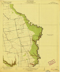
 1916 Cedar Bayou1916 Print · USGSThe coastal plains of Harris and Chambers counties are captured here just before the era of major regional change. Trace the early school at Ellis League School, find ferry crossings at Milam Bend, and follow the Barbers Hill Road through the bayou country.
 - 1919 Map of Cedar Bayou
 1919 Cedar Bayou1919 Print · USGSHarris County at the end of the Great War shows a transition from rural river life to an emerging road network. Genealogists and researchers can trace local landmarks like the Ellis League School and historical crossings such as Williams Ferry and Cedar Bayou.2 unique versions available
End of results
Showing maps 1-3 of 3
Frequently asked questions
- What are the different types of historical maps available for Goose Creek Reserve?
- What is the oldest map of Goose Creek Reserve?
- Where can I purchase historical maps of Goose Creek Reserve for my home or office?
- Where can I download high-res historical maps of Goose Creek Reserve?
- Are there historical topographic maps available for Goose Creek Reserve?
- Is there historical aerial imagery available for Goose Creek Reserve?
- Where are historical maps of Goose Creek Reserve sourced from?