1960s Maps of Houston, Texas
Explore 19 historic maps of Houston from the 1960s. These maps offer a rare glimpse into what life looked like during the 1960s — showing old roads, neighborhoods, homes, and landmarks that have changed or disappeared over time.
Whether you're researching your family's past, planning a metal detecting trip, or studying how Houston's landscape evolved across the 1960s, these high-resolution maps are a powerful tool for exploring the history of this region.
- Focus on a specific era: All maps on this page are from the 1960s, giving you a focused view of this time period.
- See what’s changed: Compare century-old streets, trails, and buildings to today's modern landscape using overlays and satellite layers.
- Research with precision: Use these maps for genealogy, historical research, land use analysis, or educational projects.
- View, download, or print: Maps are fully viewable online in high resolution, and can be downloaded or printed for your own records.
Start exploring Houston's history through authentic maps from the 1960s. This is your window into the past.
Houston, TX maps
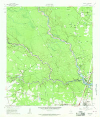
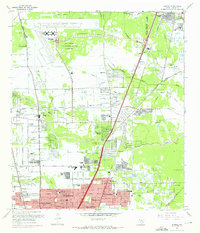
(19)- 1960 Map of Waller, 1961 Print
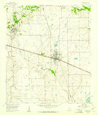 1960 Waller1961 Print · USGSCovers Houston, including Prairie View, Waller, and other nearby areas4 unique versions available
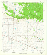
 - 1960 Map of Spring, 1962 Print
 1960 Spring1962 Print · USGSCovers Houston, including The Woodlands, Spring, and other nearby areas2 unique versions available
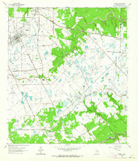
 - 1960 Map of Huffman, 1962 Print
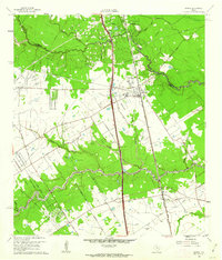
 1960 Huffman1962 Print · USGSCovers Houston, including Dayton, Huffman, and other nearby areas4 unique versions available
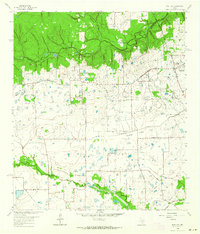
 - 1961 Map of Moonshine Hill, 1962 Print
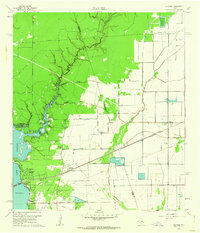
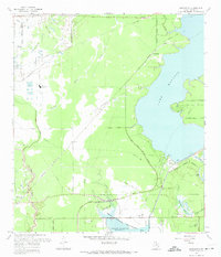
 1961 Moonshine Hill1962 Print · USGSCovers Houston, including Kingwood, Humble, and other nearby areas4 unique versions available
 - 1961 Map of Maedan, 1962 Print
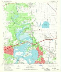
 1961 Maedan1962 Print · USGSCovers Houston, including Humble, Maedan, and other nearby areas2 unique versions available
 - 1962 Map of Hockley, 1964 Print
 1962 Hockley1964 Print · USGSCovers Houston, including Hegar, Fairfield, and other nearby areas3 unique versions available
 - 1962 Map of Tomball, 1964 Print
 1962 Tomball1964 Print · USGSCovers Houston, including Tomball, Champions Trail, and other nearby areas4 unique versions available
 - 1962 Map of Rose Hill, 1964 Print
 1962 Rose Hill1964 Print · USGSCovers Houston, including Tomball, Rose Hill, and other nearby areas3 unique versions available
 - 1967 Map of Humble
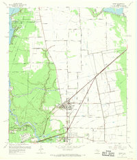
 1967 Humble1967 Print · USGSCovers Houston, including Humble, Emerson Place, and other nearby areas2 unique versions available
 - 1967 Map of Harmaston
 1967 Harmaston1967 Print · USGSCovers Houston, including Atascocita, Humble, and other nearby areas2 unique versions available
 - 1967 Map of Aldine
 1967 Aldine1967 Print · USGSCovers Houston, including Aldine, Northwest Park, and other nearby areas3 unique versions available
 - 1967 Map of Highlands, 1969 Print
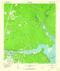
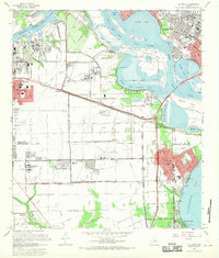
 1967 Highlands1969 Print · USGSCovers Houston, including Baytown, Channelview, and other nearby areas
 - 1967 Map of Crosby, 1969 Print
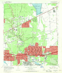
 1967 Crosby1969 Print · USGSCovers Houston, including Crosby, Magnolia Gardens, and other nearby areas
 - 1967 Map of Park Place, 1969 Print
 1967 Park Place1969 Print · USGSCovers Houston, including Galena Park, East Haven, and other nearby areas
 - 1967 Map of Houston Heights, 1970 Print
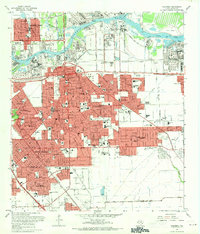
 1967 Houston Heights1970 Print · USGSCovers Houston, including Hunters Creek Village, Spring Valley Village, and other nearby areas
 - 1967 Map of Pasadena, 1970 Print
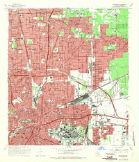
 1967 Pasadena1970 Print · USGSCovers Houston, including Pasadena, Deer Park, and other nearby areas
 - 1967 Map of Settegast, 1970 Print
 1967 Settegast1970 Print · USGSCovers Houston, including Galena Park, Jacinto City, and other nearby areas2 unique versions available
 - 1967 Map of La Porte, 1970 Print
 1967 La Porte1970 Print · USGSCovers Houston, including Pasadena, Baytown, and other nearby areas
 - 1967 Map of Jacinto City, 1970 Print
 1967 Jacinto City1970 Print · USGSCovers Houston, including Galena Park, Jacinto City, and other nearby areas
End of results
Showing maps 1-19 of 19
Top cities near Houston
- Sugar Land historical maps
- Missouri City historical maps
- Stafford historical maps
- Bellaire historical maps
- South Houston historical maps
- Aldine historical maps
See more
Top neighborhoods of Houston
- Mayfair historical maps
- Westwood Park historical maps
- Bordersville historical maps
- Hobby historical maps
- Golfcrest historical maps
- Dunnam historical maps
See more
Frequently asked questions
- What are the different types of historical maps available for Houston?
- What is the oldest map of Houston?
- Where can I purchase historical maps of Houston for my home or office?
- Where can I download high-res historical maps of Houston?
- Are there historical topographic maps available for Houston?
- Is there historical aerial imagery available for Houston?
- Where are historical maps of Houston sourced from?