1990s Maps of Acres Homes, Houston
Explore 3 historic maps of Acres Homes from the 1990s. These maps offer a rare glimpse into what life looked like during the 1990s — showing old roads, neighborhoods, homes, and landmarks that have changed or disappeared over time.
Whether you're researching your family's past, planning a metal detecting trip, or studying how Acres Homes's landscape evolved across the 1990s, these high-resolution maps are a powerful tool for exploring the history of this region.
- Focus on a specific era: All maps on this page are from the 1990s, giving you a focused view of this time period.
- See what’s changed: Compare century-old streets, trails, and buildings to today's modern landscape using overlays and satellite layers.
- Research with precision: Use these maps for genealogy, historical research, land use analysis, or educational projects.
- View, download, or print: Maps are fully viewable online in high resolution, and can be downloaded or printed for your own records.
Start exploring Acres Homes's history through authentic maps from the 1990s. This is your window into the past.
Acres Homes, Houston maps
(3)- 1992 Map of Houston
 1992 Houston1992 Print · USGSThe Houston metropolitan area reached its modern sprawl in the early nineties, centered on the Buffalo Bayou and a massive regional rail network. Genealogists and historians can trace the development of satellite cities like Sugar Land and Pasadena, or locate legacy sites like the Humble Oil Field and the NASA Lyndon B Johnson Space Center.
 - 1995 Map of Houston Heights, 1998 Print
 1995 Houston Heights1998 Print · USGSMid-nineties Houston is captured here during a period of dense urban development and institutional growth. Researchers can trace historic burial sites like Hollywood Cem and Glenwood Cemetery or locate old school sites like Bethune Sch.
 - 1995 Map of Aldine, 1999 Print
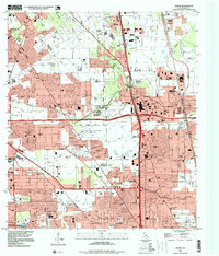 1995 Aldine1999 Print · USGSAldine and the surrounding Harris County suburbs are shown in the mid-1990s, where energy production and residential growth converge. Researchers can trace family history at Houston National Cemetery or locate local landmarks like the Greenspoint Mall and Aldine High Sch.
End of results
Showing maps 1-3 of 3
Frequently asked questions
- What are the different types of historical maps available for Acres Homes?
- What is the oldest map of Acres Homes?
- Where can I purchase historical maps of Acres Homes for my home or office?
- Where can I download high-res historical maps of Acres Homes?
- Are there historical topographic maps available for Acres Homes?
- Is there historical aerial imagery available for Acres Homes?
- Where are historical maps of Acres Homes sourced from?