Old Maps of Songwood, Houston for Metal Detecting
Plan your next treasure hunt with 18 historic maps of Songwood. Find old homesites, ghost towns, trails, and gathering spots that may be lost to time — perfect for identifying promising metal detecting locations.
- Locate forgotten sites: Uncover places like long-lost settlements, abandoned rail lines, or gathering spots.
- Plan better hunts: Use map overlays combined with LiDAR or satellite views to narrow in on historically rich areas.
- Made for detectorists: Thousands of hobbyists use these maps to discover relics, coins, and hidden history.
Use these historic maps to boost your research and find new opportunities beneath the surface of Songwood.
Songwood, Houston maps
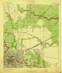
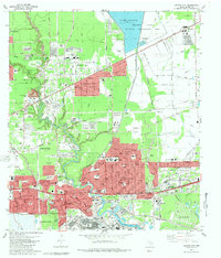
(18)- 1916 Map of Settegast
 1916 Settegast1916 Print · USGSCovers Songwood, including Houston, Galena Park, and other nearby areas2 unique versions available
 - 1916 Map of Fauna
 1916 Fauna1916 Print · USGSCovers Songwood, including Houston, Galena Park, and other nearby areas
 - 1920 Map of Fauna
 1920 Fauna1920 Print · USGSCovers Songwood, including Houston, Galena Park, and other nearby areas
 - 1922 Map of Settegast
 1922 Settegast1922 Print · USGSCovers Songwood, including Houston, Galena Park, and other nearby areas2 unique versions available
 - 1932 Map of Fauna
 1932 Fauna1932 Print · USGSCovers Songwood, including Houston, Galena Park, and other nearby areas
 - 1946 Map of Settegast
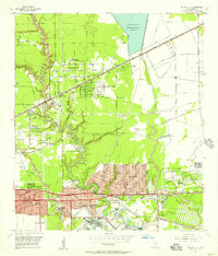
 1946 Settegast1946 Print · USGSCovers Songwood, including Houston, Galena Park, and other nearby areas
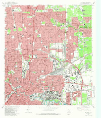
 - 1950 Map of Houston, 1953 Print
 1950 Houston1953 Print · USGSCovers Songwood, including Houston, Pasadena, and other nearby areas
 - 1955 Map of Jacinto City, 1957 Print
 1955 Jacinto City1957 Print · USGSCovers Songwood, including Houston, Galena Park, and other nearby areas
 - 1955 Map of Settegast, 1957 Print
 1955 Settegast1957 Print · USGSCovers Songwood, including Houston, Galena Park, and other nearby areas
 - 1956 Map of Houston, 1963 Print
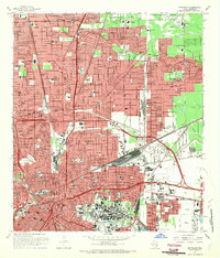
 1956 Houston1963 Print · USGSCovers Songwood, including Houston, Pasadena, and other nearby areas2 unique versions available
 - 1967 Map of Settegast, 1970 Print
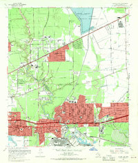
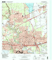
 1967 Settegast1970 Print · USGSCovers Songwood, including Houston, Galena Park, and other nearby areas2 unique versions available
 - 1967 Map of Jacinto City, 1970 Print
 1967 Jacinto City1970 Print · USGSCovers Songwood, including Houston, Galena Park, and other nearby areas
 - 1975 Map of Houston, 1977 Print
 1975 Houston1977 Print · USGSCovers Songwood, including Houston, Pasadena, and other nearby areas2 unique versions available
 - 1982 Map of Jacinto City, 1983 Print
 1982 Jacinto City1983 Print · USGSCovers Songwood, including Houston, Galena Park, and other nearby areas2 unique versions available
 - 1982 Map of Settegast, 1983 Print
 1982 Settegast1983 Print · USGSCovers Songwood, including Houston, Galena Park, and other nearby areas2 unique versions available
 - 1992 Map of Houston
 1992 Houston1992 Print · USGSCovers Songwood, including Houston, Pasadena, and other nearby areas
 - 1995 Map of Settegast, 1999 Print
 1995 Settegast1999 Print · USGSCovers Songwood, including Houston, Galena Park, and other nearby areas
 - 1995 Map of Jacinto City, 2000 Print
 1995 Jacinto City2000 Print · USGSCovers Songwood, including Houston, Galena Park, and other nearby areas
End of results
Showing maps 1-18 of 18
Frequently asked questions
- What are the different types of historical maps available for Songwood?
- What is the oldest map of Songwood?
- Where can I purchase historical maps of Songwood for my home or office?
- Where can I download high-res historical maps of Songwood?
- Are there historical topographic maps available for Songwood?
- Is there historical aerial imagery available for Songwood?
- Where are historical maps of Songwood sourced from?