
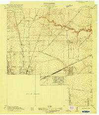
1916 Map of Settegast
USGS Topo · Published 1916About this map
The northern edge of the City of Houston meets a complex industrial and residential fringe during the mid-1910s. This survey captures early development patterns before the city's massive post-war expansion, characterized by a dense web of rail lines including the International and Great Northern and the Southern Pacific System. The landscape is transitioning from prairie to an industrial hub, evidenced by the presence of the Tank Farm near Englewood and the emerging infrastructure at Houston Harbor and Port Houston. Rural education is well-distributed through several neighborhood institutions like Berry School, Sykes School, and Oats Prairie School. Drainage is defined by the winding paths of Halls Bayou and Hunting Bayou, which slice through the developing residential blocks of Brooks Smith Addition and Crosstimbers.
Find a feature on this map
27 named features on this map. Tap any name to fly to it.
Don’t see what you’re looking for? This feature index may not catch every label — zoom into the map to look around manually.
Map Details
Editions of this 1916 Settegast Map
2 editions found
Other maps of this area

1915 · Bellaire
USGS Topo · 1:24,000

1915 · Park Place
USGS Topo · 1:24,000

1915 · Houston Heights
USGS Topo · 1:24,000

1915 · Deepwater
USGS Topo · 1:24,000

1916 · Aldine
USGS Topo · 1:24,000

1916 · Fauna
USGS Topo · 1:24,000

1916 · Harmaston
USGS Topo · 1:24,000

1916 · Humble
USGS Topo · 1:24,000

1919 · Aldine
USGS Topo · 1:31,680

1919 · Deepwater
USGS Topo · 1:31,680