1900s (20th Century) Maps of Crossroads, Texas
Explore 6 historic maps of Crossroads from the 1900s (20th Century). These maps offer a rare glimpse into what life looked like during the 1900s — showing old roads, neighborhoods, homes, and landmarks that have changed or disappeared over time.
Whether you're researching your family's past, planning a metal detecting trip, or studying how Crossroads's landscape evolved across the 1900s, these high-resolution maps are a powerful tool for exploring the history of this region.
- Focus on a specific era: All maps on this page are from the 1900s, giving you a focused view of this time period.
- See what’s changed: Compare century-old streets, trails, and buildings to today's modern landscape using overlays and satellite layers.
- Research with precision: Use these maps for genealogy, historical research, land use analysis, or educational projects.
- View, download, or print: Maps are fully viewable online in high resolution, and can be downloaded or printed for your own records.
Start exploring Crossroads's history through authentic maps from the 1900s. This is your window into the past.
Crossroads, TX maps
(6)- 1943 Map of Waskom, 1954 Print
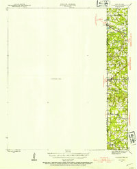 1943 Waskom1954 Print · USGSThe Texas-Louisiana borderlands in the 1940s were a network of rural schools and rail-side settlements. Genealogists can trace family footprints through numerous sites like Union Chapel, Richmond Sch, and Forest Park Cem along the interstate line.
 - 1945 Map of Waskom
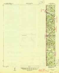 1945 Waskom1945 Print · USGSThe Texas-Louisiana borderlands come into focus during the mid-1940s as rail and road networks began to reshape rural Harrison and Panola counties. Genealogists can trace family landmarks like Forest Park Cem, Union Chapel, and numerous schools including Waco Sch and Liberty Sch.
 - 1956 Map of Tyler
 1956 Tyler1956 Print · USGSEast Texas was a powerhouse of oil production and rail transport during the mid-fifties, centered on the sprawling East Texas Oil Field. Researchers can trace the heritage of industrial hubs like Kilgore, military sites such as the Longhorn Ordnance Works, and many rural landmarks like Mount Enterprise.5 unique versions available
 - 1962 Map of Stricklin Springs, 1964 Print
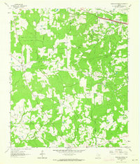 1962 Stricklin Springs1964 Print · USGSEast Texas energy and rural life converge in the early sixties as the Elysian Gas Field expands through Harrison County. Genealogists and local historians can trace community roots at the Elysian Fields Sch, Granbury Cem, and Stricklin Springs.2 unique versions available
 - 1984 Map of Tyler
 1984 Tyler1984 Print · USGSEast Texas at the peak of its reservoir-building era shows a landscape defined by new lakes and established rail corridors. Trace the path of the St Louis Southwestern RR or locate industrial sites like the Longhorn Ordnance Works.3 unique versions available
 - 1986 Map of Henderson
 1986 Henderson1986 Print · USGSEast Texas and the Louisiana borderlands come into focus in the 1980s as industrial energy production meets quiet rural townships. Researchers can trace family sites and local landmarks from Elysian Fields to Old Panola, alongside major features like the Strip Mine and Martin Lake State Park.2 unique versions available
End of results
Showing maps 1-6 of 6
Top cities near Crossroads
Frequently asked questions
- What are the different types of historical maps available for Crossroads?
- What is the oldest map of Crossroads?
- Where can I purchase historical maps of Crossroads for my home or office?
- Where can I download high-res historical maps of Crossroads?
- Are there historical topographic maps available for Crossroads?
- Is there historical aerial imagery available for Crossroads?
- Where are historical maps of Crossroads sourced from?