Old Maps of San Marcos, Texas
Explore 15 old maps of San Marcos, spanning from 1911 to today. These high-resolution historic maps reveal how streets, neighborhoods, landmarks, and natural features evolved over time — perfect for genealogy, metal detecting, research, and local history exploration.
What you can do with these maps:
- See how San Marcos changed over time: Compare historical maps to modern-day views to trace roads, homesites, rail lines & more.
- View detailed metadata: Each map includes creators, publishers, year, scale, and archive source.
- Overlay maps with satellite & LiDAR: Visualize the past alongside modern tools to explore terrain & human change.
- Trusted historical sources: Maps sourced from the USGS, Library of Congress, and other archives.
- Access maps your way: View online, download high-res files, or order prints for personal or research use.
Start exploring old maps of San Marcos to uncover forgotten places, hidden landmarks, and the deep history beneath your feet.
San Marcos, TX maps
(15)- 1911 Map of San Marcos
 1911 San Marcos1911 Print · USGSCovers San Marcos, including Seguin, Kyle, and other nearby areas2 unique versions available
 - 1919 Map of San Marcos
 1919 San Marcos1919 Print · USGSCovers San Marcos, including Seguin, Kyle, and other nearby areas
 - 1929 Map of Hunter
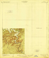 1929 Hunter1929 Print · USGSCovers San Marcos, including New Braunfels, Wimberley, and other nearby areas2 unique versions available
 - 1953 Map of Seguin, 1965 Print
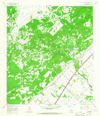
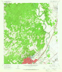
 1953 Seguin1965 Print · USGSCovers San Marcos, including Seguin, Kyle, and other nearby areas4 unique versions available
 - 1954 Map of San Antonio, 1964 Print
 1954 San Antonio1964 Print · USGSCovers San Marcos, including San Antonio, New Braunfels, and other nearby areas3 unique versions available
 - 1957 Map of San Antonio
 1957 San Antonio1957 Print · USGSCovers San Marcos, including San Antonio, New Braunfels, and other nearby areas
 - 1958 Map of Seguin
 1958 Seguin1958 Print · USGSCovers San Marcos, including Seguin, Kyle, and other nearby areas
 - 1964 Map of Hunter, 1965 Print
 1964 Hunter1965 Print · USGSCovers San Marcos, including New Braunfels, Royal Forest, and other nearby areas5 unique versions available
 - 1964 Map of San Marcos South, 1966 Print
 1964 San Marcos South1966 Print · USGSCovers San Marcos, including Centerpoint, Stringtown, and other nearby areas3 unique versions available
 - 1964 Map of Uhland, 1966 Print
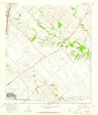 1964 Uhland1966 Print · USGSCovers San Marcos, including Kyle, Niederwald, and other nearby areas3 unique versions available
 - 1964 Map of San Marcos North, 1966 Print
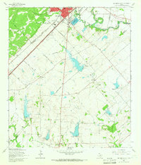
 1964 San Marcos North1966 Print · USGSCovers San Marcos, including Kyle, Centex, and other nearby areas5 unique versions available
 - 1985 Map of New Braunfels
 1985 New Braunfels1985 Print · USGSCovers San Marcos, including San Antonio, New Braunfels, and other nearby areas
 - 1985 Map of Seguin, 1986 Print
 1985 Seguin1986 Print · USGSCovers San Marcos, including Seguin, Kyle, and other nearby areas2 unique versions available
 - 1992 Map of New Braunfels
 1992 New Braunfels1992 Print · USGSCovers San Marcos, including San Antonio, New Braunfels, and other nearby areas2 unique versions available
 - 1995 Map of San Marcos North, 1998 Print
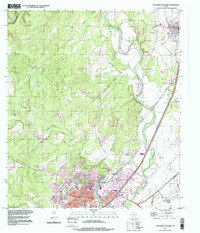 1995 San Marcos North1998 Print · USGSCovers San Marcos, including Kyle, Centex, and other nearby areas
End of results
Showing maps 1-15 of 15
Top cities near San Marcos
- New Braunfels historical maps
- Seguin historical maps
- Kyle historical maps
- Buda historical maps
- Lockhart historical maps
- Wimberley historical maps
See more
Top neighborhoods of San Marcos
- Centex historical maps
- Castle Forest historical maps
- Blanco Gardens historical maps
- Blanco Vista historical maps
- East Guadalupe historical maps
- Fairlawn historical maps
See more
Frequently asked questions
- What are the different types of historical maps available for San Marcos?
- What is the oldest map of San Marcos?
- Where can I purchase historical maps of San Marcos for my home or office?
- Where can I download high-res historical maps of San Marcos?
- Are there historical topographic maps available for San Marcos?
- Is there historical aerial imagery available for San Marcos?
- Where are historical maps of San Marcos sourced from?