Old Maps of McAllen, Texas for Hiking & Exploration
Hike through history with 55 historic maps of McAllen. Explore old trails, ghost towns, and forgotten backroads — perfect for outdoor adventurers and local explorers.
- Rediscover forgotten places: Map out old mining camps, roads, and footpaths that no longer exist on modern maps.
- Layer with modern tools: Combine with LiDAR or satellite views to plan hikes through historical terrain.
- Made for exploration: Popular among hikers, overlanders, and local history lovers.
Use these maps to find adventure and explore the hidden past of McAllen.
McAllen, TX maps
(55)- 1914 Map of San Juan
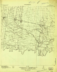 1914 San Juan1914 Print · USGSThe Lower Rio Grande Valley is captured here just before the First World War, showing the early rail-driven growth of McAllen, Pharr, and San Juan. Genealogists and historians can trace the transition from old river-side life along the Military Road to the irrigation-based settlements at Ebenezer and Valley View Plantation.2 unique versions available
 - 1916 Map of San Juan
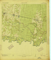 1916 San Juan1916 Print · USGSThe Lower Rio Grande Valley underwent a dramatic transformation in the mid-1910s as rail and irrigation reshaped the border. Trace the early growth of Mc Allen and Pharr or follow the historic Military Road as it winds past the Valley View Plantation.3 unique versions available
 - 1940 Map of Monte Christo
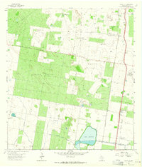
 1940 Monte Christo1940 Print · USGSHidalgo County ranching and irrigation systems are shown here in the 1930s and 40s as a structured agricultural grid takes shape. Researchers can trace family homesteads like Tanquecillas Ranch or locate the site of the Wimobasis Club and early railroad stops on the St L B & M Ry.2 unique versions available
 - 1949 Map of Mc Allen, 1954 Print
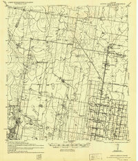
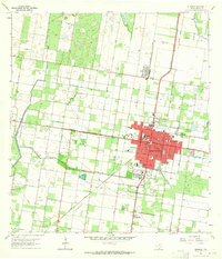
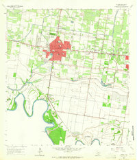
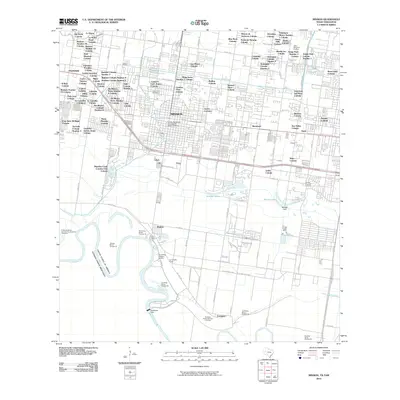
 1949 Mc Allen1954 Print · USGSThe Rio Grande Valley at mid-century reveals a bustling international corridor of citrus groves, rail lines, and growing border towns. Genealogists and historians can trace the Missouri Pacific RR through McAllen or locate rural landmarks like the Santa Fe School and Arkansas City.
 - 1954 Map of McAllen
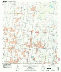
 1954 McAllen1954 Print · USGSCovers McAllen, including Reynosa, Edinburg, and other nearby areas
 - 1957 Map of Mc Allen, 1962 Print
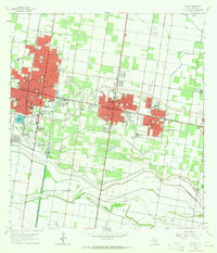
 1957 Mc Allen1962 Print · USGSThe South Texas borderlands emerge in the late fifties as a hub of energy production and military activity. Researchers can trace the river economy through Rio Grande City, find the Brewster School, and locate the Moore Air Force Base.2 unique versions available
 - 1962 Map of McAllen
 1962 McAllen1962 Print · USGSThe Lower Rio Grande Valley in the mid-twentieth century shows a complex landscape of irrigation, oil production, and border commerce. Genealogists and historians can trace family roots through riverside towns like Zapata, Roma-Los Saenz, and Hidalgo, or locate landmarks like Santa Elena Ch and Moore Air Force Base.
 - 1963 Map of Monte Christo, 1965 Print
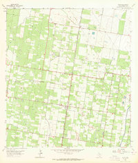
 1963 Monte Christo1965 Print · USGSThe Hidalgo County brushlands in the early 1960s reveal a landscape of energy extraction and military aviation. Researchers can trace the infrastructure of Mission Air Base, the Missouri Pacific railroad, and local landmarks like La Gloria Ranch.2 unique versions available
 - 1963 Map of Edinburg, 1965 Print
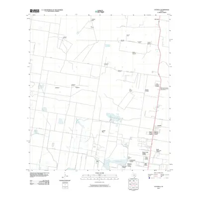
 1963 Edinburg1965 Print · USGSEdinburg in the early sixties was a thriving valley hub where irrigation canals and rail lines met amongst the citrus groves. Researchers can trace the layout of Pan American College, the Old Edinburg Cem, and the tracks of the Southern Pacific Railroad.3 unique versions available
 - 1963 Map of Faysvillle, 1965 Print
 1963 Faysvillle1965 Print · USGSHidalgo County ranchlands come into focus in the early sixties, showing a landscape defined by water management and family outposts. Trace the cattle-country history of Faysville through landmarks like Vela Cem, Guadalupe Ranch, and Lake Edinburg.
 - 1963 Map of Alton, 1965 Print
 1963 Alton1965 Print · USGSThe Rio Grande Valley's citrus groves and energy fields are laid bare in the early sixties near Alton. Genealogists and historians can trace the development of Palmhurst and Cantu alongside the industrial infrastructure of the Mission Gas Field and the Missouri Pacific railroad.
 - 1963 Map of Hidalgo, 1965 Print
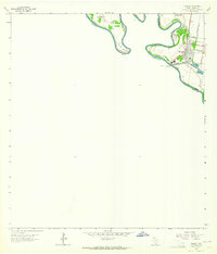 1963 Hidalgo1965 Print · USGSHidalgo and the international border come to life in the early sixties as a hub of river commerce and irrigation. Researchers can trace the path of the Missouri Pacific railroad or locate the McAllen-Hidalgo-Reynosa Toll Bridge and U S Customs office.2 unique versions available
 - 1963 Map of Mission, 1965 Print
 1963 Mission1965 Print · USGSThe citrus-rich corridor of the Rio Grande Valley comes to life in this early 1960s survey of Hidalgo County. Genealogists and historians can trace family-named sites and landmarks like La Lomita Mission, Marcell Sch, and the Laurel Hill Cem.3 unique versions available
 - 1963 Map of Pharr, 1965 Print
 1963 Pharr1965 Print · USGSHidalgo County's urban and industrial corridor is captured in the early sixties as it centers on the growth of McAllen and Pharr. Researchers can trace the mid-century development of landmarks like Miller International Airport, Guadalupe Cem, and the massive Main Floodway.2 unique versions available
 - 1983 Map of Mc Allen, 1984 Print
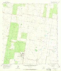
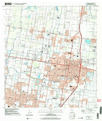
 1983 Mc Allen1984 Print · USGSThe Lower Rio Grande Valley is captured here during the early 1980s, showcasing the intense cross-border connectivity and agricultural expansion of the era. Researchers can trace the sprawling irrigation networks around Mc Allen and Mission, or locate landmarks like the Zapata Aircraft Control and Warning Station and Falcon State Park.
 - 1992 Map of Mc Allen, 1993 Print
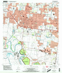
 1992 Mc Allen1993 Print · USGSThe Lower Rio Grande Valley in the early nineties shows a dense network of border settlements and agricultural tracts. Genealogists and historians can trace the growth of Mc Allen, Mission, and Rio Grande City or locate family sites near the Yturria Oil Field.
 - 2002 Map of Edinburg, 2003 Print
 2002 Edinburg2003 Print · USGSEdinburg and northern McAllen are shown during a period of rapid expansion in the early 2000s, reflecting the region's educational and civic growth. Researchers can trace local heritage through sites like Old Edinburg Cemetery, the University of Texas Pan American, and the Sacred Heart Sch.
 - 2002 Map of Mission, 2003 Print
 2002 Mission2003 Print · USGSThe Rio Grande borderlands come alive in this early 2000s survey of the Hidalgo County corridor. Genealogists and historians can trace family sites from La Lomita Mission to the Valley Memorial Gardens and the community of Granjeno.
 - 2002 Map of Alton, 2003 Print
 2002 Alton2003 Print · USGSHidalgo County's residential and industrial growth is captured here at the start of the new millennium. Researchers can trace local school districts and energy sites like the Oblate Gas Field, Salinas Sch, and the community of Alton.
 - 2002 Map of Hidalgo, 2003 Print
 2002 Hidalgo2003 Print · USGSHidalgo and the border region are captured in the early 2000s, showing the international connection between Texas and Mexico. Researchers can trace the infrastructure of the Rio Grande, from the International Bridge to local schools like Salinas Elem Sch.
 - 2010 Map of Monte Christo, 2010 Print
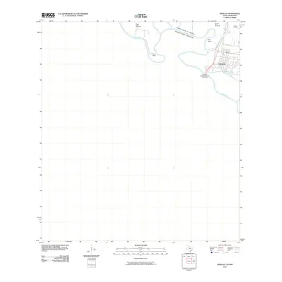
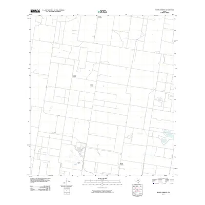 2010 Monte Christo2010 Print · USGSCovers McAllen, including Monte Christo, Hidalgo County, and other nearby areas
 - 2010 Map of Edinburg, 2010 Print
 2010 Edinburg2010 Print · USGSCovers McAllen, including Edinburg, Pharr, and other nearby areas
 - 2010 Map of Mission, 2010 Print
 2010 Mission2010 Print · USGSCovers McAllen, including Mission, Palmview, and other nearby areas
 - 2010 Map of Faysville, 2010 Print
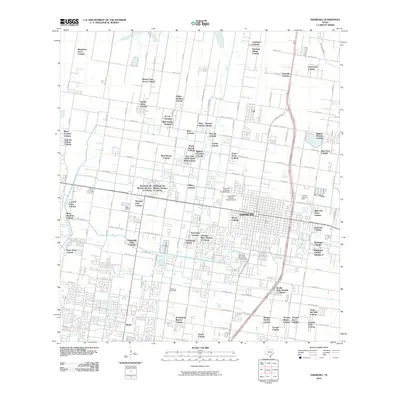
 2010 Faysville2010 Print · USGSCovers McAllen, including Edinburg, Puerta del Sol Colonia, and other nearby areas
 - 2010 Map of Hidalgo, 2010 Print
 2010 Hidalgo2010 Print · USGSCovers McAllen, including Reynosa, Hidalgo, and other nearby areas
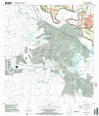
Showing maps 1-25 of 55
Top cities near McAllen
- Edinburg historical maps
- Mission historical maps
- Pharr historical maps
- Weslaco historical maps
- San Juan historical maps
- Alamo historical maps
See more
Top neighborhoods of McAllen
- Timberhill Villa Colonia historical maps
- North Depot Road Colonia historical maps
- Casa Bonita Colonia historical maps
- Bryan's Addition Colonia historical maps
- Trevino Colonia historical maps
- Bentsen Colonia historical maps
See more
Frequently asked questions
- What are the different types of historical maps available for McAllen?
- What is the oldest map of McAllen?
- Where can I purchase historical maps of McAllen for my home or office?
- Where can I download high-res historical maps of McAllen?
- Are there historical topographic maps available for McAllen?
- Is there historical aerial imagery available for McAllen?
- Where are historical maps of McAllen sourced from?