Old Maps of Salt Flat, Texas for Metal Detecting
Plan your next treasure hunt with 6 historic maps of Salt Flat. Find old homesites, ghost towns, trails, and gathering spots that may be lost to time — perfect for identifying promising metal detecting locations.
- Locate forgotten sites: Uncover places like long-lost settlements, abandoned rail lines, or gathering spots.
- Plan better hunts: Use map overlays combined with LiDAR or satellite views to narrow in on historically rich areas.
- Made for detectorists: Thousands of hobbyists use these maps to discover relics, coins, and hidden history.
Use these historic maps to boost your research and find new opportunities beneath the surface of Salt Flat.
Salt Flat, TX maps
(6)- 1954 Map of Van Horn, 1964 Print
 1954 Van Horn1964 Print · USGSThe Trans-Pecos region of West Texas comes into focus in the mid-1950s as a vital corridor of rail and desert commerce. Researchers can trace the path of the Texas and Pacific through Van Horn or locate remote rail sidings like Borracho and Laska Siding.2 unique versions available
 - 1955 Map of Black Mountains, 1956 Print
 1955 Black Mountains1956 Print · USGSMid-century Hudspeth County was a landscape of remote ranching outposts and vital water sources at the edge of the desert. Researchers can trace family-named sites and infrastructure like Babb Camp, Big Tank Ranch, and the Salt Flat Airfield.
 - 1958 Map of Van Horn
 1958 Van Horn1958 Print · USGSWest Texas ranching and rail history come alive in this 1950s survey of the Trans-Pecos desert during the era of major steam-to-diesel transition. Genealogists and historians can trace family-named outposts like Mayfield Ranch or locate the ruins of Presidio Viejo along the Rio Grande.
 - 1984 Map of Salt Flat, 1985 Print
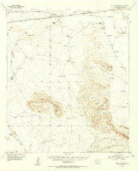
 1984 Salt Flat1985 Print · USGSHudspeth County, Texas, was a land of infrastructure and elevation in the mid-eighties. Genealogists and historians can trace local landmarks like Salt Flat, family-named sites such as Cavender Tank, and the high peaks of Flattop Mountain and Jim Hill.
 - 1985 Map of Dell City
 1985 Dell City1985 Print · USGSThe northern Chihuahuan Desert in the mid-1980s reveals a landscape of isolated farming hubs and vast salt basins. Genealogists and researchers can trace the roads and water tanks around Dell City, the remote outpost at Salt Flat, and the rugged slopes of the Sierra Diablo.2 unique versions available
 - 2022 Map of Salt Flat, 2022 Print
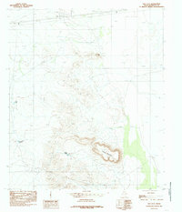
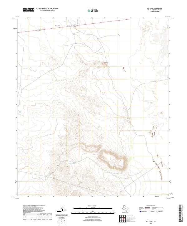 2022 Salt Flat2022 Print · USGSThe settlement of Salt Flat and its surrounding West Texas ranchlands are documented here in the early twenty-first century. Researchers can trace the elevation of Flattop Mtn. and locate specific water resources like Flattop Tank and Rock Tank.
End of results
Showing maps 1-6 of 6
Top cities near Salt Flat
Frequently asked questions
- What are the different types of historical maps available for Salt Flat?
- What is the oldest map of Salt Flat?
- Where can I purchase historical maps of Salt Flat for my home or office?
- Where can I download high-res historical maps of Salt Flat?
- Are there historical topographic maps available for Salt Flat?
- Is there historical aerial imagery available for Salt Flat?
- Where are historical maps of Salt Flat sourced from?