2020s Maps of Mertzon, Texas
Explore 2 historic maps of Mertzon from the 2020s. These maps offer a rare glimpse into what life looked like during the 2020s — showing old roads, neighborhoods, homes, and landmarks that have changed or disappeared over time.
Whether you're researching your family's past, planning a metal detecting trip, or studying how Mertzon's landscape evolved across the 2020s, these high-resolution maps are a powerful tool for exploring the history of this region.
- Focus on a specific era: All maps on this page are from the 2020s, giving you a focused view of this time period.
- See what’s changed: Compare century-old streets, trails, and buildings to today's modern landscape using overlays and satellite layers.
- Research with precision: Use these maps for genealogy, historical research, land use analysis, or educational projects.
- View, download, or print: Maps are fully viewable online in high resolution, and can be downloaded or printed for your own records.
Start exploring Mertzon's history through authentic maps from the 2020s. This is your window into the past.
Mertzon, TX maps
(2)- 2022 Map of Noelke NE, 2022 Print
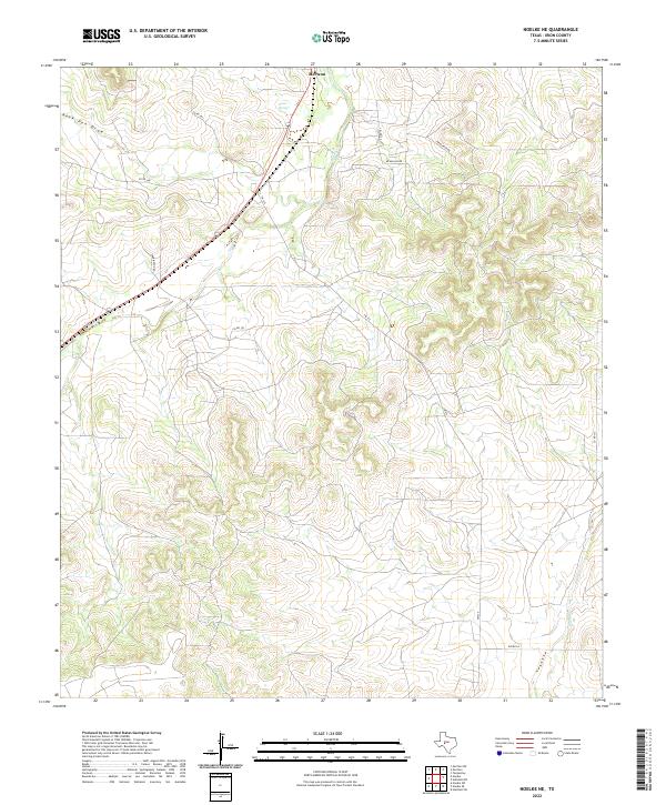 2022 Noelke NE2022 Print · USGSIrion County ranchlands and high plateau draws are captured here in the early twenty-first century as energy infrastructure meets the traditional landscape. Researchers can trace the winding course of Spring Cr from Seven Springs or locate rural access points along Pikes Peak Rd and Farrington Rd.
 - 2022 Map of Mertzon, 2022 Print
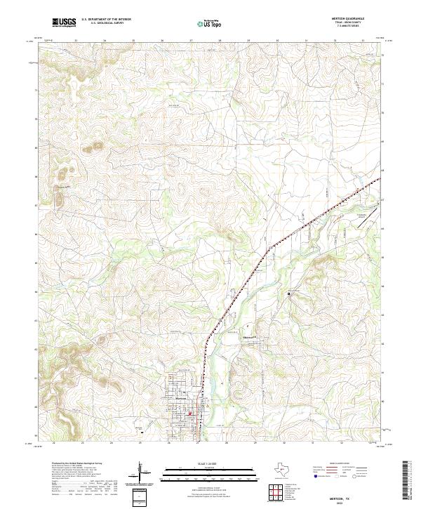 2022 Mertzon2022 Print · USGSIrion County, Texas, is captured here in the early twenty-first century, showcasing the relationship between the seat of government at Mertzon and the nearby community of Sherwood. Researchers can trace local lineages through the Mertzon Cem and Sherwood Cem while locating landmarks like Lopez Peaks.
End of results
Showing maps 1-2 of 2
Frequently asked questions
- What are the different types of historical maps available for Mertzon?
- What is the oldest map of Mertzon?
- Where can I purchase historical maps of Mertzon for my home or office?
- Where can I download high-res historical maps of Mertzon?
- Are there historical topographic maps available for Mertzon?
- Is there historical aerial imagery available for Mertzon?
- Where are historical maps of Mertzon sourced from?