Old Maps of Beaumont, Texas
Explore 26 old maps of Beaumont, spanning from 1926 to today. These high-resolution historic maps reveal how streets, neighborhoods, landmarks, and natural features evolved over time — perfect for genealogy, metal detecting, research, and local history exploration.
What you can do with these maps:
- See how Beaumont changed over time: Compare historical maps to modern-day views to trace roads, homesites, rail lines & more.
- View detailed metadata: Each map includes creators, publishers, year, scale, and archive source.
- Overlay maps with satellite & LiDAR: Visualize the past alongside modern tools to explore terrain & human change.
- Trusted historical sources: Maps sourced from the USGS, Library of Congress, and other archives.
- Access maps your way: View online, download high-res files, or order prints for personal or research use.
Start exploring old maps of Beaumont to uncover forgotten places, hidden landmarks, and the deep history beneath your feet.
Beaumont, TX maps
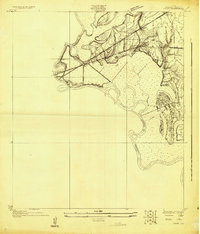
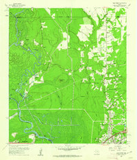
(26)- 1926 Map of Lakeview
 1926 Lakeview1926 Print · USGSCovers Beaumont, including Vidor, Pine Forest, and other nearby areas
 - 1926 Map of Vidor
 1926 Vidor1926 Print · USGSCovers Beaumont, including Nederland, Vidor, and other nearby areas
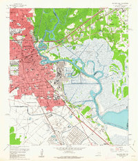
 - 1932 Map of Beaumont
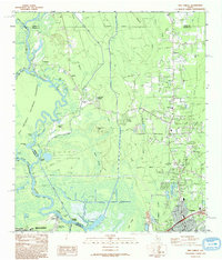
 1932 Beaumont1932 Print · USGSCovers Beaumont, including Nederland, Vidor, and other nearby areas2 unique versions available
 - 1943 Map of Fannett East, 1959 Print
 1943 Fannett East1959 Print · USGSCovers Beaumont, including Taylor Landing, Cheek, and other nearby areas2 unique versions available
 - 1943 Map of Beaumont East, 1960 Print
 1943 Beaumont East1960 Print · USGSCovers Beaumont, including Nederland, Vidor, and other nearby areas
 - 1945 Map of Fannett East
 1945 Fannett East1945 Print · USGSCovers Beaumont, including Taylor Landing, Cheek, and other nearby areas
 - 1950 Map of Houston, 1953 Print
 1950 Houston1953 Print · USGSCovers Beaumont, including Houston, Pasadena, and other nearby areas
 - 1954 Map of Beaumont, 1964 Print
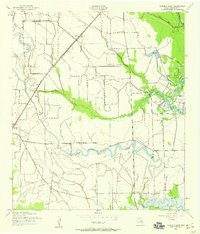
 1954 Beaumont1964 Print · USGSCovers Beaumont, including Houston, The Woodlands, and other nearby areas3 unique versions available
 - 1956 Map of Houston, 1963 Print
 1956 Houston1963 Print · USGSCovers Beaumont, including Houston, Pasadena, and other nearby areas2 unique versions available
 - 1957 Map of Beaumont
 1957 Beaumont1957 Print · USGSCovers Beaumont, including Houston, The Woodlands, and other nearby areas
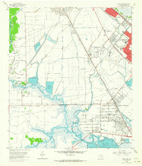
 - 1960 Map of Beaumont West, 1962 Print
 1960 Beaumont West1962 Print · USGSCovers Beaumont, including Amelia, Jefferson County, and other nearby areas4 unique versions available
 - 1960 Map of Voth, 1962 Print
 1960 Voth1962 Print · USGSCovers Beaumont, including Lumberton, Rose Hill Acres, and other nearby areas3 unique versions available
 - 1960 Map of Pine Forest, 1962 Print
 1960 Pine Forest1962 Print · USGSCovers Beaumont, including Vidor, Pine Forest, and other nearby areas3 unique versions available
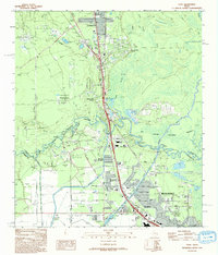
 - 1960 Map of Beaumont East, 1962 Print
 1960 Beaumont East1962 Print · USGSCovers Beaumont, including Nederland, Vidor, and other nearby areas6 unique versions available
 - 1962 Map of Fannett East, 1964 Print
 1962 Fannett East1964 Print · USGSCovers Beaumont, including Taylor Landing, Cheek, and other nearby areas
 - 1962 Map of Port Acres, 1964 Print
 1962 Port Acres1964 Print · USGSCovers Beaumont, including Port Arthur, Nederland, and other nearby areas4 unique versions available
 - 1975 Map of Houston, 1977 Print
 1975 Houston1977 Print · USGSCovers Beaumont, including Houston, Pasadena, and other nearby areas2 unique versions available
 - 1983 Map of Anahuac
 1983 Anahuac1983 Print · USGSCovers Beaumont, including Pasadena, League City, and other nearby areas2 unique versions available
 - 1984 Map of Beaumont
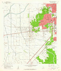
 1984 Beaumont1984 Print · USGSCovers Beaumont, including Houston, The Woodlands, and other nearby areas3 unique versions available
 - 1986 Map of Beaumont
 1986 Beaumont1986 Print · USGSCovers Beaumont, including Nederland, Vidor, and other nearby areas
 - 1993 Map of Voth
 1993 Voth1993 Print · USGSCovers Beaumont, including Lumberton, Rose Hill Acres, and other nearby areas
 - 1993 Map of Pine Forest
 1993 Pine Forest1993 Print · USGSCovers Beaumont, including Vidor, Pine Forest, and other nearby areas
 - 1993 Map of Port Acres, 1994 Print
 1993 Port Acres1994 Print · USGSCovers Beaumont, including Port Arthur, Nederland, and other nearby areas
 - 1994 Map of Beaumont East
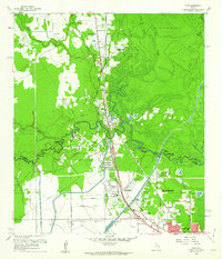
 1994 Beaumont East1994 Print · USGSCovers Beaumont, including Nederland, Vidor, and other nearby areas
 - 1994 Map of Fannett East
 1994 Fannett East1994 Print · USGSCovers Beaumont, including Taylor Landing, Cheek, and other nearby areas
Showing maps 1-25 of 26
Top cities near Beaumont
- Port Arthur historical maps
- Nederland historical maps
- Groves historical maps
- Port Neches historical maps
- Vidor historical maps
- Lumberton historical maps
See more
Top neighborhoods of Beaumont
- Amelia historical maps
- Gladys historical maps
- West Oakland historical maps
- Lucas historical maps
- Rosedale historical maps
- Spindletop historical maps
See more
Frequently asked questions
- What are the different types of historical maps available for Beaumont?
- What is the oldest map of Beaumont?
- Where can I purchase historical maps of Beaumont for my home or office?
- Where can I download high-res historical maps of Beaumont?
- Are there historical topographic maps available for Beaumont?
- Is there historical aerial imagery available for Beaumont?
- Where are historical maps of Beaumont sourced from?