Old Maps of West Port Arthur, Texas for Hiking & Exploration
Hike through history with 15 historic maps of West Port Arthur. Explore old trails, ghost towns, and forgotten backroads — perfect for outdoor adventurers and local explorers.
- Rediscover forgotten places: Map out old mining camps, roads, and footpaths that no longer exist on modern maps.
- Layer with modern tools: Combine with LiDAR or satellite views to plan hikes through historical terrain.
- Made for exploration: Popular among hikers, overlanders, and local history lovers.
Use these maps to find adventure and explore the hidden past of West Port Arthur.
West Port Arthur, TX maps
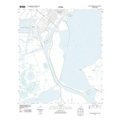
(15)- 1943 Map of Port Arthur South, 1954 Print
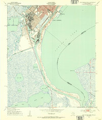 1943 Port Arthur South1954 Print · USGSPort Arthur's industrial waterfront and the coastal marshlands of the Texas-Louisiana border are captured here during the 1940s. Researchers can trace the rail lines of the Southern Pacific, locate the Radio Tower (WPA), and see the layout of the Port Arthur Pleasure Pier.2 unique versions available
 - 1954 Map of Port Arthur
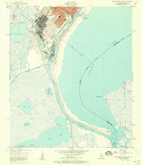
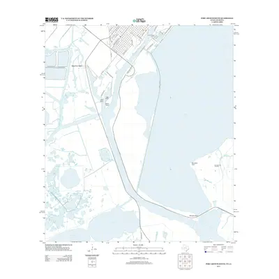
 1954 Port Arthur1954 Print · USGSThe Texas and Louisiana coastlines meet here in the mid-fifties, showing the industrial rise of Port Arthur alongside vast wildlife preserves. Researchers can trace remote coastal settlements and infrastructure like Pecan Island, the Sabine Pass Lighthouse, and the North Island School.
 - 1956 Map of Port Arthur, 1965 Print
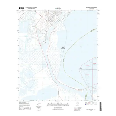
 1956 Port Arthur1965 Print · USGSThe Texas and Louisiana coastlines meet here in the mid-fifties, showing a landscape of sprawling marshes and growing refinery towns. Genealogists and historians can trace ridge settlements like Grand Cheniere or find the Sabine Pass Lighthouse and Pecan Island.3 unique versions available
 - 1957 Map of Port Arthur South, 1958 Print
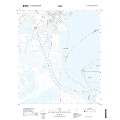
 1957 Port Arthur South1958 Print · USGSThe industrial waterfront of Port Arthur in the late fifties is defined by its deep-water canals and rail-linked refineries. Genealogists and historians can trace local schools like Lincoln High Sch or follow the Old Railroad Grade through the marsh.3 unique versions available
 - 1957 Map of Port Arthur, 1958 Print
 1957 Port Arthur1958 Print · USGSCoastal Texas and Louisiana are mapped during a period of rapid industrial expansion and shoreline change. Genealogists and local historians can trace the mid-century footprints of Groves, locate family plots at Johnson Cem, or explore the old docks at Johnsons Bayou Landing.2 unique versions available
 - 1958 Map of Port Arthur
 1958 Port Arthur1958 Print · USGSThe Texas and Louisiana coastlines meet in the late fifties at the busy industrial port of Port Arthur. Historians and genealogists can trace the early rail networks of the Southern Pacific and locate coastal settlements like Cameron, Pecan Island, and Abbeville.
 - 1959 Map of Port Arthur
 1959 Port Arthur1959 Print · USGSThe Texas and Louisiana coastlines meet in this late-fifties study of a landscape defined by industry and wildlife preserves. Trace the Intracoastal Waterway past Pecan Island and Abbeville, or locate the shipping channels at Sabine Pass.
 - 1973 Map of Port Arthur, 1974 Print
 1973 Port Arthur1974 Print · USGSThe Texas-Louisiana borderlands in the early seventies reveal an intricate landscape of coastal marshes and heavy industry. Trace the growth of Port Arthur, the extent of the oil and gas fields, and old ridge settlements like Pecan Island.
 - 1983 Map of Port Arthur
 1983 Port Arthur1983 Print · USGSThe Texas and Louisiana coastline comes into sharp focus during the early 1980s, showcasing the industrial hubs of the Gulf. Trace the development of Port Arthur and Port Neches or locate specific facilities like St Gabriel Hospital and the West Hackberry Oil Field.
 - 1993 Map of Port Arthur South
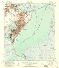
 1993 Port Arthur South1993 Print · USGSJefferson County's industrial coastline and the Sabine Lake marshes are captured in the early nineties, revealing a landscape of heavy shipping and civic life. Trace the local geography from Lincoln High Sch to the expansive J D Murphree Wildlife Management Area.
 - 2010 Map of Port Arthur South, 2010 Print
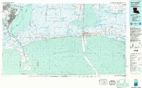
 2010 Port Arthur South2010 Print · USGSCovers West Port Arthur, including Port Arthur, Jefferson County, and other nearby areas
 - 2013 Map of Port Arthur South, 2013 Print
 2013 Port Arthur South2013 Print · USGSCovers West Port Arthur, including Port Arthur, Jefferson County, and other nearby areas
 - 2016 Map of Port Arthur South, 2016 Print
 2016 Port Arthur South2016 Print · USGSCovers West Port Arthur, including Port Arthur, Jefferson County, and other nearby areas
 - 2019 Map of Port Arthur South, 2019 Print
 2019 Port Arthur South2019 Print · USGSCovers West Port Arthur, including Port Arthur, Jefferson County, and other nearby areas
 - 2022 Map of Port Arthur South, 2022 Print
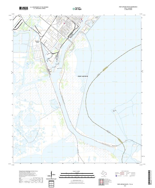 2022 Port Arthur South2022 Print · USGSPort Arthur and the Gulf Coast industrial corridors are shown at the Texas-Louisiana border. Researchers can trace shipping infrastructure like Texaco Island or identify landmarks near Sabine Pass and Pleasure Island.
End of results
Showing maps 1-15 of 15
Top cities near West Port Arthur
- Beaumont historical maps
- Port Arthur historical maps
- Orange historical maps
- Nederland historical maps
- Groves historical maps
- Port Neches historical maps
See more
Frequently asked questions
- What are the different types of historical maps available for West Port Arthur?
- What is the oldest map of West Port Arthur?
- Where can I purchase historical maps of West Port Arthur for my home or office?
- Where can I download high-res historical maps of West Port Arthur?
- Are there historical topographic maps available for West Port Arthur?
- Is there historical aerial imagery available for West Port Arthur?
- Where are historical maps of West Port Arthur sourced from?