1950s Maps of Kendall County, Texas
Explore 9 historic maps of Kendall County from the 1950s. These maps offer a rare glimpse into what life looked like during the 1950s — showing old roads, neighborhoods, homes, and landmarks that have changed or disappeared over time.
Whether you're researching your family's past, planning a metal detecting trip, or studying how Kendall County's landscape evolved across the 1950s, these high-resolution maps are a powerful tool for exploring the history of this region.
- Focus on a specific era: All maps on this page are from the 1950s, giving you a focused view of this time period.
- See what’s changed: Compare century-old streets, trails, and buildings to today's modern landscape using overlays and satellite layers.
- Research with precision: Use these maps for genealogy, historical research, land use analysis, or educational projects.
- View, download, or print: Maps are fully viewable online in high resolution, and can be downloaded or printed for your own records.
Start exploring Kendall County's history through authentic maps from the 1950s. This is your window into the past.
Kendall County, TX maps
(9)- 1953 Map of Van Raub, 1959 Print
 1953 Van Raub1959 Print · USGSBexar County ranch land and military outposts are detailed here in the early fifties. Genealogists can locate the Lower Balcones Sch, trace the Southern Pacific line near Van Raub, and find family sites near Leon Springs.
 - 1954 Map of Llano, 1964 Print
 1954 Llano1964 Print · USGSThe Texas Hill Country and Highland Lakes appear in the mid-fifties, just as new reservoirs began reshaping the landscape. Trace ranching history and river routes from Mason to Llano, or follow the Gulf Colorado and Santa Fe RR past Buchanan Lake.2 unique versions available
 - 1954 Map of San Antonio, 1964 Print
 1954 San Antonio1964 Print · USGSSan Antonio and the Texas Hill Country are captured here in the mid-fifties, showing a landscape defined by massive military air bases and the rising Canyon Reservoir. Trace family ties through historic rail towns like D'Hanis and Castroville or explore the Cold War footprint of Lackland AFB and Randolph AFB.3 unique versions available
 - 1955 Map of Llano
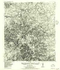
 1955 Llano1955 Print · USGSCentral Texas and the Hill Country are seen here during the mid-1950s growth of the Highland Lakes. Trace old settlements and geologic landmarks from Enchanted Rock and Longhorn Cavern to the small community of Luckenbach.
 - 1956 Map of Comfort
 1956 Comfort1956 Print · USGSThe Guadalupe River valley in the mid-fifties shows a landscape of rural schools and Hill Country retreats. Genealogists can trace family landmarks like the Hermann Sons Home, Camp Idlewilde, and the Union Valley School along the rail lines.
 - 1956 Map of Medina Lake
 1956 Medina Lake1956 Print · USGSMedina Lake and the surrounding Texas highlands are captured here in the 1920s and early 1930s. Genealogists and local historians can trace family properties like Kallison Ranch and the Granieri Hotel, or locate landmarks such as the Mico P.O. and Toll Gate.
 - 1956 Map of Llano, 1976 Print
 1956 Llano1976 Print · USGSThe Texas Hill Country comes alive in this mid-seventies survey of the Llano Uplift and Colorado River lakes. Genealogists and historians can trace family roots through settlements like Luckenbach and Castell or locate the famed L B J Ranch and Enchanted Rock.
 - 1957 Map of Boerne
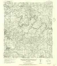 1957 Boerne1957 Print · USGSThe Texas Hill Country around the mid-century shows a network of family ranch-lands and rural schoolhouses. Genealogists can trace family homesteads like E Fischer or Zoeller and locate historic sites such as Cascade Cavern and Bergheim Cemetery.
 - 1957 Map of San Antonio
 1957 San Antonio1957 Print · USGSSan Antonio and the Texas Hill Country are shown here during the mid-fifties, capturing the region's expanding post-war military and transportation footprint. Genealogists and local historians can trace the early residential boundaries of Alamo Heights or locate rural landmarks like St Hedwig and Medina Lake.
End of results
Showing maps 1-9 of 9
Top cities of Kendall County
Frequently asked questions
- What are the different types of historical maps available for Kendall County?
- What is the oldest map of Kendall County?
- Where can I purchase historical maps of Kendall County for my home or office?
- Where can I download high-res historical maps of Kendall County?
- Are there historical topographic maps available for Kendall County?
- Is there historical aerial imagery available for Kendall County?
- Where are historical maps of Kendall County sourced from?