1960s Maps of Kendall County, Texas
Explore 20 historic maps of Kendall County from the 1960s. These maps offer a rare glimpse into what life looked like during the 1960s — showing old roads, neighborhoods, homes, and landmarks that have changed or disappeared over time.
Whether you're researching your family's past, planning a metal detecting trip, or studying how Kendall County's landscape evolved across the 1960s, these high-resolution maps are a powerful tool for exploring the history of this region.
- Focus on a specific era: All maps on this page are from the 1960s, giving you a focused view of this time period.
- See what’s changed: Compare century-old streets, trails, and buildings to today's modern landscape using overlays and satellite layers.
- Research with precision: Use these maps for genealogy, historical research, land use analysis, or educational projects.
- View, download, or print: Maps are fully viewable online in high resolution, and can be downloaded or printed for your own records.
Start exploring Kendall County's history through authentic maps from the 1960s. This is your window into the past.
Kendall County, TX maps
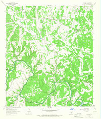
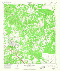
(20)- 1961 Map of Stonewall, 1962 Print
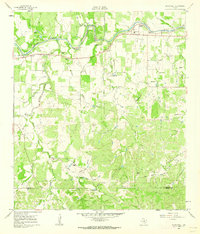 1961 Stonewall1962 Print · USGSGillespie County ranching and Presidential history intersect along the Pedernales River in the early sixties. Researchers can trace family legacies through landmark sites like the LBJ Ranch, St Francis Xavier Ch, and Luckenbach Cem.3 unique versions available
 - 1961 Map of Hye, 1962 Print
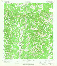
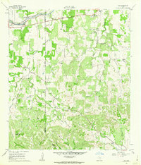 1961 Hye1962 Print · USGSThe Pedernales River valley in the early sixties remains a landscape of sprawling family ranches and rural schoolhouses. Genealogists and historians can trace local legacies at the LBJ Ranch, the Johnson Cem, and early centers like Albert and Hye.3 unique versions available
 - 1963 Map of Crabapple Creek, 1965 Print
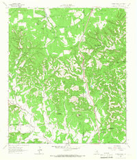
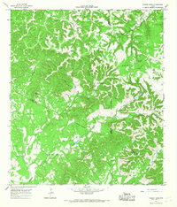
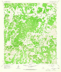 1963 Crabapple Creek1965 Print · USGSThe rural Hill Country landscape of Kendall and Blanco Counties comes into focus in this mid-century survey. Genealogists and local historians can trace the area's social fabric through landmarks like the Lindendale Community Hall and the settlement of Kendalia.2 unique versions available
 - 1963 Map of Whitworth Ranch, 1965 Print
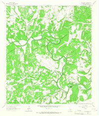
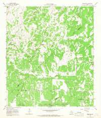
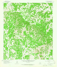 1963 Whitworth Ranch1965 Print · USGSThe ranchlands of Kendall County are captured here in the early sixties, showing a landscape defined by family estates and winding waterways. Researchers can trace the boundaries of the Whitworth Ranch or locate remote landmarks like Wolf Mountain and De Puy.
 - 1963 Map of Blanco, 1965 Print
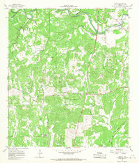
 1963 Blanco1965 Print · USGSThe Texas Hill Country comes alive in the mid-sixties, centered on the riverfront town of Blanco. Genealogists and historians can trace family ranching lines at Hereford Hills Ranch and the Wegner Cem, or explore the rural settlement of Twin Sisters.
 - 1963 Map of Cain City, 1967 Print
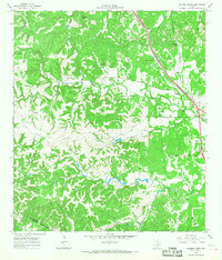
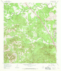
 1963 Cain City1967 Print · USGSThe Texas Hill Country south of Fredericksburg is captured here in the early sixties, showing rural life along the Pedernales River. Researchers can trace the Old San Antonio Road and locate sites like Luckenbach, Cain City, and the Meusebach Cem.
 - 1964 Map of Comfort, 1966 Print
 1964 Comfort1966 Print · USGSThe Texas Hill Country comes alive in the mid-sixties as the Southern Pacific railroad tracks and the Guadalupe River converge at Comfort. Researchers can trace old family burial sites at Hermann Sons Cem or locate the site of the Rodeo Ground and Wolkenburg.2 unique versions available
 - 1964 Map of Oak Crest Park, 1966 Print
 1964 Oak Crest Park1966 Print · USGSGillespie County is shown during the mid-sixties, capturing a landscape of Hill Country ranching and rural aviation. Genealogists can trace family footprints at Morris Ranch and Eckert Cem or locate the Wieder Community House along the Pedernales River.3 unique versions available
 - 1964 Map of Waring, 1966 Print
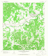
 1964 Waring1966 Print · USGSKendall County in the mid-1960s reveals a Hill Country landscape where the Southern Pacific rail line and the Guadalupe River converge. Researchers can trace the historic Old San Antonio Road and locate family burial grounds like Brownsboro Cemetery and Zoeller Cem.2 unique versions available
 - 1964 Map of Kendalia, 1966 Print
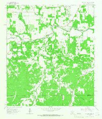
 1964 Kendalia1966 Print · USGSThe Texas Hill Country around Kendalia is documented here in the mid-1960s, showing a landscape defined by the winding Guadalupe River and ranching life. Genealogists can locate several family burial sites like Knupper Cemetery and Short Cem alongside local landmarks like Obelby Crossing.2 unique versions available
 - 1964 Map of Rafter Hollow, 1966 Print
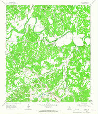
 1964 Rafter Hollow1966 Print · USGSThe Texas Hill Country in the mid-1960s was a landscape of historic cattle operations and winding canyon drainages. Researchers can trace family legacies at the Hillingdon Ranch and Jung Ranch, or follow the path of the storied Old San Antonio Road.2 unique versions available
 - 1964 Map of Cypress Creek, 1966 Print
 1964 Cypress Creek1966 Print · USGSThe ranching country along the Kerr and Kendall county line comes into focus in the mid-1960s, showing a land of springs and limestone peaks. Genealogists and historians can locate family holdings like Hasenwinkel Ranch and Turkey Hollow Ranch among landmarks like Rattlesnake Mountain.3 unique versions available
 - 1964 Map of Sisterdale, 1967 Print
 1964 Sisterdale1967 Print · USGSThe Texas Hill Country valley of the Guadalupe River is captured here during the mid-sixties, showing the rural character of Kendall County. Genealogists and historians can trace family locations near Sisterdale, Ammann Crossing, and the Community Church.2 unique versions available
 - 1964 Map of Boerne, 1967 Print
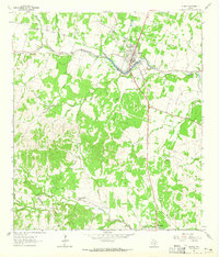
 1964 Boerne1967 Print · USGSMid-century Boerne serves as the anchor for this 1960s Hill Country survey as the town begins to expand around its historic rail line. Researchers can locate family landmarks like Phillips Cem, the Herff Park Fairground, and the subterranean Cascade Cavern.4 unique versions available
 - 1964 Map of Bergheim, 1967 Print
 1964 Bergheim1967 Print · USGSThe Texas Hill Country at the intersection of Kendall and Comal counties is captured here in the mid-1960s as rural crossroads began to evolve. Researchers can locate several family burial sites including Willke Cem and Honey Creek Cem, or trace the winding course of Cibolo Creek.2 unique versions available
 - 1964 Map of Spring Branch, 1967 Print
 1964 Spring Branch1967 Print · USGSTexas hill country life in the mid-1960s is centered here on the Guadalupe River and the settlement of Spring Branch. You can trace rural landmarks from the Spring Branch PO to the Twin Sisters peaks and the small community of Knibbe.2 unique versions available
 - 1964 Map of Ranger Creek, 1968 Print
 1964 Ranger Creek1968 Print · USGSCentral Kendall County is captured in the mid-sixties, showing a landscape of limestone hills and creek-fed valleys. Genealogists and researchers can trace the Southern Pacific line near Spanish Pass or locate Frederick and Lake Oz.2 unique versions available
 - 1964 Map of Turkey Knob, 1968 Print
 1964 Turkey Knob1968 Print · USGSThe Texas Hill Country at the triple junction of Bandera, Kerr, and Kendall Counties is captured here during the mid-sixties. Researchers can locate family landmarks such as the Polly Cem, Privilege Sch, and Rodriquez Ch among the limestone ridges.2 unique versions available
 - 1964 Map of Anhalt, 1968 Print
 1964 Anhalt1968 Print · USGSComal County rural life in the mid-1960s is preserved here, showing the Texas Hill Country's network of family homesteads and local creeks. Genealogists can trace family lines through sites like Beierle Cem, St Joseph Chapel, and Farmers Hall.3 unique versions available
 - 1967 Map of Van Raub, 1969 Print
 1967 Van Raub1969 Print · USGSBexar County's Hill Country transition comes into focus in the late 1960s as suburban growth began to meet historic ranchlands. Researchers can trace the Southern Pacific rail line, old school sites at Leon Springs, and family burial grounds like Robles Cem.3 unique versions available
End of results
Showing maps 1-20 of 20
Top cities of Kendall County
Frequently asked questions
- What are the different types of historical maps available for Kendall County?
- What is the oldest map of Kendall County?
- Where can I purchase historical maps of Kendall County for my home or office?
- Where can I download high-res historical maps of Kendall County?
- Are there historical topographic maps available for Kendall County?
- Is there historical aerial imagery available for Kendall County?
- Where are historical maps of Kendall County sourced from?