
1961 Map of Stonewall
USGS Topo · Published 1962About this map
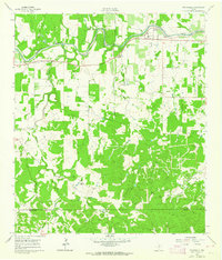
The Pedernales River carves through the heart of this Gillespie County landscape, anchoring a community defined by German-Texan ranching traditions and political history. Near the town of Stonewall, the presence of the LBJ Ranch marks the era of Lyndon B. Johnson's presidency, while the surrounding countryside is dotted with legacy family holdings like the Gingerbread Ranch and Brehmers Ranch. Cultural centers of gravity are clear in the placement of the St Francis Xavier Ch and the South Grape Creek Sch, serving the families who established the orchards and pastures of the Texas Hill Country.
Find a feature on this map
57 named features on this map. Tap any name to fly to it.
Don’t see what you’re looking for? This feature index may not catch every label — zoom into the map to look around manually.
Map Details
Editions of this 1961 Stonewall Map
Other maps of this area

1894 · Fredericksburg
USGS Topo · 1:125,000

1954 · Llano
USGS Topo · 1:250,000

1955 · Llano
USGS Topo · 1:250,000

1956 · Llano
USGS Topo · 1:250,000

1961 · Hye
USGS Topo · 1:24,000

1961 · Cave Creek School
USGS Topo · 1:24,000

1961 · Rocky Creek
USGS Topo · 1:24,000
1963 · Crabapple Creek
USGS Topo · 1:24,000

1963 · Whitworth Ranch
USGS Topo · 1:24,000

1963 · Cain City
USGS Topo · 1:24,000