
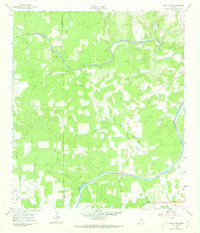
1961 Map of Rocky Creek
USGS Topo · Published 1962About this map
The Pedernales River snakes through the southern portion of this landscape, marking the transition between Blanco Co and Gillespie Co in the heart of the Texas Hill Country. Surveyed in the early 1960s, the map reveals a rural economy centered on natural resources, evidenced by several Gravel Pit sites and a Quarry near the riverbanks. The Post Oak Cem stands as a primary genealogical landmark for the local area, situated north of the river near Post Oak Creek.
Find a feature on this map
17 named features on this map. Tap any name to fly to it.
Don’t see what you’re looking for? This feature index may not catch every label — zoom into the map to look around manually.
Map Details
Editions of this 1961 Rocky Creek Map
2 editions found
Other maps of this area

1887 · Blanco
USGS Topo · 1:125,000

1894 · Fredericksburg
USGS Topo · 1:125,000

1894 · Blanco
USGS Topo · 1:125,000

1954 · Llano
USGS Topo · 1:250,000

1955 · Llano
USGS Topo · 1:250,000

1956 · Llano
USGS Topo · 1:250,000

1961 · Stonewall
USGS Topo · 1:24,000

1961 · Hye
USGS Topo · 1:24,000

1961 · Cave Creek School
USGS Topo · 1:24,000
1961 · Johnson City
USGS Topo · 1:24,000