2020s Maps of Boerne, Texas
Explore 4 historic maps of Boerne from the 2020s. These maps offer a rare glimpse into what life looked like during the 2020s — showing old roads, neighborhoods, homes, and landmarks that have changed or disappeared over time.
Whether you're researching your family's past, planning a metal detecting trip, or studying how Boerne's landscape evolved across the 2020s, these high-resolution maps are a powerful tool for exploring the history of this region.
- Focus on a specific era: All maps on this page are from the 2020s, giving you a focused view of this time period.
- See what’s changed: Compare century-old streets, trails, and buildings to today's modern landscape using overlays and satellite layers.
- Research with precision: Use these maps for genealogy, historical research, land use analysis, or educational projects.
- View, download, or print: Maps are fully viewable online in high resolution, and can be downloaded or printed for your own records.
Start exploring Boerne's history through authentic maps from the 2020s. This is your window into the past.
Boerne, TX maps
(4)- 2022 Map of Boerne, 2022 Print
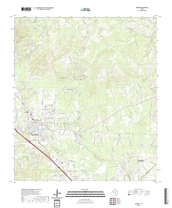 2022 Boerne2022 Print · USGSThe Boerne area in the early twenty-first century reflects a blend of Hill Country heritage and suburban growth. Researchers can trace family history at Boerne Cem and Howard Cem or locate the historic Kendall County Courthouse near Cibolo Creek.
 - 2022 Map of Jack Mountain, 2022 Print
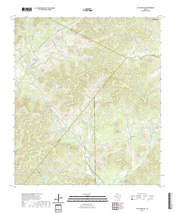 2022 Jack Mountain2022 Print · USGSThe Bandera County hills meet the Bexar County line in this recent study of ranch lands and spring-fed headwaters. Researchers can locate the Heimsath Cemetery and family landmarks like White Ranch Lake, Walton Lake, and Jack Mountain.
 - 2022 Map of Van Raub, 2022 Print
 2022 Van Raub2022 Print · USGSThe hill country northwest of San Antonio enters a new era of suburban growth in the early 2020s. Researchers can trace family history at the Charles Cole Cem or explore the geography of Van Raub and the Kremkau Divide.
 - 2022 Map of Ranger Creek, 2022 Print
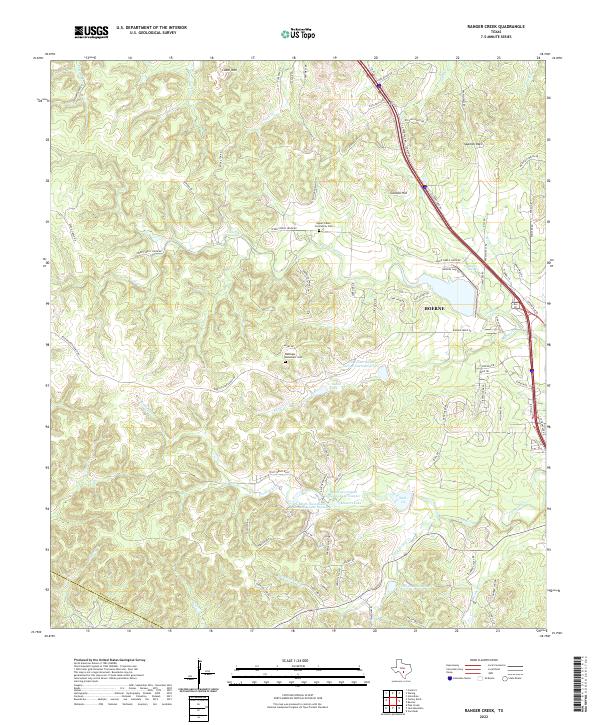 2022 Ranger Creek2022 Print · USGSThe hills of Kendall County come alive in this recent survey showing the suburban and ranching interface of the Hill Country. Genealogists and hikers can trace local landmarks like Upper Cibolo Community Cem, Comanche Spring, and Spanish Pass.
End of results
Showing maps 1-4 of 4
Top cities near Boerne
- San Antonio historical maps
- Lakehills historical maps
- Helotes historical maps
- Fair Oaks Ranch historical maps
- Bulverde historical maps
- Shavano Park historical maps
See more
Top neighborhoods of Boerne
Frequently asked questions
- What are the different types of historical maps available for Boerne?
- What is the oldest map of Boerne?
- Where can I purchase historical maps of Boerne for my home or office?
- Where can I download high-res historical maps of Boerne?
- Are there historical topographic maps available for Boerne?
- Is there historical aerial imagery available for Boerne?
- Where are historical maps of Boerne sourced from?