1950s Maps of Riviera Beach, Texas
Explore 4 historic maps of Riviera Beach from the 1950s. These maps offer a rare glimpse into what life looked like during the 1950s — showing old roads, neighborhoods, homes, and landmarks that have changed or disappeared over time.
Whether you're researching your family's past, planning a metal detecting trip, or studying how Riviera Beach's landscape evolved across the 1950s, these high-resolution maps are a powerful tool for exploring the history of this region.
- Focus on a specific era: All maps on this page are from the 1950s, giving you a focused view of this time period.
- See what’s changed: Compare century-old streets, trails, and buildings to today's modern landscape using overlays and satellite layers.
- Research with precision: Use these maps for genealogy, historical research, land use analysis, or educational projects.
- View, download, or print: Maps are fully viewable online in high resolution, and can be downloaded or printed for your own records.
Start exploring Riviera Beach's history through authentic maps from the 1950s. This is your window into the past.
Riviera Beach, TX maps
(4)- 1950 Map of Corpus Christi, 1953 Print
 1950 Corpus Christi1953 Print · USGSThe South Texas coast comes into focus during the early fifties, showing the interplay between booming oil fields and expansive ranching operations. Genealogists and historians can trace the Texas Mexican rail line through Kingsville or locate heritage sites like Chapman Ranch and Riviera Beach.
 - 1952 Map of Riviera Beach, 1953 Print
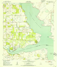 1952 Riviera Beach1953 Print · USGSThe South Texas coast comes alive in the early fifties as coastal settlements like Loyola Beach and Riviera Beach began to take shape. Researchers can trace the military and industrial landscape through the Naval Reservation Auxiliary Field and isolated sites like Visnaga Well.4 unique versions available
 - 1952 Map of Riviera Beach, 1957 Print
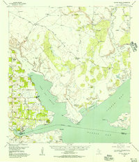 1952 Riviera Beach1957 Print · USGSCoastal Kleberg County comes alive in the early fifties, showing the ranching and maritime landscape of the South Texas bays. Genealogists and historians can trace family-named sites like Jaboncillos Ranch, artesian wells, and shoreline spots like Loyola Beach and La Parra Landing.
 - 1956 Map of Corpus Christi
 1956 Corpus Christi1956 Print · USGSThe South Texas coast and the burgeoning port of Corpus Christi are captured here during the mid-fifties. Genealogists and historians can trace the rail-and-oil economy through labels like Robstown Airpark, Chapman Ranch, and the Missouri Pacific railroad.
End of results
Showing maps 1-4 of 4
Top cities near Riviera Beach
Frequently asked questions
- What are the different types of historical maps available for Riviera Beach?
- What is the oldest map of Riviera Beach?
- Where can I purchase historical maps of Riviera Beach for my home or office?
- Where can I download high-res historical maps of Riviera Beach?
- Are there historical topographic maps available for Riviera Beach?
- Is there historical aerial imagery available for Riviera Beach?
- Where are historical maps of Riviera Beach sourced from?