1940s Maps of Givens, Paris
Explore 2 historic maps of Givens from the 1940s. These maps offer a rare glimpse into what life looked like during the 1940s — showing old roads, neighborhoods, homes, and landmarks that have changed or disappeared over time.
Whether you're researching your family's past, planning a metal detecting trip, or studying how Givens's landscape evolved across the 1940s, these high-resolution maps are a powerful tool for exploring the history of this region.
- Focus on a specific era: All maps on this page are from the 1940s, giving you a focused view of this time period.
- See what’s changed: Compare century-old streets, trails, and buildings to today's modern landscape using overlays and satellite layers.
- Research with precision: Use these maps for genealogy, historical research, land use analysis, or educational projects.
- View, download, or print: Maps are fully viewable online in high resolution, and can be downloaded or printed for your own records.
Start exploring Givens's history through authentic maps from the 1940s. This is your window into the past.
Givens, Paris maps
(2)- 1948 Map of Paris, 1966 Print
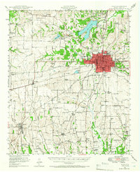 1948 Paris1966 Print · USGSLamar County in the late 1940s shows the growth of Paris alongside its vital rail lines and military infrastructure. Researchers can trace family sites at Evergreen Cem, explore the Camp Maxey Military Reservation, or locate rural landmarks like Roxton and Ambia Sch.
 - 1949 Map of Paris
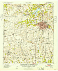 1949 Paris1949 Print · USGSPost-war Paris and Lamar County are shown here at a peak of rail and agricultural connectivity before the highway era transformed the rural landscape. Genealogists and local historians can locate dozens of country schools and churches, such as Cedar Hill Sch, Ambia Sch, and Mount Vernon Church.
End of results
Showing maps 1-2 of 2
Top cities near Givens
- Paris historical maps
- Reno historical maps
- Blossom historical maps
- Detroit historical maps
- Roxton historical maps
- Toco historical maps
See more
Frequently asked questions
- What are the different types of historical maps available for Givens?
- What is the oldest map of Givens?
- Where can I purchase historical maps of Givens for my home or office?
- Where can I download high-res historical maps of Givens?
- Are there historical topographic maps available for Givens?
- Is there historical aerial imagery available for Givens?
- Where are historical maps of Givens sourced from?