Old Maps of Taylor Town, Texas for Genealogy
Trace your family roots with 10 historic maps of Taylor Town. These high-res maps reveal old neighborhoods, homesites, landmarks, and streets — helping you uncover where your ancestors lived and how the area evolved over time.
- Explore historic neighborhoods: Identify where your relatives may have lived in the 1800s or 1900s.
- Compare maps over time: Trace the changes in streets, buildings, and landmarks for multi-generational research.
- Perfect for genealogy & ancestry research: Used by family historians and researchers to map out lineage and migration.
These maps are an incredible resource for exploring your personal connection to Taylor Town's past.
Taylor Town, TX maps
(10)- 1953 Map of Texarkana, 1964 Print
 1953 Texarkana1964 Print · USGSThe Texas-Arkansas borderlands are captured here in the mid-fifties, during a decade of massive military and hydraulic engineering projects. Genealogists and researchers can locate family landmarks like Old Boston Cem, Siloam Ch, and the vast Red River Arsenal.4 unique versions available
 - 1956 Map of Texarkana
 1956 Texarkana1956 Print · USGSThe Ark-La-Tex borderlands come alive in the mid-fifties, showing the transition from a rail-dependent rural economy to a post-war industrial landscape. Researchers can trace the massive Red River Ordnance Depot and find towns like Talco, Bogata, and Naples.
 - 1963 Map of Minter, 1964 Print
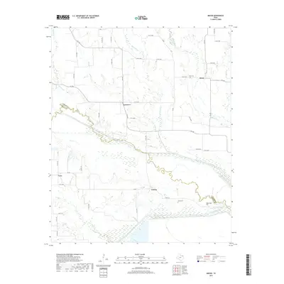
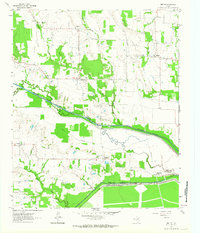 1963 Minter1964 Print · USGSLamar and Delta Counties in the early sixties reveal a landscape of river-bottom farms and small rural settlements. Genealogists and historians can locate family landmarks like Minter Cem, Rockford Ch, and the community of Taylor Town.
 - 1985 Map of Sulphur Springs
 1985 Sulphur Springs1985 Print · USGSNortheast Texas in the mid-eighties shows a landscape transitioning between its deep-rooted rail towns and a new era of reservoir development. Genealogists and historians can trace family locations near Shooks Chapel, the rural Farmers Academy, and the banks of the South Sulphur River.
 - 1991 Map of Sulphur Springs
 1991 Sulphur Springs1991 Print · USGSNortheast Texas in the early nineties shows a transition from rail-dependent agriculture to a landscape defined by massive reservoirs. Researchers can trace rural lineages through sites like Gafford Chapel and the Forest Academy Cem, or follow the path of the St Louis Southwestern RR.
 - 2010 Map of Minter, 2010 Print
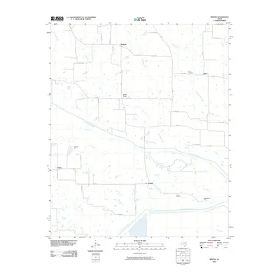 2010 Minter2010 Print · USGSCovers Taylor Town, including Kensing, Vasco, and other nearby areas
 - 2012 Map of Minter, 2012 Print
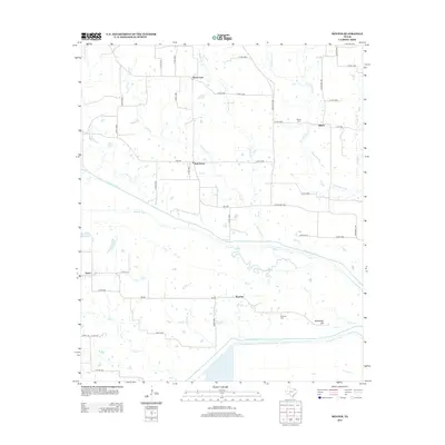 2012 Minter2012 Print · USGSCovers Taylor Town, including Kensing, Vasco, and other nearby areas
 - 2016 Map of Minter, 2016 Print
 2016 Minter2016 Print · USGSCovers Taylor Town, including Kensing, Vasco, and other nearby areas
 - 2019 Map of Minter, 2019 Print
 2019 Minter2019 Print · USGSCovers Taylor Town, including Kensing, Vasco, and other nearby areas
 - 2022 Map of Minter, 2022 Print
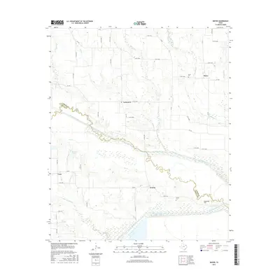
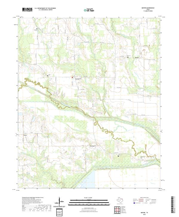 2022 Minter2022 Print · USGSThe Sulphur River basin along the Lamar and Delta county line is shown in this recent survey, featuring its network of rural townships and winding waterways. Researchers can locate small communities such as Minter, Vasco, and Taylortown, along with family-history sites like Union Cem and Kensing Cem.
End of results
Showing maps 1-10 of 10
Top cities near Taylor Town
- Paris historical maps
- Reno historical maps
- Cooper historical maps
- Blossom historical maps
- Bogata historical maps
- Detroit historical maps
See more
Frequently asked questions
- What are the different types of historical maps available for Taylor Town?
- What is the oldest map of Taylor Town?
- Where can I purchase historical maps of Taylor Town for my home or office?
- Where can I download high-res historical maps of Taylor Town?
- Are there historical topographic maps available for Taylor Town?
- Is there historical aerial imagery available for Taylor Town?
- Where are historical maps of Taylor Town sourced from?