Old Maps of Lavaca County, Texas for Metal Detecting
Plan your next treasure hunt with 63 historic maps of Lavaca County. Find old homesites, ghost towns, trails, and gathering spots that may be lost to time — perfect for identifying promising metal detecting locations.
- Locate forgotten sites: Uncover places like long-lost settlements, abandoned rail lines, or gathering spots.
- Plan better hunts: Use map overlays combined with LiDAR or satellite views to narrow in on historically rich areas.
- Made for detectorists: Thousands of hobbyists use these maps to discover relics, coins, and hidden history.
Use these historic maps to boost your research and find new opportunities beneath the surface of Lavaca County.
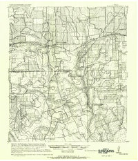
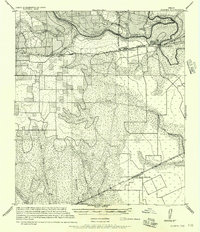
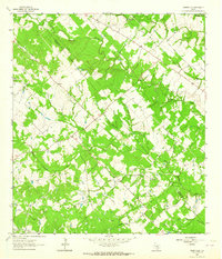
Lavaca County, TX maps
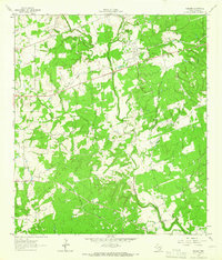
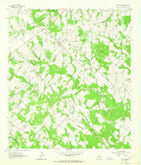
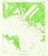
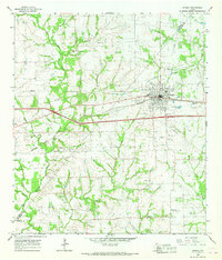
(63)- 1901 Map of Flatonia
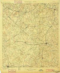 1901 Flatonia1901 Print · USGSCentral Texas at the turn of the century shows a landscape defined by the railroad and distinct ethnic communities. Trace family roots in the Bohemian Settlement or Negro Settlement, and locate early sites like Old Redrock and Old Flatonia.2 unique versions available
 - 1919 Map of Schulenburg, 1956 Print
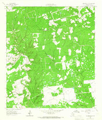
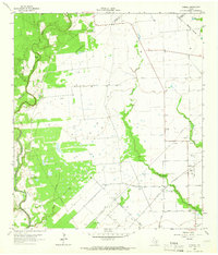
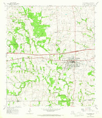
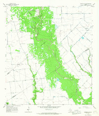
 1919 Schulenburg1956 Print · USGSTexas at the close of the Great War was a landscape of rail-connected towns and river crossings. Genealogists can trace family roots through the settlements of High Hill, Dubina, and St. Johns, while following the old fords across the Navidad River.
 - 1953 Map of Seguin, 1965 Print
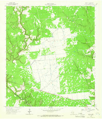
 1953 Seguin1965 Print · USGSSouth Texas in the early fifties shows a thriving river-and-rail economy across the Guadalupe and Colorado basins. Genealogists and historians can trace rail routes like the Southern Pacific through Seguin, locate oil wells, or find the Gary AAF near San Marcos.4 unique versions available
 - 1956 Map of Glidden
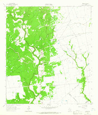
 1956 Glidden1956 Print · USGSCoastal prairie and river bottomlands near the Colorado River are captured here during the mid-century, showing the rail-driven growth of Columbus. Genealogists can trace early homesteads and crossings near Rock Island, Borden, and the Skull Creek drainage.
 - 1958 Map of Seguin
 1958 Seguin1958 Print · USGSSouth Texas in the late fifties was a network of river-valley settlements and active oilfields tied together by major rail lines. Genealogists and historians can trace family-named sites across Rabb Prairie, locate the Behring Store, or follow the Southern Pacific through Schulenburg.
 - 1962 Map of Terryville, 1964 Print
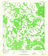
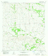
 1962 Terryville1964 Print · USGSDeWitt and Lavaca counties are shown here in the early 1960s as the local economy balanced ranching with a growing petroleum industry. Researchers can trace family sites at Terryville, locate the BRUSHY CREEK OIL FIELD, and find the Cook-Holland Cem or Hebron Ch.2 unique versions available
 - 1962 Map of Sublime, 1966 Print
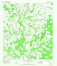
 1962 Sublime1966 Print · USGSLavaca County in the early 1960s is depicted as a rural landscape shaped by the Navidad River and its many creek systems. Researchers can trace family history at the Pagel Settlement Cem, locate the small community of Vsetin, or follow the Old Railroad Grade through Sublime.2 unique versions available
 - 1962 Map of Hallettsville SE, 1966 Print
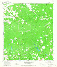
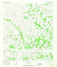
 1962 Hallettsville SE1966 Print · USGSThe river systems of Lavaca County come into focus in the early sixties as the local economy began to balance traditional agriculture with new energy production. Researchers can trace family sites near Solmsville Ch or follow the paths of Laughlin Creek and the Lavaca River.2 unique versions available
 - 1962 Map of Hallettsville, 1966 Print
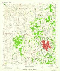
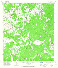
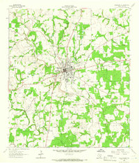 1962 Hallettsville1966 Print · USGSHallettsville and the Lavaca River valley in the early sixties reveal a landscape of rural settlements and emerging industry. Family historians can trace landmarks like Pagel Settlement, the Old County Farm Cemetery, and Light Chapel.2 unique versions available
 - 1963 Map of Yoakum, 1964 Print
 1963 Yoakum1964 Print · USGSIn the early sixties, the railroad town of Yoakum served as a bustling crossroads for the Southern Pacific. Genealogists and historians can trace numerous rural landmarks, including the Sons of Herman Cem, Pearl City, and Morris Sch.2 unique versions available
 - 1963 Map of Sweet Home, 1964 Print
 1963 Sweet Home1964 Print · USGSLavaca County's ranching and energy landscape is captured here during the early sixties, showing the rural community of Sweet Home. Researchers can trace family history through numerous sites like Queen of Peace Cem or explore the industrial footprint of the South Yoakum Oilfield.2 unique versions available
 - 1964 Map of Cordele, 1966 Print
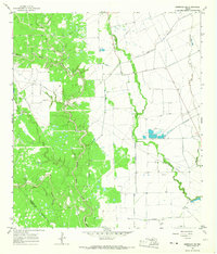
 1964 Cordele1966 Print · USGSIn the mid-1960s, the Jackson County prairie near the Lavaca line was a landscape of cattle, cotton, and the rising energy industry. Local historians can trace family burial sites at Gandy Cem and Flourney Cem or explore the early development of the Morales Gas Field.2 unique versions available
 - 1964 Map of Morales, 1966 Print
 1964 Morales1966 Print · USGSThe river bottomlands near the Lavaca and Jackson county line were a hub of resource extraction and ranching in the 1960s. Researchers can trace family history at Partridge Cem or explore the industrial footprint of the Gas Field and the northern Refinery.2 unique versions available
 - 1964 Map of Speaks, 1966 Print
 1964 Speaks1966 Print · USGSCoastal plains and petroleum fields define this pocket of Lavaca County in the 1960s. Researchers can trace the industrial layout of the Wilcox Refinery or locate remote burial sites like Bright Cem and the small settlement of Seclusion.2 unique versions available
 - 1964 Map of Navidad, 1966 Print
 1964 Navidad1966 Print · USGSCoastal Texas ranching and energy production intersect in the mid-1960s as the Lavaca River winds through the Jackson and Lavaca county lines. Researchers can trace rural family sites like Knopp Cem or explore the mid-century infrastructure of the Navidad Gas Field.2 unique versions available
 - 1964 Map of Ezzell, 1967 Print
 1964 Ezzell1967 Print · USGSLavaca County during the mid-sixties reveals a rural landscape defined by the winding Lavaca River and the small settlements of Koerth and Ezzell. Researchers can locate country community landmarks such as Mossy Grove Ch, Providence Sch, and the Brown Bridge river crossing.2 unique versions available
 - 1965 Map of Oakland, 1967 Print
 1965 Oakland1967 Print · USGSCrossing the Colorado and Lavaca county line in the 1960s, this area is defined by the winding Navidad River and its rural farming outposts. Genealogists can trace family names through numerous local burial sites like Oakland Hill Cem, Shiloh Cem, and Bila Hora Cem.2 unique versions available
 - 1965 Map of Sawmill Branch, 1967 Print
 1965 Sawmill Branch1967 Print · USGSThe Colorado and Lavaca county line runs through this Texas creek-bottom landscape in the mid-1960s. Genealogists and historians can trace the rural drainage network from West Sandy Creek to Crooked Creek Lake and find old Gas Well and Gravel Pit sites.2 unique versions available
 - 1965 Map of Weimar, 1967 Print
 1965 Weimar1967 Print · USGSWeimar and its rural surroundings in the 1960s reveal a landscape defined by the Southern Pacific railroad and the East Navidad River. Researchers can trace the layout of Dubina, locate family plots at Hehr Cem, or identify historic church sites like St Cyril Ch.2 unique versions available
 - 1965 Map of Schulenburg, 1967 Print
 1965 Schulenburg1967 Print · USGSIn the mid-1960s, the rural border between Fayette and Lavaca counties centered on the busy rail town of Schulenburg. Researchers can trace old family sites at Old High Hill Cem, visit St John, or locate the site of the Drive-in Theater.2 unique versions available
 - 1965 Map of Wied, 1967 Print
 1965 Wied1967 Print · USGSLavaca County's rural landscape is captured here in the mid-sixties, showing a region shaped by winding creeks and early transit routes. You can trace the Old RR Grade and locate long-standing landmarks like the Charlottenburg Cem and Vysehrad Sch.2 unique versions available
 - 1965 Map of Sheridan NE, 1967 Print
 1965 Sheridan NE1967 Print · USGSCoastal Texas oil and gas production is in full swing during the mid-1960s as this survey of the Colorado County line reveals. Researchers can trace the industrial footprint of the Sheridan Gas Field, locating scattered oil wells and the remote Landing Strip.2 unique versions available
 - 1965 Map of Komensky, 1967 Print
 1965 Komensky1967 Print · USGSLavaca County in the mid-sixties remains a landscape of quiet agricultural hamlets and complex river forks. Genealogists and local historians can locate rural landmarks like Baursville Cem and trace the paths of the Lavaca River and Novohrad.2 unique versions available
 - 1965 Map of Sheridan SE, 1967 Print
 1965 Sheridan SE1967 Print · USGSCoastal Texas ranching and energy production intersect in the mid-1960s where three counties converge along Sandy Creek. Researchers can locate the Brownson Cem and trace early oil and gas development near the Whitegate Landing Strip.2 unique versions available
 - 1965 Map of Hope, 1967 Print
 1965 Hope1967 Print · USGSThe Lavaca and DeWitt county line in the mid-sixties reveals a landscape of cattle ranching and early petroleum development. Genealogists can locate the Harless Cemetery and the settlement of Hope while tracing the winding banks of the Lavaca River and Big Brushy Creek.2 unique versions available
Showing maps 1-25 of 63
Top cities of Lavaca County
Frequently asked questions
- What are the different types of historical maps available for Lavaca County?
- What is the oldest map of Lavaca County?
- Where can I purchase historical maps of Lavaca County for my home or office?
- Where can I download high-res historical maps of Lavaca County?
- Are there historical topographic maps available for Lavaca County?
- Is there historical aerial imagery available for Lavaca County?
- Where are historical maps of Lavaca County sourced from?