Old Maps of Eastgate, Texas for Hiking & Exploration
Hike through history with 12 historic maps of Eastgate. Explore old trails, ghost towns, and forgotten backroads — perfect for outdoor adventurers and local explorers.
- Rediscover forgotten places: Map out old mining camps, roads, and footpaths that no longer exist on modern maps.
- Layer with modern tools: Combine with LiDAR or satellite views to plan hikes through historical terrain.
- Made for exploration: Popular among hikers, overlanders, and local history lovers.
Use these maps to find adventure and explore the hidden past of Eastgate.
Eastgate, TX maps
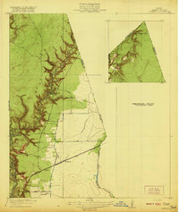
(12)- 1916 Map of Huffman
 1916 Huffman1916 Print · USGSThe Harris and Liberty County border comes into focus during the early twentieth century as a landscape of bayous and rails. Genealogists can trace the early layout of Huffman and the path of the Beaumont Sour Lake and Western railroad near Luce Bayou.3 unique versions available
 - 1920 Map of Huffman
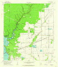
 1920 Huffman1920 Print · USGSCoastal prairie and timberlands north of Houston come into focus during the early twentieth century as a burgeoning rail and road network took shape. Genealogists can trace family landmarks and early transit routes through Huffman, Scott Ranch, and the Lumber R R.2 unique versions available
 - 1954 Map of Beaumont, 1964 Print
 1954 Beaumont1964 Print · USGSSoutheast Texas in the mid-fifties reveals a landscape of massive national forests, emerging reservoirs, and a booming oil economy. Genealogists and researchers can trace rural settlements like Dallardsville and Village Mills or locate early drilling sites at Sour Lake Oil Field.3 unique versions available
 - 1957 Map of Beaumont
 1957 Beaumont1957 Print · USGSSoutheast Texas in the mid-fifties is defined by the timber-rich lands between the Trinity River and Beaumont. Trace the history of the Alabama and Coushatti Indian Reservation or locate early campus sites like Prairie View College.
 - 1960 Map of Huffman, 1962 Print
 1960 Huffman1962 Print · USGSNortheast Harris County in the early sixties was a landscape of bayous and rail lines at the edge of the rising Houston Lake. Genealogists and local historians can trace the foundations of Huffman, locating the Huffman School, St Annes Church, and the historic Atascocita Road.4 unique versions available
 - 1984 Map of Beaumont
 1984 Beaumont1984 Print · USGSSoutheast Texas in the late seventies and early eighties shows a landscape of expanding reservoirs and deep timber industry. Researchers can trace the development of the Sam Houston National Forest or locate regional landmarks like Grabbs Prairie and the Wynne State Prison Farm.3 unique versions available
 - 1985 Map of Conroe
 1985 Conroe1985 Print · USGSSoutheast Texas in the mid-eighties shows a landscape of timberlands and new lakeside developments. Researchers can trace the legacy of rail lines like the Southern Pacific RR or locate rural communities such as Plantersville, Yarboro, and Hufsmith.2 unique versions available
 - 2010 Map of Huffman, 2010 Print
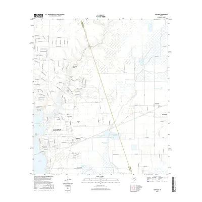
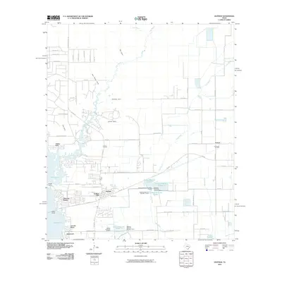 2010 Huffman2010 Print · USGSCovers Eastgate, including Houston, Dayton, and other nearby areas
 - 2013 Map of Huffman, 2013 Print
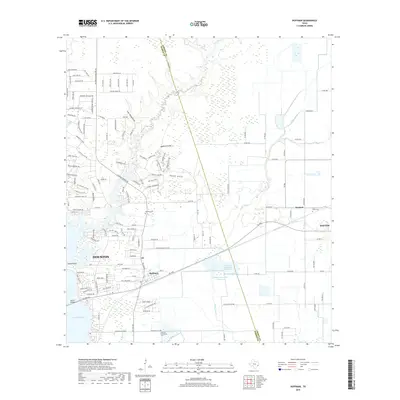
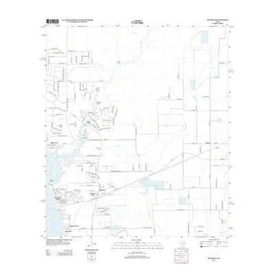 2013 Huffman2013 Print · USGSCovers Eastgate, including Houston, Dayton, and other nearby areas
 - 2016 Map of Huffman, 2016 Print
 2016 Huffman2016 Print · USGSCovers Eastgate, including Houston, Dayton, and other nearby areas
 - 2019 Map of Huffman, 2019 Print
 2019 Huffman2019 Print · USGSCovers Eastgate, including Houston, Dayton, and other nearby areas
 - 2022 Map of Huffman, 2022 Print
 2022 Huffman2022 Print · USGSThe Lake Houston shoreline and the Liberty-Harris county line define this area in the early 2020s. Genealogists can trace family sites at Huffman Heritage Cemetery or SPJST Cemetery and follow the waters of Luce Bayou and Cedar Bayou.
End of results
Showing maps 1-12 of 12
Top cities near Eastgate
- Houston historical maps
- Atascocita historical maps
- Kingwood historical maps
- Liberty historical maps
- Cleveland historical maps
- Dayton historical maps
See more
Frequently asked questions
- What are the different types of historical maps available for Eastgate?
- What is the oldest map of Eastgate?
- Where can I purchase historical maps of Eastgate for my home or office?
- Where can I download high-res historical maps of Eastgate?
- Are there historical topographic maps available for Eastgate?
- Is there historical aerial imagery available for Eastgate?
- Where are historical maps of Eastgate sourced from?