Old Maps of Liberty, Texas for Metal Detecting
Plan your next treasure hunt with 30 historic maps of Liberty. Find old homesites, ghost towns, trails, and gathering spots that may be lost to time — perfect for identifying promising metal detecting locations.
- Locate forgotten sites: Uncover places like long-lost settlements, abandoned rail lines, or gathering spots.
- Plan better hunts: Use map overlays combined with LiDAR or satellite views to narrow in on historically rich areas.
- Made for detectorists: Thousands of hobbyists use these maps to discover relics, coins, and hidden history.
Use these historic maps to boost your research and find new opportunities beneath the surface of Liberty.
Liberty, TX maps
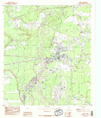
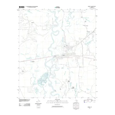
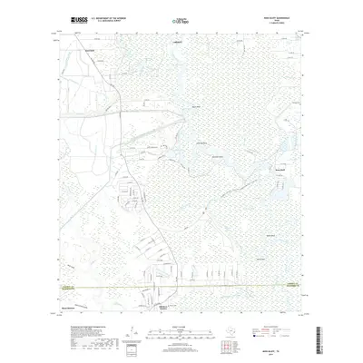
(30)- 1943 Map of Liberty
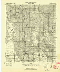 1943 Liberty1943 Print · USGSLiberty and the surrounding Big Thicket are documented here during the early twentieth-century boom in timber and oil. Researchers can locate vanished landmarks such as the Yellow School House, trace family lands like Mears Ranch, and follow the path of the Old Tram through the river bottomlands.
 - 1950 Map of Houston, 1953 Print
 1950 Houston1953 Print · USGSCoastal Texas in the early fifties reveals a landscape of massive civil engineering and industrial transit. Genealogists and researchers can trace the growth of the Houston suburbs and the maritime infrastructure of Galveston Bay, including the Gulf Freeway and the Texas City Dike.
 - 1954 Map of Beaumont, 1964 Print
 1954 Beaumont1964 Print · USGSSoutheast Texas in the mid-fifties reveals a landscape of massive national forests, emerging reservoirs, and a booming oil economy. Genealogists and researchers can trace rural settlements like Dallardsville and Village Mills or locate early drilling sites at Sour Lake Oil Field.3 unique versions available
 - 1955 Map of Daisetta, 1956 Print
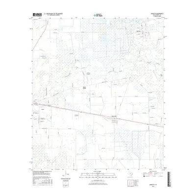
 1955 Daisetta1956 Print · USGSLiberty County was undergoing an industrial transition in the 1950s as oil fields and drainage canals reshaped the coastal prairie. Researchers can trace the development of salt dome operations near Daisetta or locate rural landmarks like Ames Cem and Sacred Heart Ch.3 unique versions available
 - 1955 Map of Liberty, 1957 Print
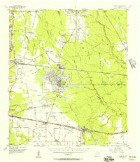
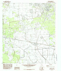
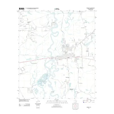
 1955 Liberty1957 Print · USGSLiberty and Dayton thrived at the crossroads of the Trinity River and major rail lines during the mid-fifties. Genealogists and historians can trace family landmarks like Magnolia Cem, Daniel Ranch, and schools like Colbert High Sch.2 unique versions available
 - 1956 Map of Houston, 1963 Print
 1956 Houston1963 Print · USGSSoutheast Texas in the mid-fifties is captured here as a powerhouse of oil and maritime trade. Genealogists and historians can trace the foundations of Houston and its ports, alongside landmarks like the Rice Institute and the Spindletop Oil Field.2 unique versions available
 - 1957 Map of Beaumont
 1957 Beaumont1957 Print · USGSSoutheast Texas in the mid-fifties is defined by the timber-rich lands between the Trinity River and Beaumont. Trace the history of the Alabama and Coushatti Indian Reservation or locate early campus sites like Prairie View College.
 - 1961 Map of Moss Bluff, 1964 Print
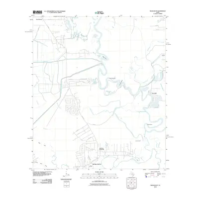
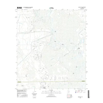
 1961 Moss Bluff1964 Print · USGSCoastal Texas industry meets the winding river bottoms in the early sixties as the petroleum fields near Liberty expanded. Researchers can trace family sites like the Winfree Cem, the Guedry Cem, and the riverside Moore Bluff Pumping Sta.3 unique versions available
 - 1975 Map of Houston, 1977 Print
 1975 Houston1977 Print · USGSThe Texas Gulf Coast in the mid-seventies shows a sprawling Houston metropolis linked to the sea by the massive Houston Ship Channel. Researchers can trace the mid-century industrial landscape from the Astrodome to the Lyndon B. Johnson Space Center.2 unique versions available
 - 1983 Map of Anahuac
 1983 Anahuac1983 Print · USGSThe Upper Texas Coast and its energy-driven landscape are detailed here in the early eighties. Genealogists and historians can trace coastal settlements like Anahuac and Winnie alongside the storied Spindletop Oil Field and the Anahuac National Wildlife Refuge.2 unique versions available
 - 1984 Map of Beaumont
 1984 Beaumont1984 Print · USGSSoutheast Texas in the late seventies and early eighties shows a landscape of expanding reservoirs and deep timber industry. Researchers can trace the development of the Sam Houston National Forest or locate regional landmarks like Grabbs Prairie and the Wynne State Prison Farm.3 unique versions available
 - 1984 Map of Liberty, 1985 Print
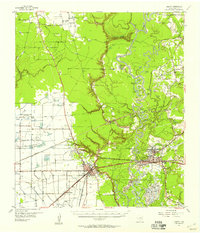
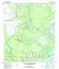
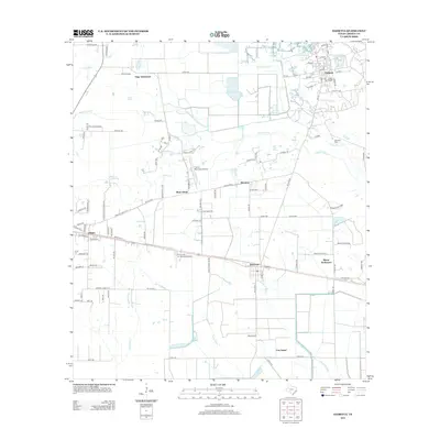
 1984 Liberty1985 Print · USGSLiberty and the lower Trinity River valley are captured in the mid-eighties as a busy corridor of energy and river commerce. Genealogists and researchers can trace the roads through Kenefick, Ames, and South Liberty, or locate family sites near Graveyard Hill and the Port of Liberty.2 unique versions available
 - 1984 Map of Daisetta, 1985 Print
 1984 Daisetta1985 Print · USGSCoastal Texas industry and rural life meet in this mid-1980s survey of Liberty County. Researchers can trace the footprint of the local energy sector at the Oil Field or locate community landmarks like the Rodeo Ground and Cem.
 - 1986 Map of Beaumont
 1986 Beaumont1986 Print · USGSThe East Texas piney woods and coastal prairies are captured here in the mid-eighties, a period of established energy production and conservation. Researchers can trace the industrial footprint of the Oil and Gas Field near Daisetta and Batson, or locate family sites at Graveyard Hill Cem.
 - 1993 Map of Moss Bluff, 1994 Print
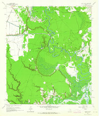
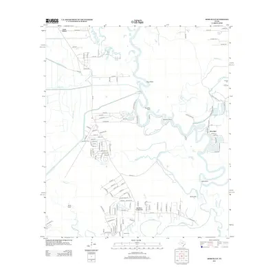
 1993 Moss Bluff1994 Print · USGSThe oxbows of the Trinity River define this Liberty County landscape in the early nineties, where water management and oil production shape the terrain. Genealogists and researchers can locate old burial sites and parish centers like Heir Lawn Cem, Winfree Ch, and the settlement of Moss Bluff.
 - 2010 Map of Daisetta, 2010 Print
 2010 Daisetta2010 Print · USGSCovers Liberty, including Daisetta, Ames, and other nearby areas
 - 2010 Map of Liberty, 2010 Print
 2010 Liberty2010 Print · USGSCovers Liberty, including Dayton, Ames, and other nearby areas
 - 2010 Map of Moss Bluff, 2010 Print
 2010 Moss Bluff2010 Print · USGSCovers Liberty, including Dayton, Mont Belvieu, and other nearby areas
 - 2013 Map of Daisetta, 2013 Print
 2013 Daisetta2013 Print · USGSCovers Liberty, including Daisetta, Ames, and other nearby areas
 - 2013 Map of Moss Bluff, 2013 Print
 2013 Moss Bluff2013 Print · USGSCovers Liberty, including Dayton, Mont Belvieu, and other nearby areas
 - 2013 Map of Liberty, 2013 Print
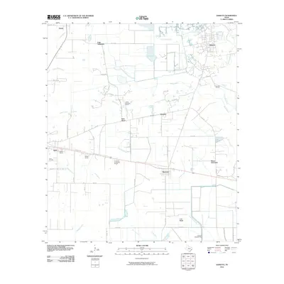
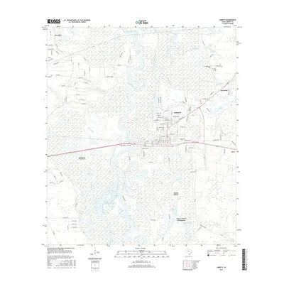
 2013 Liberty2013 Print · USGSCovers Liberty, including Dayton, Ames, and other nearby areas
 - 2016 Map of Liberty, 2016 Print
 2016 Liberty2016 Print · USGSCovers Liberty, including Dayton, Ames, and other nearby areas
 - 2016 Map of Daisetta, 2016 Print
 2016 Daisetta2016 Print · USGSCovers Liberty, including Daisetta, Ames, and other nearby areas
 - 2016 Map of Moss Bluff, 2016 Print
 2016 Moss Bluff2016 Print · USGSCovers Liberty, including Dayton, Mont Belvieu, and other nearby areas
 - 2019 Map of Moss Bluff, 2019 Print
 2019 Moss Bluff2019 Print · USGSCovers Liberty, including Dayton, Mont Belvieu, and other nearby areas
Showing maps 1-25 of 30
Top cities near Liberty
- Baytown historical maps
- Dayton historical maps
- Mont Belvieu historical maps
- Old River-Winfree historical maps
- Daisetta historical maps
- Ames historical maps
See more
Top neighborhoods of Liberty
Frequently asked questions
- What are the different types of historical maps available for Liberty?
- What is the oldest map of Liberty?
- Where can I purchase historical maps of Liberty for my home or office?
- Where can I download high-res historical maps of Liberty?
- Are there historical topographic maps available for Liberty?
- Is there historical aerial imagery available for Liberty?
- Where are historical maps of Liberty sourced from?