Old Maps of Mentone, Texas for Metal Detecting
Plan your next treasure hunt with 9 historic maps of Mentone. Find old homesites, ghost towns, trails, and gathering spots that may be lost to time — perfect for identifying promising metal detecting locations.
- Locate forgotten sites: Uncover places like long-lost settlements, abandoned rail lines, or gathering spots.
- Plan better hunts: Use map overlays combined with LiDAR or satellite views to narrow in on historically rich areas.
- Made for detectorists: Thousands of hobbyists use these maps to discover relics, coins, and hidden history.
Use these historic maps to boost your research and find new opportunities beneath the surface of Mentone.
Mentone, TX maps
(9)- 1954 Map of Pecos, 1964 Print
 1954 Pecos1964 Print · USGSMid-century West Texas reveals a landscape of expanding oil fields and cattle ranching along the winding Pecos River. Local historians can trace family ranch lands like Goodrich Ranch, follow the Texas and Pacific rails, or locate the historic Horsehead Crossing.3 unique versions available
 - 1957 Map of Pecos
 1957 Pecos1957 Print · USGSWest Texas in the mid-fifties is a landscape of desert oil fields and vital rail corridors. Researchers can trace the sprawling Pyote Air Force Base, the historic Horsehead Crossing, and the rail stops at Mentone and Saragosa.
 - 1961 Map of Mentone, 1963 Print
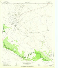 1961 Mentone1963 Print · USGSMentone and the surrounding West Texas plains are captured here in the early sixties as the local economy balanced ranching with an intensive oil boom. Researchers can trace the industrial layout of the Wheat Oil Field alongside family landmarks like Moorehead Ranch and the Panhandle and Santa Fe railroad.2 unique versions available
 - 1986 Map of Kermit
 1986 Kermit1986 Print · USGSWest Texas during the mid-eighties was a landscape defined by the energy industry and the winding Pecos River. Trace the development of Oil Field networks near Kermit, the historic Horsehead Crossing, and the rail lines of the Missouri Pacific.2 unique versions available
 - 2010 Map of Mentone, 2010 Print
 2010 Mentone2010 Print · USGSCovers Mentone, including Reeves County, Ward County, and other nearby areas
 - 2013 Map of Mentone, 2013 Print
 2013 Mentone2013 Print · USGSCovers Mentone, including Reeves County, Ward County, and other nearby areas
 - 2016 Map of Mentone, 2016 Print
 2016 Mentone2016 Print · USGSCovers Mentone, including Reeves County, Ward County, and other nearby areas
 - 2019 Map of Mentone, 2019 Print
 2019 Mentone2019 Print · USGSCovers Mentone, including Reeves County, Ward County, and other nearby areas
 - 2022 Map of Mentone, 2022 Print
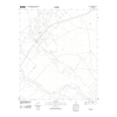
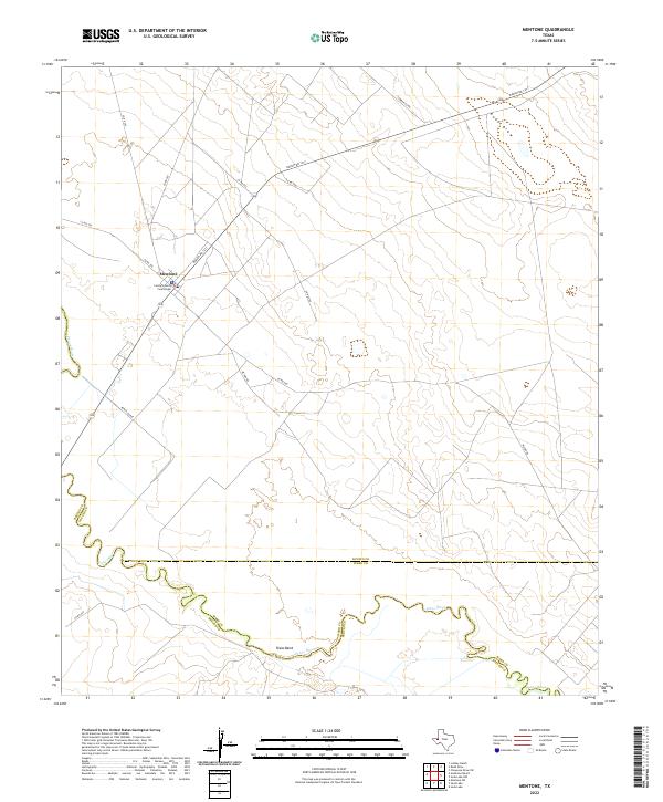 2022 Mentone2022 Print · USGSMentone remains the quiet heart of Loving County in the early twenty-first century, anchored by its remote ranching roads and river bends. You can trace the path of the Pecos River past Texas Bend or locate the historic Loving County Courthouse in the center of town.
End of results
Showing maps 1-9 of 9
Frequently asked questions
- What are the different types of historical maps available for Mentone?
- What is the oldest map of Mentone?
- Where can I purchase historical maps of Mentone for my home or office?
- Where can I download high-res historical maps of Mentone?
- Are there historical topographic maps available for Mentone?
- Is there historical aerial imagery available for Mentone?
- Where are historical maps of Mentone sourced from?